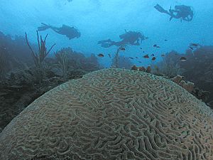
Bay Islands Department facts for kids
Quick facts for kids
Bay Islands Department
Departamento de Islas de la Bahía
|
|
|---|---|
|
Department
|
|
 |
|
| Country | |
| Municipalities | 5 |
| Villages | 23 |
| Founded | 14 March 1872 |
| Capital city | Coxen Hole |
| Government | |
| • Type | Municipal |
| Area | |
| • Total | 229 km2 (88 sq mi) |
| Population
(2020)
|
|
| • Total | 110,000 |
| • Density | 480/km2 (1,240/sq mi) |
| Time zone | UTC-6 (CST) |
| Postal code |
34101
|
| ISO 3166 code | HN-IB |
| HDI (2017) | 0.631 medium · 4th |
| Statistics derived from Consult INE online database: Population and Housing Census 2013 | |
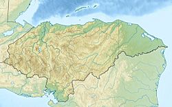
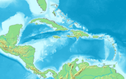
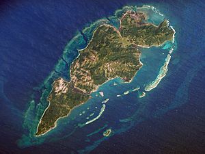
The Bay Islands (Spanish: Islas de la Bahía) are a group of islands located off the coast of Honduras. These islands together form one of the 18 departments of Honduras. The main city and capital of the department is Coxen Hole, which is found on the island of Roatán.
Contents
Exploring the Bay Islands' Geography
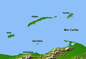
The Bay Islands are made up of eight larger islands and 53 smaller islands, called cays. They are located about 10 to 40 kilometers (6 to 25 miles) off the northern coast of Honduras. These islands have been part of Honduras since 1872. You can easily see them from the mainland mountains.
The total land area of the islands is about 250 square kilometers (97 square miles). In 2013, around 71,500 people lived there. The islands are divided into three main groups:
- Swan Islands: These are the northernmost islands.
- Islas de la Bahía: This group includes the main islands of Roatán, Guanaja, and Utila, plus many smaller islands. They are about 120 kilometers (75 miles) south of the Swan Islands.
- Cayos Cochinos: This is the southernmost group of islands.
Discovering Roatán Island
Roatán is the biggest island. It is about 40 miles (64 km) long and up to 9 miles (14 km) wide. Roatán has a mountain range running from west to east. These mountains often have exposed rocks like marble and serpentine. The southern coast has many deep harbors and wide inlets, which are protected by coral reefs. The northern coast is harder to reach because of its large coral reefs.
St. Helena Island is very close to Roatán. It is separated only by a long mangrove swamp. This island has a small hill in the middle. It is also known for its many caves, especially along a cliff on its western side.
Guanaja and Utila: Unique Islands
Guanaja is the second largest island. It is even more mountainous than Roatán. It has several hills, with the highest one reaching over 350 meters (1,150 feet) above sea level. This is the highest point in all the Bay Islands. Flat plains are found between the hills.
Utila is the third largest island. It has low mangrove swamps and a few small hills on its eastern end. The soil on Utila is very fertile. This might be because of its flat land and volcanic rocks.
Smaller Islands: Barbareta, Morat, and Hog Islands
Barbareta, Morat, and the Hog Islands are all small and rugged. Barbareta has many hills, with the tallest reaching 143 meters (469 feet) above sea level. About one-third of Barbareta is covered by a rock called serpentinite. Morat is the smallest and flattest island. It has one ridge with two hills, mostly made of sedimentary rocks.
The Bay Islands do not have large rivers. They have a few small streams that usually flow into mangrove swamps. However, there are many cool water springs. Roatán has a complex system of waterways on its south side. These are formed by saltwater lagoons and drowned valleys.
A Look at the Bay Islands' History
Early European Encounters
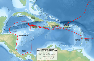
The islands were once known as Las Guanajas. Christopher Columbus first saw Guanaja on July 30, 1502, during his fourth trip to the New World. He named it 'Isle of Pines' and claimed it for Spain. From this island, he then reached the American continent.
When Europeans first arrived, the islands were home to the Pech people. They used boats to trade with Honduras, Yucatán, and possibly Jamaica. Spanish slave traders from Cuba began raiding the Bay Islands. They took many islanders away, causing the population to drop quickly.
Hernán Cortés, who conquered Mexico, helped protect the remaining Pech people in 1526. He stopped the slave traders. Later, William Claiborne tried to start an English colony on Roatán in 1638. The English would be involved with the islands for the next two centuries.
Around this time, Dutch, English, and French pirates also raided Spanish ships in the Bay of Honduras. In 1642, English settlers from British Honduras (now Belize) took over Port Royal on Roatán. The Spanish tried to drive them out and finally succeeded in 1650.
English Settlements and Conflicts
Permanent English settlements on Roatán began again around 1742. The British tried to control more of the Caribbean coast of Central America. They rebuilt the old fort on Roatán. English settlements were well-established on Roatán by 1775.
However, the Spanish fought back. In 1782, the Spanish attacked Port Royal and forced the English to surrender. They destroyed all the English homes. Six years later, in 1788, England completely left all its settlements in the Bay Islands.
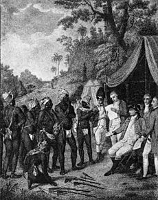
The islands were empty of Europeans for almost 15 years. Then, in 1797, the English forcibly moved about 5,000 "Black Caribs" to Roatán. These people were a mix of African and Carib and Arawak Indians. They were brought from the island of St. Vincent and landed on Roatán.
|
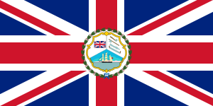
Colony of the Bay Islands
|
|||||||||||
|---|---|---|---|---|---|---|---|---|---|---|---|
| 1852-1860 | |||||||||||
|
Flag
|
|||||||||||
| Queen | |||||||||||
|
• 1852-1860
|
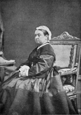
Queen Victoria | ||||||||||
| Superintendent | |||||||||||
|
|||||||||||
| Today part of | Honduras | ||||||||||
The Colony of the Bay Islands
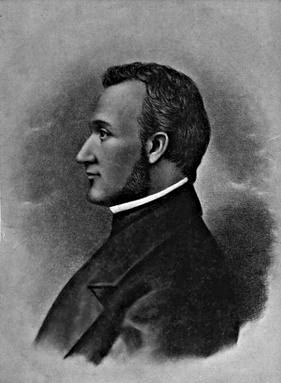
After 1821, when Central American countries became independent, the islands were under Honduras. But in 1830, the British took over Roatán again. Honduras protested, and the British government said they didn't approve.
However, British officials in Belize still wanted the islands. In 1838, some freed slaves from the Grand Cayman islands came to Roatán to settle. Some asked Honduras for permission, but others asked the British. A British official from Belize then visited the island. He took down the Honduran flag and removed Honduran soldiers.
Honduras protested strongly, but nothing changed. More people from the Cayman Islands moved to Roatán. By 1848, the population was over 1,000. In 1850, the British officially organized Roatán, Guanaja, and other islands into a colony called the Bay Islands.
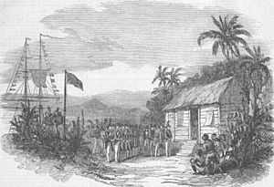
On March 20, 1852, the islands were officially made a British colony. This was announced in Roatán on August 10, 1852.
Returning to Honduras
The United States was concerned about the British making the Bay Islands a colony. They believed it went against a treaty from 1850, called the Clayton–Bulwer Treaty. This treaty said that neither the US nor Great Britain should colonize any part of Central America.
The US government told the United Kingdom that the Bay Islands belonged to Honduras. This caused tension between the two countries. Honduras then sent a representative to London. Honduras argued that the islands were theirs and should be returned.
On April 30, 1859, the United Kingdom agreed to give the Bay Islands back to Honduras. This was done with a special agreement between the UK and Honduras. The "colony of the Bay Islands" officially ended. The islands became part of Honduras.
Many English settlers on the islands were not happy about this. They even sought help from an American adventurer named William Walker. Walker tried to help them keep the islands British, but he was captured and executed in Honduras in 1860.
Becoming Honduran Citizens
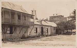
Honduras was busy with problems on its mainland. It took some time for them to fully take control of the Bay Islands. On June 1, 1861, the Bay Islands officially became the "Departamento de las Islas de la Bahía" under Honduras.
It wasn't until 1902 that many English-speaking islanders realized they were no longer British citizens. Even in the 1950s, some residents still claimed British nationality. However, both Honduras and England agreed that anyone born on the islands after 1861 was a Honduran citizen.
Who Lives in the Bay Islands?
The population of the Bay Islands in 2010 was 49,158 people. It is the smallest department in Honduras by population. There were slightly more women than men. The islands are most crowded in Roatán and Utila.
Roatán has the most people, with 29,636 residents. The average life expectancy in the islands is about 72.6 years.
Different Groups of People
Long ago, the Bay Islands were home to the Pech people and other native groups. But after Europeans arrived, many native people were forced to leave or were taken away. By 1528, the islands were almost empty.
Later, the islands started to be settled again by European pirates from England, France, and the Netherlands. This led to many fights between the Spanish and these pirates.
White Population
On the three main islands, you can find descendants of British settlers from the 18th century. Many of these white colonists became Honduran citizens after the islands returned to Honduras. However, it took a long time for them to fully become part of the Honduran population.
A 2013 study showed that about 11.41% of the Bay Islands' population is white. But on Roatán, over 40% of the people are from other countries. These are mostly white Americans and French Canadians, as well as some European immigrants.
Black Population
During the 18th and early 19th centuries, when the British were in charge, several groups of black people arrived. These included:
- Afro-colonials: Black people brought by the Spanish.
- Black Caribs or Garífunas: A mix of African, Carib, and Arawak people.
- Anglo Antilleans: English-speaking black people from Jamaica and the Cayman Islands. They came to work in farming.
Today, many black residents of the Bay Islands are called Black Caribs. They are a diverse group. Some with lighter skin might call themselves "browns," while others with darker skin might be called "colored."
How the Bay Islands Make Money
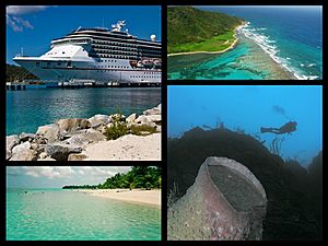
The economy of the Bay Islands mainly relies on two things: tourism and fishing. These two activities make up about half of the islands' income. They are also closely connected to the islands' natural environment. Other businesses, like transportation, real estate, and construction, support these main activities.
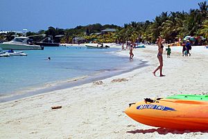
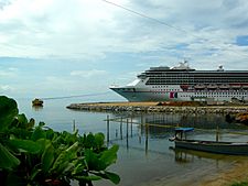
Because of tourism and fishing, the islands have grown very quickly in the last 20 years. Many people have moved here from other parts of Honduras and other countries. The Bay Islands are a major spot for tourism in Honduras. About 28% of all tourists who visit Honduras come to these islands. In 1990, about 15,000 tourists visited. By 1996, that number jumped to 60,000. In 2010, Roatán welcomed over 800,000 cruise ship visitors!
Many islander men work on merchant ships or international cruise ships for several months a year. Tourism really started to boom in the late 1960s when people discovered the islands' beautiful reefs, beaches, and unique culture. Since the late 1980s, the number of visitors has grown even more dramatically.
Bay Islands Municipalities
The Bay Islands department is divided into five main areas called municipalities:
| Municipality | Description | Capital | Area (km2) |
Area (mi2) |
Population census 2012 |
|---|---|---|---|---|---|
| 1 Guanaja | Guanaja Island | Bonacca Town | 55.4 | 21.4 | align="right" |8,300 |
| Guanaja Island | Savannah Bight | 54 | 21 | align="right" |4300 | |
| Guanaja Cays | Bonacca Town | 1.4 | 0.54 | align="right" |4000 | |
| 2 José Santos Guardiola | Eastern Roatán Island, JonesVille | Oak Ridge | 57.3 | 22.1 | align="right" |17,950 |
| Eastern Roatán Island | Oak Ridge | 50 | 19 | align="right" |17940 | |
| Barbareta Island | Playa Barbareta | 6 | 2.3 | align="right" |10 | |
| Helene Island, Morat, Pigeon Cays | 1.3 | 0.50 | 900 | ||
| 3 Roatán | Western Roatán Island | Coxen Hole | 87.3 | 33.7 | 41220 |
| Western Roatán Island | Coxen Hole | 80 | 31 | 41060 | |
| Roatan Cays | Antoney's Cay | 1.2 | 0.46 | align="right" |40 | |
| Swan Islands | Harbor Bay | 3 | 1.25 | align="right" |10 | |
| Cayos Cochinos | Chachauate | 2.9 | 1.1 | align="right" |110 | |
| 4 Utila | Utila Island | Utila Town | 49.3 | 19.0 | 4030 |
| Utila Island | Utila Island | Utila Town | 47.9 | 18.5 | 3580 |
| Utila | Utila Cays | Jewel Cay Pigeon Cay |
1 | 0.39 | align="right" |450 |
| 5 Banco Vivorillo | Vivorillo Cay | Vivorillo Cay | 0.2 | 0.077 | align="right" |2 |
| Bobel Cay | Bobel Cay | Bobel Cay | 0.02 | 0.0077 | 0 |
| Cayo Sur | Cayo Sur | Cayo Sur | 0.02 | 0.0077 | 0 |
| Savanna Cay | Savanna Cay | Savanna Cay | 0.01 | 0.0039 | 0 |
| Vivorillo Cay | Vivorillo Cay | 0.05 | 0.019 | 2 | |
| Arrecifes de la Media Luna and more cays | Media Luna Cay | 0.05 | 0.019 | 0 | |
| Bay Islands Department | Including the Swan Islands and the Cayos Cochinos |
Coxen Hole | 248.9 | 96.1 | 71500 |
See also
 In Spanish: Departamento de Islas de la Bahía para niños
- Index of Honduras-related articles
- List of islands in the Caribbean: Honduras
- Municipalities of Honduras
- Outline of Honduras
 | Kyle Baker |
 | Joseph Yoakum |
 | Laura Wheeler Waring |
 | Henry Ossawa Tanner |


