Indian Lake (Michigan) facts for kids
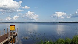
Indian Lake is a common name of many waterbodies within the U.S. state of Michigan. According to the Geographic Names Information System (GNIS), there are at least 38 bodies of water in the state that use the Indian Lake name. These bodies of water may include lakes, reservoirs, streams, swamps, or canals with the Indian Lake name or variations.
All information pertaining to the county, coordinates, and elevation are retrieved from the corresponding GNIS identification website. Lakes that provide no area measurements are likely very small and have no published information listing their size.
Name | County | Coordinates | Elevation | Area | GNIS ID |
---|---|---|---|---|---|
Eagle Lake | Gogebic | 46°09′21″N 89°08′20″W / 46.15583°N 89.13889°W | 1,690 ft (520 m) | 20.65 acres (8.4 ha) | 1619792 |
Indian Lake | Barry | 42°26′15″N 85°28′09″W / 42.43750°N 85.46917°W | 912 ft (278 m) | 99 acres (40.1 ha) | 628983 |
Indian Lake | Livingston | 42°44′15″N 83°53′22″W / 42.73750°N 83.88944°W | 846 ft (258 m) | 75 acres (30.4 ha) | 628984 |
Indian Lake | Oakland | 42°47′55″N 83°12′33″W / 42.79861°N 83.20917°W | 988 ft (301 m) | 58 acres (23.5 ha) | 628985 |
Indian Lake | Mecosta | 43°39′15″N 85°06′27″W / 43.65417°N 85.10750°W | 1,014 ft (309 m) | — | 628986 |
Indian Lake | Osceola | 43°57′44″N 85°24′01″W / 43.96222°N 85.40028°W | 1,220 ft (370 m) | 85 acres (34.4 ha) | 628987 |
Indian Lake | Gladwin | 44°09′07″N 84°21′09″W / 44.15194°N 84.35250°W | 837 ft (255 m) | 51 acres (20.6 ha) | 628988 |
Indian Lake | Ogemaw | 44°13′29″N 84°00′35″W / 44.22472°N 84.00972°W | 823 ft (251 m) | 17.2 acres (7.0 ha) | 628989 |
Indian Lake | Roscommon | 44°15′43″N 84°26′02″W / 44.26194°N 84.43389°W | 1,217 ft (371 m) | — | 628990 |
Indian Lake | Iosco | 44°20′50″N 83°39′01″W / 44.34722°N 83.65028°W | 781 ft (238 m) | 218 acres (88 ha) | 628991 |
Indian Lake | Grand Traverse | 44°41′23″N 85°28′56″W / 44.68972°N 85.48222°W | 869 ft (265 m) | 57 acres (23.1 ha) | 628992 |
Indian Lake | Oscoda | 44°46′52″N 84°13′41″W / 44.78111°N 84.22806°W | 1,188 ft (362 m) | 18 acres (7.3 ha) | 628993 |
Indian Lake | Kalkaska | 44°48′28″N 84°55′50″W / 44.80778°N 84.93056°W | 1,214 ft (370 m) | 69 acres (27.9 ha) | 628994 |
Indian Lake | Marquette | 46°35′32″N 88°05′06″W / 46.59222°N 88.08500°W | 1,683 ft (513 m) | 86 acres (34.8 ha) | 628995 |
Indian Lake | Cass | 41°59′45″N 86°12′43″W / 41.99583°N 86.21194°W | 751 ft (229 m) | 499 acres (202 ha) | 628997 |
Indian Lake | Kalamazoo | 42°09′05″N 85°29′10″W / 42.15139°N 85.48611°W | 846 ft (258 m) | 758 acres (307 ha) | 628998 |
Indian Lake | Allegan | 42°37′30″N 85°37′14″W / 42.62500°N 85.62056°W | 768 ft (234 m) | 11 acres (4.5 ha) | 628999 |
Indian Lake | Menominee | 45°45′02″N 87°25′42″W / 45.75056°N 87.42833°W | 804 ft (245 m) | — | 629000 |
Indian Lake | Iron | 46°02′35″N 88°29′44″W / 46.04306°N 88.49556°W | 1,421 ft (433 m) | 196 acres (79 ha) | 629001 |
Indian Lake | Berrien | 41°50′04″N 86°26′50″W / 41.83444°N 86.44722°W | 712 ft (217 m) | — | 1618910 |
Indian Lake | Oscoda | 44°46′03″N 83°58′45″W / 44.76750°N 83.97917°W | 935 ft (285 m) | 1620297 | |
Indian Lake | Gogebic | 46°12′35″N 89°23′10″W / 46.20972°N 89.38611°W | 1,683 ft (513 m) | 93 acres (37.6 ha) | 1620298 |
Indian Lake | Lake | 44°07′27″N 86°00′19″W / 44.12417°N 86.00528°W | 738 ft (225 m) | 19 acres (7.7 ha) | 1620299 |
Indian Lake | Schoolcraft | 45°59′20″N 86°19′56″W / 45.98889°N 86.33222°W | 610 ft (190 m) | 8,400 acres (34 km2) | 1620300 |
Indian Lake | Newaygo | 43°40′14″N 85°49′31″W / 43.67056°N 85.82528°W | 912 ft (278 m) | 33 acres (13.4 ha) | 1620976 |
Indian Lake | Montcalm | 43°25′12″N 85°26′00″W / 43.42000°N 85.43333°W | 902 ft (275 m) | 250 acres (100 ha) | 1622467 |
Indian Lake | Allegan | 42°45′42″N 85°37′56″W / 42.76167°N 85.63222°W | 791 ft (241 m) | — | 628999 |
Indian Lake Creek | Gladwin | 44°06′39″N 84°18′29″W / 44.11083°N 84.30806°W | 768 ft (234 m) | — | 629002 |
Indian Lake Drain | Kalamazoo | 42°08′05″N 85°29′02″W / 42.13472°N 85.48389°W | 850 ft (260 m) | — | 1620300 |
Indian Lakes | Kent | 43°11′38″N 85°40′12″W / 43.19389°N 85.67000°W | 755 ft (230 m) | 33 acres (13.4 ha) | 629005 |
Indian Lakes | Alcona | 44°34′07″N 83°41′10″W / 44.56861°N 83.68611°W | 883 ft (269 m) | 37.2 acres (15.1 ha) | 629006 |
Indian Spring Lake | Kent | 42°54′06″N 85°46′08″W / 42.90167°N 85.76889°W | 604 ft (184 m) | — | 2570896 |
Indian Town Lake | Delta | 45°45′01″N 86°50′13″W / 45.75028°N 86.83694°W | 584 ft (178 m) | — | 1620311 |
Little Indian Lake | Berrien | 41°54′44″N 86°16′55″W / 41.91222°N 86.28194°W | 722 ft (220 m) | 66 acres (26.7 ha) | 630643 |
Little Indian Lake | Menominee | 45°45′26″N 87°25′44″W / 45.75722°N 87.42889°W | 807 ft (246 m) | 25 acres (10.1 ha) | 630644 |
Rudd Lake | Oscoda | 44°47′36″N 84°13′22″W / 44.79333°N 84.22278°W | 1,184 ft (361 m) | 9.2 acres (3.7 ha) | 636360 |
Spring Lake | Roscommon | 44°15′45″N 84°26′16″W / 44.26250°N 84.43778°W | 935 ft (285 m) | 13 acres (5.3 ha) | 1620297 |
Stone Lake | Gogebic | 46°11′33″N 89°03′05″W / 46.19250°N 89.05139°W | 1,742 ft (531 m) | 38 acres (15.4 ha) | 1621780 |
This article includes a list of lakes that share the same name (or similar names). If an internal link incorrectly led you here, you may wish to change the link to point directly to the intended lake article. |
__DISAMBIG__
All content from Kiddle encyclopedia articles (including the article images and facts) can be freely used under Attribution-ShareAlike license, unless stated otherwise. Cite this article:
Indian Lake (Michigan) Facts for Kids. Kiddle Encyclopedia.