Isla Entre Ríos facts for kids
| Geography | |
|---|---|
| Location | South America |
| Coordinates | 27°25′15″S 57°29′15″W / 27.42083°S 57.48750°W |
| Length | 19 km (11.8 mi) |
| Width | 3.75 km (2.33 mi) |
| Highest elevation | 61 m (200 ft) |
| Administration | |
| Province | Corrientes |
| Department | Berón de Astrada |
| Demographics | |
| Population | Inhabited |
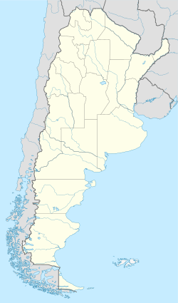
Entre Ríos Island (which means "Between Rivers Island" in Spanish) is a special island in the Paraná River. It's a part of Argentina, but it's completely surrounded by waters that belong to Paraguay. This makes it an exclave of Argentina.
The island is not home to any people. It belongs to a part of Argentina called Berón de Astrada, which is in the north of Corrientes Province.
Where is Entre Ríos Island?
Entre Ríos Island is found in a wide part of the Paraná River. It sits between two towns: Yahapé in the west and Itá Ibaté in the east.
On its southern side, the Paraná River separates it from the rest of Corrientes Province. This part of the river also forms the border between Argentina and Paraguay. It's the deepest part of the river here.
There are about 10 smaller islands nearby that also belong to Argentina. On the northern side, another part of the Paraná River separates Entre Ríos Island from some Paraguayan islands. The closest one is only 200 meters away.
The island is about 19 kilometers (12 miles) long. At its widest point, it's about 3.75 kilometers (2.3 miles) across. The highest part of the island is about 61 meters (200 feet) above sea level. This means it's about 8 meters (26 feet) higher than the river itself.
The island is mostly covered with marshy areas and swamps. You can find small lagoons and old river channels there.
A Look at the Island's History
After a big conflict called the War of the Triple Alliance, Argentina and Paraguay signed an important agreement in 1876. This agreement helped decide where the border between the two countries would be on the Paraná River.
For many years, the exact ownership of Entre Ríos Island was unclear. Paraguayan citizens often used the island. Even the Paraguayan navy had a small base there for a while. Because of this, some people in Paraguay called it Guazú in the Guarani language.
In 1995, officials from both countries met to discuss the border. They found that Entre Ríos Island should belong to Argentina based on measurements. However, the Paraguayan team couldn't make a final decision. They said the island had always been used by Paraguayans.
Finally, in 1996, the two countries reached an agreement. Paraguay officially recognized that Entre Ríos Island belonged to Argentina. In return, Argentina recognized that another island, Talavera Island, and other smaller islands belonged to Paraguay.
In 1997, both countries agreed on something else important. They confirmed that each country could easily reach any of their islands that were located in the other country's waters. This means Argentina can access Entre Ríos Island, even though it's surrounded by Paraguayan waters.
See also
 In Spanish: Isla Entre Ríos para niños
- Isla Apipé
- Isla Martín García
- Tierra del Fuego
- List of enclaves and exclaves
 | Jackie Robinson |
 | Jack Johnson |
 | Althea Gibson |
 | Arthur Ashe |
 | Muhammad Ali |


