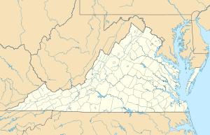
Jacks Branch (Little Nottoway River tributary) facts for kids
Quick facts for kids Jacks Branch |
|
|---|---|
| Other name(s) | Tributary to the Little Nottoway River |
| Country | United States |
| State | Virginia |
| County | Nottoway |
| Town | Blackstone |
| Physical characteristics | |
| Main source | about 0.25 miles west of Blackstone, Virginia 355 ft (108 m) 37°04′59″N 078°01′29″W / 37.08306°N 78.02472°W |
| River mouth | Little Nottoway River about 2 miles southwest of Blackstone, Virginia 240 ft (73 m) 37°02′38″N 078°02′27″W / 37.04389°N 78.04083°W |
| Length | 2.92 mi (4.70 km) |
| Basin features | |
| Progression | roughly southwest |
| River system | Nottoway River |
| Basin size | 3.08 square miles (8.0 km2) |
| Tributaries |
|
| Bridges | VA 626 |
Jacks Branch is a small stream, like a mini-river, located in Virginia, United States. It's about 2.92 miles (4.70 km) long. This stream flows into a bigger river called the Little Nottoway River. Jacks Branch is an important part of the natural water system in its area.
Contents
About Jacks Branch
Jacks Branch is a stream found in the southeastern part of Virginia. It is a "tributary," which means it's a smaller stream that flows into a larger river. In this case, it joins the Little Nottoway River. This stream is part of an even bigger water system called the Chowan-Albemarle drainage.
Where Jacks Branch Starts and Ends
Jacks Branch begins its journey about 0.25 miles (0.40 km) west of a town called Blackstone. At this starting point, the land is about 355 feet (108 meters) above sea level. From there, the stream flows generally towards the southwest.
It travels for nearly 3 miles (4.8 km) before it reaches its end. Jacks Branch flows into the Little Nottoway River about 2 miles (3.2 km) southwest of Blackstone. At this meeting point, the elevation is about 240 feet (73 meters) above sea level.
The Land Around the Stream
The area of land that drains water into Jacks Branch is called its "watershed." This watershed covers about 3.08 square miles (7.98 km²). Most of this land is covered by forests, making up about 61% of the area.
Another big part of the watershed, about 26%, is used for farming. The rest of the land is used for other things. This mix of forests and farms shows the different types of environments the stream flows through.
Its Place in the River System
Jacks Branch is a small but important part of a larger network of waterways. It flows into the Little Nottoway River, which then becomes part of the Nottoway River. Eventually, the water from these rivers makes its way to the Albemarle Sound. This shows how all streams and rivers are connected, forming a big system that carries water across the land.
 | Bayard Rustin |
 | Jeannette Carter |
 | Jeremiah A. Brown |


