Jessie Lake facts for kids
Quick facts for kids Jessie Lake |
|
|---|---|
 |
|
| Location | Bonnyville / Bonnyville No. 87, Alberta |
| Coordinates | 54°15′N 110°44′W / 54.250°N 110.733°W |
| Primary outflows | Muriel Creek |
| Basin countries | Canada |
| Max. length | 3.5 km (2.2 mi) |
| Max. width | 2 km (1.2 mi) |
| Surface area | 5 km2 (1.9 sq mi) |
| Surface elevation | 555 m (1,821 ft) |
| Settlements | Bonnyville |
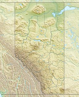
Jessie Lake is a cool lake found in eastern Alberta, Canada. It's a special type of lake called a kettle lake. This means it formed when a big chunk of ice from a glacier melted a very long time ago. The town of Bonnyville is right on its northern side.
Contents
Exploring Jessie Lake
Jessie Lake is about 3.5 kilometers (2.2 miles) long from east to west. It is also about 2 kilometers (1.2 miles) wide. The lake covers an area of about 5 square kilometers (1.9 square miles).
The Lake's Location
The northern edge of Jessie Lake touches the town of Bonnyville. On the west side, a highway crosses the lake. This road goes south to the community of Kehewin. To the east, there is a causeway and a small bridge. These are part of an eight-kilometer (5-mile) paved trail that goes all the way around the lake.
What You Can See at the Lake
Jessie Lake is a busy place for many birds. Thousands of ducks, Canada geese, and American coots visit the lake. You can see them from April through October. You might also spot muskrats swimming around. It's important to know that shooting animals is not allowed here.
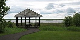
The trail around the lake is great for walking or biking. It has two tall lookout towers and four platforms. These spots offer amazing views of the lake and its wildlife.
Nature Around the Lake
A lot of the lake is covered by green algae. This is a common plant that grows in water. The shore of the lake has many reeds and marshy areas. These are like tall grasses and wet lands. There is also a small, low island covered with trees in the middle of the lake.
Sometimes, at the start of summer and fall, parts of the walking paths can get flooded. This can make it hard to walk or bike on some sections of the trail.
 | Claudette Colvin |
 | Myrlie Evers-Williams |
 | Alberta Odell Jones |


