Jordan Branch (Sewell Branch tributary) facts for kids
Quick facts for kids Jordan Branch |
|
|---|---|

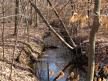
Jordan Branch in Blackiston Wildlife Area
|
|
| Other name(s) | Tributary to Sewell Branch |
| Country | United States |
| State | Delaware |
| County | Kent |
| Physical characteristics | |
| Main source | Island Pond Marsh Ditch divide about 0.1 miles east of Fords Corner, Delaware 72 ft (22 m) 39°11′31″N 075°41′36″W / 39.19194°N 75.69333°W |
| River mouth | Sewell Branch about 2 miles northeast of Pearsons Grove, Delaware 49 ft (15 m) 39°14′49″N 075°43′56″W / 39.24694°N 75.73222°W |
| Length | 5.41 mi (8.71 km) |
| Basin features | |
| Progression | northwest |
| River system | Chester River |
| Basin size | 6.04 square miles (15.6 km2) |
| Tributaries |
|
| Bridges | DE 11, DE 300, Chance Road, Underwoods Corner Road |
Jordan Branch is a small stream, also called a "tributary," located in Kent County, Delaware, in the United States. It flows for about 5.41 miles (8.71 kilometers) before it joins another stream known as Sewell Branch. Think of it like a smaller road that connects to a bigger highway!
About Jordan Branch
Jordan Branch is an important part of the local water system. It's called a "2nd order tributary." This means it's a stream that flows into a larger stream, which then flows into an even bigger one. In this case, Jordan Branch flows into Sewell Branch. Sewell Branch is part of the larger Chester River system.
Where Does Jordan Branch Start?
This stream begins near a place called Fords Corner in Delaware. It starts where the land divides the water flow, specifically near the Island Pond Marsh Ditch. From its beginning point, the stream travels generally northwest. It flows through the landscape until it reaches its end point.
What is a Watershed?
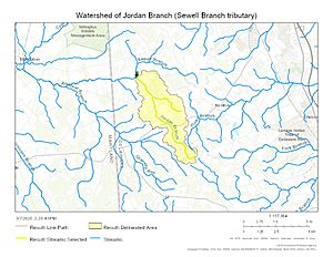
The Jordan Branch has a "watershed" that covers about 6.04 square miles (15.6 square kilometers). A watershed is like a giant bowl or basin. All the rain and snow that falls within this area eventually drains into the Jordan Branch. It's how the stream gets its water!
The area around Jordan Branch receives about 44.7 inches (114 centimeters) of rain and snow each year. About 6.6% of this watershed is covered by forests. These forests are important because they help keep the water clean and provide homes for wildlife.
Maps
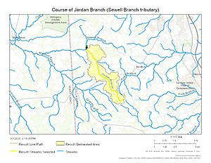
Here are some maps that show the Jordan Branch and its surrounding area.
 | Calvin Brent |
 | Walter T. Bailey |
 | Martha Cassell Thompson |
 | Alberta Jeannette Cassell |


