K'gari, Queensland facts for kids
Quick facts for kids K'gariQueensland |
|||||||||||||||
|---|---|---|---|---|---|---|---|---|---|---|---|---|---|---|---|
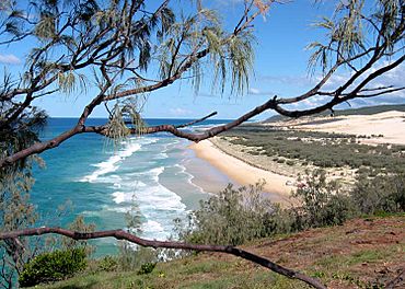
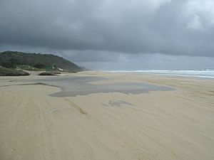
75 Mile Beach, 2006
|
|||||||||||||||
| Population | 152 (2021 census) | ||||||||||||||
| • Density | 0.09184/km2 (0.2379/sq mi) | ||||||||||||||
| Postcode(s) | 4581 | ||||||||||||||
| Area | 1,655.0 km2 (639.0 sq mi) | ||||||||||||||
| Time zone | AEST (UTC+10:00) | ||||||||||||||
| LGA(s) | Fraser Coast Region | ||||||||||||||
| State electorate(s) | Hervey Bay | ||||||||||||||
| Federal Division(s) | Wide Bay | ||||||||||||||
|
|||||||||||||||
K'gari (formerly Fraser Island) is a special place in Queensland, Australia. It's a small area on the much larger island of the same name. The island of K'gari used to be called Fraser Island.
The island is split into two main parts. This K'gari area covers most of the land. The other part is a town called Eurong, found on the island's east coast.
In 2021, about 152 people lived in the K'gari area.
Contents
History of K'gari
K'gari has a rich history. Several small schools opened and closed here long ago.
- Sandy Cape Provisional School was open from about 1874 to 1915.
- Wungoolba State School opened in 1920 but closed around 1921.
- North White Cliffs State School was open from 1921 to 1925.
- Fraser Island Provisional School operated from 1937 to 1941.
The K'gari area, which makes up most of the island, was officially created in June 2023. Before that, it was known as Fraser Island. On June 7, 2023, both the island and this area were officially renamed K'gari. This new name honors the traditional owners, the Butchulla people.
Geography of K'gari
The island of K'gari is divided into two main parts. This K'gari area covers most of the land. The other part is the town of Eurong on the east coast.
Happy Valley is the only town within the K'gari area. It's located on the east coast, just north of Eurong. Most of the K'gari area is part of the Great Sandy National Park. There are only a few small developed spots like Orchid Beach, Happy Valley, and Kingfisher Bay Resort.
Mountains and Sand Dunes
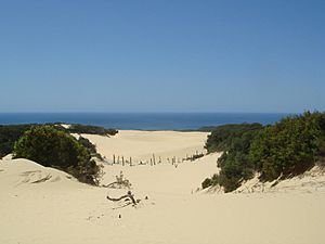
K'gari is famous for its amazing sand dunes and hills. Many of these places have names from the local Aboriginal languages.
- Boomanjin Hill is the tallest mountain at 277 meters (about 909 feet). It was formerly called Mount Boemingen.
- Burrgum Hill is another significant hill, standing at 235 meters (about 771 feet). It was once known as Boomerang Hill.
- Badjala Sand Blow is a large sand dune named after the Aboriginal clan who lived in the island's central part.
- Ban'ga Sand Blow gets its name from the Badtjala word for Zamia, a type of plant.
- Ba'pun Sand Blow means moon in the Badtjala language.
- Birre Sand Blow means hand in the Butchulla language.
- Dhu'lar Hill is named after the blackbutt tree in the Badtjala language.
- Di'bing Sand Blow means mosquito in the Badtjala language.
- Diray Sand Blow means star in the Butchulla language.
- Duling Sand Blow means shell necklace in the Badtjala language.
- Dulingbara Sand Blow is named after an Aboriginal clan. Their name means people of the nautilus shell ornament.
- Flinders Sand Blow is where explorer Matthew Flinders landed in 1802.
- Gira Sand Blow means fire in the Butchulla language.
- Guluri Sand Blow means canoe in the Butchulla language.
- Gumari Sand Blow means shield in the Butchulla language.
- Jun Jaree Sand Blow means fairy or pixie in the Butchulla language.
- Kirrar Sand Blow means fire in the Badtjala language.
- Koorooman Sand Blow means kangaroo in the Badtjala language.
- Kooroy Sand Blow means opossum in the Badtjala language.
- Ngiya Sand Blow means sand in the Badtjala language.
- Ngulungbara Sand Blow is named after an Aboriginal clan from the island's northern part.
- Quartztool Sand Blow is where Aboriginal tools made from quartz pebbles were found.
- Stonetool Sand Blow is known for an undisturbed Aboriginal campsite found there.
- Tuk'ka Sand Blow means grass tree in the Badtjala language.
- Tukkee Sand Blow is the Badtjala name for Indian Head.
- Warbu Sand Blow means frog in the Badtjala language.
- Winnam Sand Blow means breadfruit in the Butchulla language.
- Wul'lan Sand Blow means pretty-faced wallaby in the Badtjala language.
- Wungai Sand Blow means carpet snake in the Badtjala language.
- Wun'gul Sand Blow means swamp oak tree in the Badtjala language.
- Wurgu Sand Blow means east wind in the Butchulla language.
- Yurru Sand Blow means fishline or rope in the Butchulla language.
Coastal Features
The coast of K'gari has many interesting points and beaches.
- Hook Point is also known as Torerr in the Badtjala language.
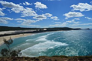
- Indian Head was named by Captain James Cook in 1770. He saw many local people gathered there. Its Badtjala name is Tukkee, meaning stone or stone knife.
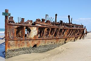
- Maheno Beach is famous for the wreck of the SS Maheno ship.
- Manann Beach means carrying water in the Kabi language.
- Orchid Beach stretches between South Ngkala Rocks and Waddy Point.
- Sandy Cape was named by Captain James Cook in 1770 because of its sandy look. Its local name is Woakoh.
- Seventy Five Mile Beach is a very long beach on the island's east coast.
- Waddy Point is also known as Minker.
Creeks and Lakes
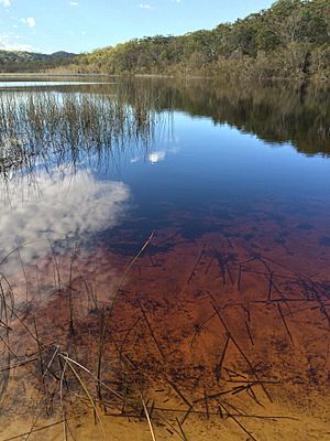
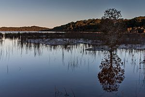
K'gari is home to many beautiful creeks and lakes, including stunning freshwater lakes.
- Coomboo Lakes are beautiful water bodies on the island.
- Awinya Creek is believed to mean crossing place in the Kabi language.
- Beeliwa Lagoon refers to the casuarina tree in the Kabi language.
- Biddierr Creek means crab hole in the Kabi language.
- Boolla Lagoons means two in the Kabi language.
- Boon Boon Creek means call of the swamp pheasant in the Kabi language.
- Calarga Lagoon is named after the sparrow hawk in the Kabi language.
- Coolooloi Creek means cypress pine in the Kabi language.
- Coonangoor Creek is a Kabi word for human excreta.
- Coondagarramine Creek means shallow water in the Kabi language.
- Coongul Creek is believed to mean salt water in the Kabi language.
- Coorong Creek refers to the Moreton Bay Pine.
- Cubbih Creek is believed to mean honey in the Kabi language.
- Deep Creek is also known as Dilgarring Creek, meaning Acacia (wattle) tree in the Kabi language.
- Dibing Swamp refers to the white flowered tea-tree in the Badtjala language.
- Dundonga Creek is another important waterway.
- Dundubara Creek means flies in the Kabi language.
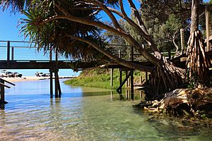
- Eli Creek is a popular spot for visitors.
- Figtree Lake is also known as Lake Goomboor, meaning bald head in the Kabi language.
- Gerowweea Creek means flying fox (a type of fruit bat) in the Kabi language.
- Goochee Lagoon means sand goanna in the Kabi language.
- Govi Creek means native bee and honey in the Kabi language.
- Lake Barga is believed to mean come on in the Kabi language.
- Lake Benaroon is believed to mean tight in the Kabi language.
- Lake Birrabeen is a beautiful lake.
- Lake Boomanjin is another significant lake, formerly Lake Boemingen.
- Lake Geeoong means white cockatoo in the Kabi language.
- Lake Gnarann means cracked bark in the Kabi language.
- Lake Minker means forest box tree in the Kabi language.
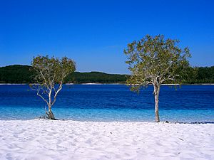
- Lake McKenzie is also known as Boorangoora. It's famous for its clear blue water and white sand.
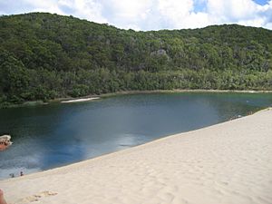
- Lake Wabby is a unique green lake next to a large sand dune.
- Lake Woonjeel is believed to mean dark water or darkness in the Kabi language.
- Manoolcoong Lakes are believed to mean death adder in the Kabi language.
- Moondoora Lagoon is believed to mean red ant in the Kabi language.
- Ngarr Lagoon means white ant in the Kabi language.
- Poyungan Creek is believed to mean tree grub in the Kabi language.
- Red Lagoon is also known as Walameboulha.
- Taleerba Creek is believed to mean small vine in the Kabi language.
- Thow-wool Lagoon is believed to mean alone or lonely in the Kabi language.
- Tooloora Creek reportedly means louse in the Kabi language.
- Tootawwah Creek is believed to mean small nut in the Kabi language.
- Towoi Creek and Towoi Swamp are believed to mean sardine in the Kabi language.
- Urow-Wa Lakes are believed to mean tea tree in the Kabi language.
- Wang-ann Lagoon is believed to mean carpet snake in the Kabi language.
- Wathumba Creek is believed to mean place of the dead in the Kabi language.
- Wocco Lagoon is believed to mean mopoke (a type of owl) in the Kabi language.
- Yeenyargoor Creek is believed to mean edible vine in the Kabi language.
- Yeerall Creek is believed to mean small fish in the Kabi language.
- Yidney Creek is believed to mean mystical or god figure in the Kabi language.
- Yindeering Lakes are believed to mean kingfisher in the Kabi language.
Other Interesting Areas
There are many other special spots within the K'gari area.
- Central Forest Station is a key point in the island's center.
- Dilli Village is a popular spot for visitors.
- Fourways is a major road intersection.
- Orchid Beach is a small community.
- Pile Valley and Pine Valley are known for their tall trees.
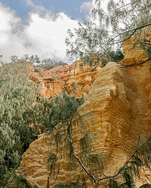
- The Cathedrals are amazing colored sand cliffs shaped by wind and rain.
- The Pinnacles are another stunning example of colored sand formations.
- Valley of the Giants is an area with huge tallow wood trees.
Population of K'gari
In 2016, the K'gari area (then called Fraser Island) had 182 people living there. By 2021, the population was 152 people.
Facilities in K'gari
K'gari has important facilities to help residents and visitors.
- The Orchid Beach SES Facility (State Emergency Service) is near the airstrip and heliport.
- The Happy Valley Ambulance Station provides emergency medical help.
- The Happy Valley SES Facility is also located in Yidney Drive.
- The Fraser Island Police Station is just north of Eurong.
- The University of the Sunshine Coast runs the K'gari-Fraser Island Research and Learning Centre at Dilli Village. This center helps people learn about the island and its environment.
Attractions in K'gari
K'gari offers many exciting attractions for visitors.
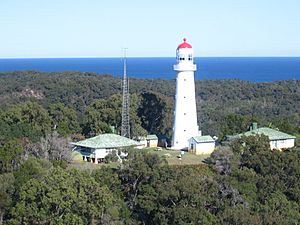
- The Sandy Cape Lighthouse is a historic lighthouse at the northern tip of the island. It's still active today.
- Simpson Reef is a large artificial reef in the Great Sandy Marine Park.
- The Cathedrals are beautiful colored sand cliffs, about 18 kilometers (11 miles) south of Indian Head on 75 Mile Beach.
- The Champagne Pools are natural rock pools where you can swim safely next to the ocean. They are located on 75 Mile Beach, between Waddy Point and Indian Head.
There are also several lookouts where you can enjoy amazing views:
- Markwells Lookout
- Lake Wabby Lookout
- Stonetool Sandblow Lookout
- Knifeblade Sandblow Lookout
- Lake Allom Viewing Platform
Transport in K'gari
Getting around K'gari often involves special vehicles or small aircraft. The island has several airstrips and heliports.
- Boomanjin Airstrip (also known as Toby's Gap airstrip)
- Pailba Airstrip
- Orchid Beach airstrip
- There are also other unnamed airstrips.
- Orchid Beach Resort heliport
- Eurong heliport
- Happy Valley heliport
- Kingfisher Resort heliport
 | John T. Biggers |
 | Thomas Blackshear |
 | Mark Bradford |
 | Beverly Buchanan |


