Kabetogama Township, St. Louis County, Minnesota facts for kids
Quick facts for kids
Kabetogama Township, Minnesota
|
|
|---|---|
|
Township
|
|
| Country | United States |
| State | Minnesota |
| County | Saint Louis |
| Area | |
| • Total | 33.2 sq mi (86.0 km2) |
| • Land | 16.1 sq mi (41.6 km2) |
| • Water | 17.1 sq mi (44.4 km2) |
| Elevation | 1,112 ft (339 m) |
| Population
(2010)
|
|
| • Total | 135 |
| • Density | 4.066/sq mi (1.570/km2) |
| Time zone | UTC-6 (Central (CST)) |
| • Summer (DST) | UTC-5 (CDT) |
| GNIS feature ID | 2397817 |
| Website | www.kabtownship.org |
Kabetogama Township is a small community in Saint Louis County, Minnesota, United States. The name is pronounced like KAB-ə-TOH-gə-mə. In 2010, about 135 people lived here. Part of the township is inside the Kabetogama State Forest.
Important roads in the township include Saint Louis County Roads 122 and 123. U.S. Highway 53 is also nearby. The famous Voyageurs National Park is very close. Kabetogama Township is located along a part of Kabetogama Lake.
The small community of Kabetogama is found within Kabetogama Township.
Contents
Exploring Kabetogama Township
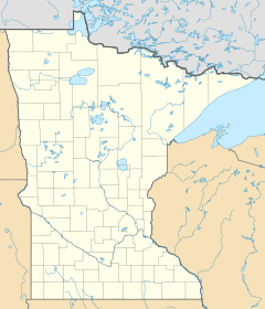
This area is located in Minnesota, a state in the United States. It is part of Saint Louis County.
Geography and Location
Kabetogama Township covers about 33.2 square miles (86.0 square kilometers). A little more than half of this area, about 17.1 square miles (44.4 square kilometers), is water. The rest, about 16.1 square miles (41.6 square kilometers), is land.
Kabetogama Township is the northernmost organized township in Saint Louis County. This means it's one of the farthest north communities in the county.
The community of Kabetogama, which is inside the township, is about 27 miles southeast of International Falls. It is also about 49 miles north of Cook.
Weather in Kabetogama
Kabetogama Township experiences a climate with warm summers and very cold winters. Here's a quick look at the average temperatures:
- Winter (January): Average temperature is about 3.9°F (-15.6°C).
- Summer (July): Average temperature is about 64.7°F (18.2°C).
The area gets a good amount of rain, especially in summer. Snowfall is common in winter, with December and January often seeing the most snow.
People of Kabetogama Township
In 2000, there were 156 people living in Kabetogama Township. These people lived in 72 households. About 50 of these households were families. The population density was about 9.7 people per square mile.
Most of the people living here were White (99.36%). A small number (0.64%) were Native American.
In the households, about 19.4% had children under 18. Most households (66.7%) were married couples living together. About 23.6% of households were single people. Of those, 8.3% were people aged 65 or older living alone.
The average age of people in the township was 52 years old. This shows that many adults and older adults live here. For every 100 females, there were about 95 males.
The average income for a household was $42,000 per year. For families, the average income was $50,938 per year.
Local News
The official newspaper for Kabetogama is called The Timberjay. It is published every week. Over 1,000 copies are printed for people to read.
See also
 In Spanish: Municipio de Kabetogama para niños
 | Bessie Coleman |
 | Spann Watson |
 | Jill E. Brown |
 | Sherman W. White |


