Voyageurs National Park facts for kids
Quick facts for kids Voyageurs National Park |
|
|---|---|
|
IUCN Category II (National Park)
|
|
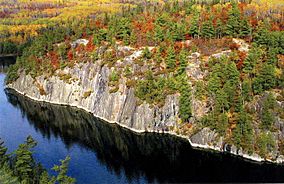
Early autumn in Voyageurs National Park
|
|
| Location | Saint Louis & Koochiching counties, Minnesota, United States |
| Nearest city | International Falls |
| Area | 218,200 acres (883 km2) |
| Established | April 8, 1975 |
| Visitors | 232,974 (in 2019) |
| Governing body | National Park Service |
| Website | Voyageurs National Park |
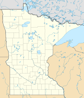
Voyageurs National Park is a beautiful national park in northern Minnesota, close to the town of International Falls. It was created in 1975. The park is named after the voyageurs, who were French-Canadian fur traders. They were some of the first Europeans to travel often through this area.
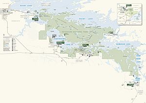
This park is famous for its amazing water. It's a popular spot for people who love to canoe, kayak, boat, and fish. Most of the park's land is on the Kabetogama Peninsula. You can only reach this peninsula by boat. To the east of the park is the Boundary Waters Canoe Area Wilderness.
The park has several places where you can launch a boat and visitor centers around its edges. However, you can only get into the main part of the park by boat. In winter, you can use a snowmobile, skis, or snowshoes. In 2018, over 239,000 people visited the park.
Contents
- Exploring the Park's Ancient Rocks
- How to Get to Voyageurs National Park
- Discovering the Park's Big Lakes
- Fun Activities at Voyageurs National Park
- Weather in Voyageurs National Park
- Animals and Plants of the Park
- History of Voyageurs National Park
- Places to See in Voyageurs National Park
- Staying Safe in the Park
- The International Border
Exploring the Park's Ancient Rocks
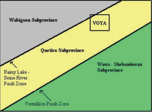
Voyageurs National Park sits on the Canadian Shield. The rocks here are super old, about 1 to 3 billion years old! These are some of the oldest rocks in North America. They formed when the Earth was very young.
Over time, these rocks were squeezed and folded under huge pressure. Hot, melted rock (lava) pushed through these layers. This created a mix of different types of rocks, like gneiss and granite. Later, layers of softer rocks formed on top. But huge sheets of ice, called glaciers, scraped these layers away. This happened during the Ice Ages, like the Wisconsin Glacial period.
You can see signs of these glaciers everywhere. There are long scratches on the rocks from the ice. You can also find big rocks, called glacial erratics, that were carried here by the ice.
How to Get to Voyageurs National Park
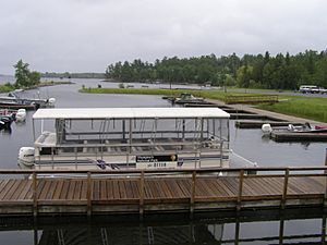
The biggest city near Voyageurs National Park is International Falls, Minnesota. Unlike many other national parks, you mostly get around Voyageurs by water. Many visitors use kayaks and canoes. Others rent houseboats or take a guided boat tour.
Discovering the Park's Big Lakes
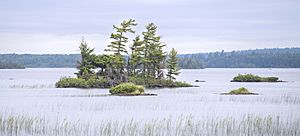
The park includes all or part of four main lakes:
- Rainy Lake - 60 miles (97 km) long, 929 miles (1,495 km) of shoreline, 227,604 acres (921 km2), 161 feet (49 m) deep at its deepest point.
- Kabetogama Lake - 15 miles (24 km) long, 78 miles (126 km) of shoreline, 25,760 acres (104 km2), 80 feet (24 m) deep at its deepest point.
- Namakan Lake - 16 miles (26 km) long, 146 miles (235 km) of shoreline, 25,130 acres (102 km2), 150 feet (46 m) deep at its deepest point.
- Sand Point Lake - 8 miles (13 km) long, 92 miles (148 km) of shoreline, 5,179 acres (21 km2), 184 feet (56 m) deep at its deepest point.
Namakan, Rainy, and Sand Point lakes are on the border between the United States and Canada. You can only get to Lake Namakan and Sand Point Lake by boat, except in winter. The southern edge of the park is the northern shore of Crane Lake. The park also has many smaller lakes, especially on the Kabetogama peninsula. The Locator Lakes trail has some of the most popular small lakes.
Fun Activities at Voyageurs National Park
Camping Adventures
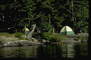
The National Park Service takes care of the campsites here. You can only reach them by water! There are 282 sites for tents, houseboats, or day use. Each site has a sign. You need a permit to stay overnight. You can get permits online or at park visitor centers. There are also public and private campgrounds outside the park that you can reach by car.
Fishing for Fun
The big lakes in the park are home to fish like Walleye, Northern pike, Muskellunge, Smallmouth bass, and Crappie. In the smaller lakes, you might find Largemouth bass, Lake trout, Bluegill, and Yellow Perch. Not every lake has all these types of fish. For example, Lake Trout are mostly in Cruiser Lake.
Boating and Exploring
Visitors love to travel and explore the park's lakes and islands using canoes, kayaks, and motorboats. The park's inner peninsula can only be reached by boat. However, when the lakes freeze in winter, you can use other routes. The park also rents canoes and boats for use on its inner lakes. In summer, the park offers shuttle services to an inner lake. Rangers also lead boat tours to show off the park's nature and history.
Hiking Trails
The park has over 50 miles (80 km) of hiking trails. Some trails are on the mainland. But most of them are on the park's inner peninsula, including long trails for backpacking.
Stargazing at Night
The Voyageurs Forest Overlook, Beaver Pond Overlook, and Kettle Falls Dam area are great places to look at the stars. The park is also working to become a "dark sky park" with the International Dark-Sky Association. This means they want to protect the night sky from light pollution.
Winter Fun in the Park
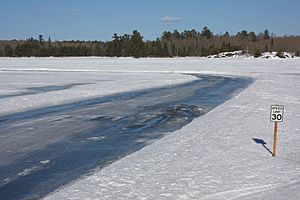
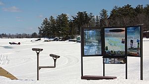
The park is covered in snow from late November to early April. An ice road is plowed on Rainy Lake. It goes from the visitor center's boat ramp towards Cranberry Bay or around Dryweed Island, depending on how thick the ice is.
In winter, you can drive on the lake, go snowmobiling, cross-country skiing, winter camping, ice fishing, and snowshoe hiking. Snowmobiling is only allowed on the frozen lakes and the Chain of Lakes Scenic Trail. You can get trail maps from the visitor centers.
Using snowmobiles in Voyageurs National Park, like in Yellowstone, is a topic of discussion. Some people believe they harm the park's natural beauty and affect wildlife.
Snowmobile Trails
- The Rainy Lake Trail is 28 miles (45 km) long. It goes from Black Bay (Rainy Lake Visitor Center) to Kettle Falls.
- The Kettle Falls Trail is 7.4 miles (11.9 km) long. It goes over land to avoid thin ice near the narrows.
- The Rudder Bay Trail is a short trail that connects to the Ash River Visitor Center.
- The Voyageur Trail is a long trail with many parts. It starts near the Thunderbird Lodge. From Black Bay, it's almost 6 miles (9.7 km) to the Chain of Lakes Trail. The entire Voyageur Trail is about 37 miles (60 km) long.
Weather in Voyageurs National Park
The park has a climate with mild summers and dry winters. This means the coldest month is usually below 0 °C (32 °F). All months have average temperatures below 22 °C (71.6 °F). At least four months have average temperatures above 10 °C (50 °F). Also, most of the rain falls in the warmer six months.
| Climate data for Ash River Visitor Center, Voyageurs National Park. Elev: 1181 ft (360 m) | |||||||||||||
|---|---|---|---|---|---|---|---|---|---|---|---|---|---|
| Month | Jan | Feb | Mar | Apr | May | Jun | Jul | Aug | Sep | Oct | Nov | Dec | Year |
| Mean daily maximum °F (°C) | 15.9 (−8.9) |
23.3 (−4.8) |
35.2 (1.8) |
51.6 (10.9) |
64.7 (18.2) |
73.3 (22.9) |
77.5 (25.3) |
75.8 (24.3) |
65.9 (18.8) |
51.4 (10.8) |
34.3 (1.3) |
20.0 (−6.7) |
49.2 (9.6) |
| Daily mean °F (°C) | 5.4 (−14.8) |
10.8 (−11.8) |
23.6 (−4.7) |
39.2 (4.0) |
52.0 (11.1) |
61.4 (16.3) |
65.7 (18.7) |
63.7 (17.6) |
54.4 (12.4) |
41.7 (5.4) |
26.6 (−3.0) |
10.9 (−11.7) |
38.1 (3.4) |
| Mean daily minimum °F (°C) | −5.2 (−20.7) |
−1.6 (−18.7) |
11.9 (−11.2) |
26.8 (−2.9) |
39.3 (4.1) |
49.4 (9.7) |
53.9 (12.2) |
51.5 (10.8) |
42.9 (6.1) |
32.0 (0.0) |
18.9 (−7.3) |
1.8 (−16.8) |
26.9 (−2.8) |
| Average precipitation inches (mm) | 0.90 (23) |
0.62 (16) |
1.06 (27) |
1.82 (46) |
3.19 (81) |
4.08 (104) |
3.66 (93) |
3.50 (89) |
3.36 (85) |
2.69 (68) |
1.63 (41) |
1.01 (26) |
27.52 (699) |
| Average relative humidity (%) | 83.9 | 78.4 | 69.2 | 58.1 | 59.7 | 68.1 | 72.4 | 75.2 | 77.5 | 75.1 | 81.5 | 86.6 | 73.8 |
| Average dew point °F (°C) | 1.6 (−16.9) |
5.4 (−14.8) |
15.0 (−9.4) |
25.7 (−3.5) |
38.4 (3.6) |
50.8 (10.4) |
56.6 (13.7) |
55.7 (13.2) |
47.5 (8.6) |
34.4 (1.3) |
21.7 (−5.7) |
7.7 (−13.5) |
30.2 (−1.0) |
| Source: PRISM Climate Group | |||||||||||||
Animals and Plants of the Park
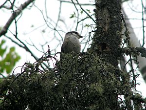
Voyageurs National Park is home to many animals. You might see timber wolves, black bears, moose, and lots of white-tailed deer. Smaller animals like foxes, beavers, river otters, muskrats, snowshoe hares, and weasels also live here. Sometimes, you can spot them crossing the frozen lakes in winter.
Many birds live here too, such as Bald eagles, loons, double-crested cormorants, owls, and warblers. The park's forests are mostly made up of Spruce and Fir trees, and also Pine trees.
History of Voyageurs National Park
The idea for this park first came up in 1891. But it wasn't until 1971 that President Richard Nixon signed the law to create it. The park officially opened in 1975. It is the only national park in Minnesota.
First People in the Area
Humans have lived in the Voyageurs National Park area for almost 10,000 years! The first people, called Paleo-Indians, came here as the waters from a huge ancient lake, glacial Lake Agassiz, went away. Later, during the Archaic Period (8,000 B.C. - 100 B.C.), people moved around, following animals they hunted and ripening plants. Fishing also became a very important food source.
The Fur Trade Era
Europeans started exploring this area around 1688. But it was the demand for beaver furs that brought many fur traders, known as voyageurs. As beavers became harder to find in the east, the voyageurs moved further west. Here, along what is now the border between the U.S. and Canada, they met the Cree, Monsoni, and Assiniboine tribes. By the mid-1700s, the Ojibwe people became the main residents. They played a key role by providing food, furs, and canoes to the traders.
Logging in the Forests
Logging came to the northern forests when the big white pine trees in other states were mostly cut down. Starting in the 1880s and 1890s, logging grew very big. Dams were built in the early 1900s to help move logs. Logging changed the forest a lot. Where white and red pine trees used to be common, they are now much less so. There are few areas left with very old, large trees.
The Rainy Lake Gold Rush
In 1893, a man named George Davis found gold on Rainy Lake. He found it on a small island, which is now called Little American Island. This discovery started a "gold rush." A town called Rainy Lake City quickly grew. It had a school, a bank, stores, hotels, and even a newspaper!
Other mines opened too, like the Lyle Mine and the Big American Mine. You can still see remains of 13 old mines in the park today. But the mines didn't produce much gold, and the gold rush ended by 1898. The town of Rainy Lake City was gone by 1901.
Settlers and Resorts
When the park was created in 1975, there were many resorts and private homes around and inside the park. Many owners sold their land to the park. Some chose to leave right away, while others stayed for a certain number of years. As these properties become empty, the park will remove most buildings to let nature return. However, about 20 properties with over 50 buildings will be kept by the National Park Service because they are important historical sites.
Places to See in Voyageurs National Park
Visitor Centers
The park has three visitor centers. Here you can get information, watch films, and see exhibits about the park's geology, wildlife, plants, and history:
| Visitor Center | When it's Open | Where it Is | Picture |
|---|---|---|---|
| Ash River | Open seasonally, late May to late September | On the park's southern edge, about 11 miles (18 km) from U.S. Route 53 on Saint Louis County Road 129 (Ash River Trail) | |
| Kabetogama Lake | Open seasonally, late May to late September | In the Kabetogama community, on the park's southwest edge, about 3 miles (4.8 km) from U.S. Route 53 | |
| Rainy Lake | Open all year | 12 miles (19 km) east of International Falls at the end of Koochiching County Road 96, off State Highway 11 |
Rainy Lake Area Sites
- Kettle Falls Hotel
This hotel was built in 1910 and is still open today! It's located between Lake Namakan and Rainy Lake. You can only get to Kettle Falls by boat in the summer. It's one of the few places in the lower 48 states where you look south to see Canada. - Anderson Bay
The cliffs here rise 80 feet (24 m) above the water. From the top, you get great views of the bay and Rainy Lake. This is a starting point for the Cruiser Lake Trail system. - Surveyor's Island
This island is on the east end of Rainy Lake. It was a campsite for surveyors in the early 1900s. - Camp Marston
This was a summer camp for engineering students from Iowa State University from 1922 to 1940. You can still see some old foundations and chimneys here. - Rainy Lake City
This was a "boom town" during the gold rush in the 1890s. An old saloon still stands here. You can also see where old streets and buildings used to be. - Harry Oveson Fish Camp
This is a well-preserved old commercial fishing camp. You can see several buildings, including Oveson's house, an ice house, and a fish processing building. - Little American Island
This island is on Rainy Lake. It's where gold was first found in 1893. The island now has an accessible trail, a restroom, and a dock.
Kabetogama Lake Area Sites
- Ellsworth Rock Gardens
These gardens were once filled with sculptures and flowers. Mr. Ellsworth created them as part of his family's summer home. Boat tours from the Kabetogama Visitor Center visit this site.
Namakan Lake Area Sites
- Hoist Bay
This area was used for logging and recreation. You can still see parts of an old railroad bridge and buildings from the resort days. It's a good spot for a day visit. - Moose River Indian Village
The Bois Forte Ojibwe people lived in this area from the 1760s to the 1930s. They lived in different parts of the park before the Nett Lake reservation was created.
Staying Safe in the Park
Boating Safety Tips
The U.S. Coast Guard marks safe channels in the main lakes. When you are going east on Rainy Lake and Namakan Lake, or west on Kabetogama Lake, or south on Sand Point Lake and Crane Lake:
- Green buoys with numbers mark the left side of the channel.
- Red buoys with numbers mark the right side of the channel.
Be careful! There are many hidden rocks just under the water's surface. Less than 10% of these dangerous spots are marked. The park has many parallel rock ridges that form the islands and the peninsula.
Winter Safety
Snowmobiling is a popular winter activity. In the middle of winter, the most dangerous areas for thin ice or open water are along river channels, like Rainy River, or in narrow spots. The current under the ice can create pressure ridges and soft spots. Snowmobilers usually avoid these areas.
Old Mines
Voyageurs National Park has 13 abandoned mines with 22 openings. These are mostly in the northwest part of the park. Some old mine pits, shafts, and open cuts are hidden by plants. Park staff have checked these sites, and they are not considered major dangers.
The International Border
The voyageurs used canoes and carried their boats over land for 2,000 miles (3,220 km) from Grand Portage to Lake Athabasca. This well-known water route between Lake Superior and Lake of the Woods became the official border after the Treaty of Paris (1783).
 | Lonnie Johnson |
 | Granville Woods |
 | Lewis Howard Latimer |
 | James West |


