Kamaniskeg Lake facts for kids
Quick facts for kids Kamaniskeg Lake |
|
|---|---|
| Location | Hastings County and Renfrew County, Ontario |
| Coordinates | 45°25′03″N 77°41′23″W / 45.41750°N 77.68972°W |
| Type | Max depth: 131ft |
| Part of | Ottawa River drainage basin |
| Primary inflows | Madawaska River |
| Primary outflows | Madawaska River |
| Basin countries | Canada |
| Max. length | 13 km (8.1 mi) |
| Max. width | 6 km (3.7 mi) |
| Surface elevation | 283 m (928 ft) |
| Settlements | Barry's Bay, Combermere |
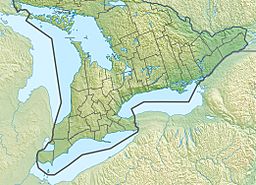
Kamaniskeg Lake is a beautiful lake in Ontario, Canada. It is located in both Hastings County and Renfrew County. This lake is part of the larger Ottawa River drainage basin, which means its waters eventually flow into the Ottawa River. You can find Kamaniskeg Lake in the Madawaska River Valley, with the towns of Barry's Bay and Combermere nearby. The lake is known for its natural beauty, featuring forests, rocky areas, and sandy beaches.
Contents
Exploring Kamaniskeg Lake's Geography
Kamaniskeg Lake is an important part of the Ottawa River drainage basin. The town of Barry's Bay is at the northern end of the lake. The community of Combermere is closer to the southeast side. A smaller community called Barrymere is also located on the lake's southeast end.
Where is the Lake Located?
The southern two-thirds of Kamaniskeg Lake are in a part of Hastings County called geographic Bangor Township. The northern one-third of the lake is in geographic Sherwood Township. A small tip on the southeast side is in geographic Radcliffe Township. Both Sherwood and Radcliffe Townships are in Renfrew County.
Rivers and Creeks Flowing In and Out
The Madawaska River is the main river that flows into Kamaniskeg Lake from the west. It also flows out of the lake from the southeast. This river is famous for its rapids. Besides the Madawaska River, three other smaller streams, or creeks, flow into the lake. These are Biernacki Creek, Carson Creek, and Purdy Creek.
The History of Kamaniskeg Lake
The name Kamaniskeg comes from the Ojibwe language. It means "lake of many islands." This name perfectly describes the lake, which has several islands.
The Sunken Steamboat Mayflower
One interesting piece of history in Kamaniskeg Lake is the wreck of a ship called the Mayflower. This was a paddle steamer that sank in 1912. The wreck site is on the north side of two islands in the lake. It's about 500 yards (or about 457 meters) from the larger island, heading towards the part of the lake that goes to Barry's Bay. Divers can usually find the spot marked by a white floating jug. The Mayflower rests at a depth of about 25 feet (or about 7.6 meters) on the lake bottom.
Getting Around Kamaniskeg Lake
There are a few ways to travel near and on Kamaniskeg Lake.
Roads Near the Lake
Renfrew County Road 62 runs along the east side of the lake. This road connects Barry's Bay in the north to Combermere further south. At Barry's Bay, County Road 62 also connects to Ontario Highway 60, a major road in the area.
Water Travel on the Lake
For those who like to travel by air and water, the Kamaniskeg Lake Water Aerodrome is located on the southeast side of the lake. This is a special seaplane base where seaplanes can land and take off from the water.
 | Jessica Watkins |
 | Robert Henry Lawrence Jr. |
 | Mae Jemison |
 | Sian Proctor |
 | Guion Bluford |


