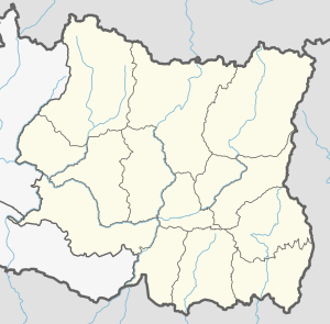
Kankai Municipality facts for kids
Quick facts for kids
Kankai Municipality
कन्काई नगरपालिका
|
|
|---|---|
| Country | |
| Zone | Mechi Zone |
| District | Jhapa |
| Wards | 9 |
| Incorporated | November 16, 1960 |
| Government | |
| • Type | Mayor–council |
| • Body | Kankai Municipality |
| Elevation | 300 m (1,000 ft) |
| Time zone | UTC+05:45 (NST) |
| Area code(s) | 023 |
| Website | official website: http://kankaimun.gov.np |
Kankai Municipality is a lively town located in the eastern part of Nepal. It's found in the Jhapa District, which is known for its beautiful landscapes. Kankai is an important and growing municipality in this region.
This municipality was created in May 2014. It was formed by combining two smaller areas, which were once called village development committees: Ghailadubba and Surunga. This merger helped Kankai become one of the biggest and most developed municipalities in Jhapa.
Contents
What is a Municipality?
A municipality is like a local government that manages a town or city. It helps organize services for the people living there. This includes things like managing local roads, schools, and health services.
How Kankai is Governed
Kankai Municipality has its own leaders who make decisions for the town. The main leader is called the Mayor. The Mayor works with a team to ensure the town runs smoothly. They help plan for the future and make sure everyone has what they need.
- The current Mayor is Rajendra Kumar Pokharel.
- The Deputy Mayor is Asha Sharma Shiwakoti.
Important Places in Kankai
Kankai Municipality has several important places that are hubs for daily life and trade. These areas are where people go to buy and sell goods. They are also places where communities gather.
Trade Centers
These are busy areas where people do business and shop. They are important for the local economy.
- Ghailadubba
- Surunga
- Durgapur
- Laxmipur
- Champapur
Fun Places to Visit
Kankai also has some interesting spots that visitors and locals enjoy. These places are great for exploring and learning about the area.
- Kankai Dham (Kotihome): This is a special religious site.
- Jamunkhadi Simsar: A wetland area, great for nature lovers.
- Domukha Jhapa: Another scenic spot to enjoy the outdoors.
- Dhanuskoti Dham: A place with cultural significance.
- Selfi Dada: A popular spot, perhaps known for great views or photos.
- Jhandi dada: Another local favorite for recreation.
- Naya basti plotting: A developing area that might offer new sights.
 | Lonnie Johnson |
 | Granville Woods |
 | Lewis Howard Latimer |
 | James West |


