Kapoho, Hawaii facts for kids
Kapoho, Hawaii, was a small area in the Puna district on the island of Hawaii, in the United States. It was located near the eastern tip of the island, in a special area above the Kīlauea volcano's east rift zone. Kapoho was first destroyed by a lava eruption from Kīlauea in 1960. People rebuilt it, and it became a community with private homes and places for tourists to stay. However, the town was destroyed again by lava during the 2018 lower Puna eruption. This time, even the bay next to it was mostly covered by lava. Today, no one lives there.
The 1960 Lava Eruption
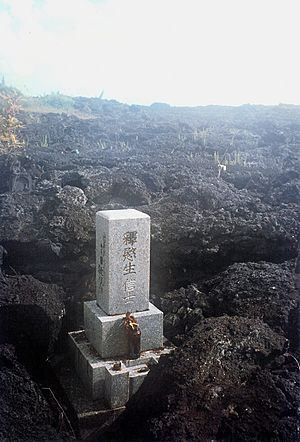
On January 12, 1960, people living in Kapoho felt more than 1,000 small earthquakes. Deep cracks appeared in the streets. There are old photos showing residents looking at the damage.
The eruption started on the night of January 13. Lava began to flow out of the ground in a sugar cane field just above Kapoho. Most of the lava flowed into the ocean. But a slower part of the lava flow moved towards the town of Kapoho. People tried very hard to stop the lava. They built dirt walls and sprayed water on the lava to make it hard. But on January 28, the lava entered and covered the town. Nearly 100 homes and businesses were destroyed. A hot spring resort, a place where people could relax in warm water, was also covered. The Cape Kumukahi Light, a lighthouse east of the town, was saved and still works today. However, the homes where the lighthouse keepers lived were destroyed.
Kapoho: 1960 to 2018
For almost 60 years, there was no lava activity in Kapoho. The area became a popular place to live and visit. It had natural tide pools, a black sand beach, and warm hot springs. These things made Kapoho a very attractive spot.
Even though Kapoho was in a very high-risk area for lava flows (called "lava flow hazard zone 1"), it became the most expensive place to live in Puna. Many homes there cost over $1,000,000.
The 2018 Lava Eruption
The 2018 lower Puna eruption caused problems for Kapoho in late May. Electricity was cut off, and the main road connecting Kapoho to the rest of the island was closed. On May 30, people living there were told to leave for their safety.
On June 1, the lava flow reached Kapoho. It moved over the lava from the 1960 eruption and then turned south. On June 2, 2018, a beautiful place called Green Lake (also known as Ka Wai o Pele) was destroyed. Lava flows boiled away all the water and completely filled the lake basin.
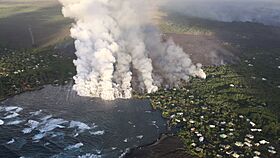
The lava reached the ocean at Kapoho Bay on June 4. It was about half a mile (800 meters) wide. Many homes were destroyed by the lava on June 4, but some were still standing. By June 5, the lava flow had built new land that stretched nearly 3,700 feet (1.1 kilometers) into the bay. Officials said that hundreds of homes in the areas called Vacationland Hawaii and Kapoho Beach Lots were destroyed by the fast-moving lava. Even the house of Hawaii Island Mayor Harry Kim, which he bought in 1971, was among the hundreds of houses destroyed.
Over the next few days, the entire Kapoho Bay was filled with lava. On June 6, officials reported that the few remaining homes in Vacationland were gone. The nearby gated community, Kapoho Beach Lots, was also largely covered by lava. This included the famous Kapoho tide pools and the Champagne Ponds.
By the end of June, about 520 acres (2.1 square kilometers) of new land had been created along the coast.
 | Mary Eliza Mahoney |
 | Susie King Taylor |
 | Ida Gray |
 | Eliza Ann Grier |


