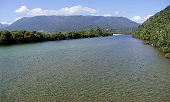
Karamea River facts for kids
Quick facts for kids Karamea River |
|
|---|---|
 |
|
| Country | New Zealand |
| Physical characteristics | |
| Length | 73 kilometres (45 mi) |
The Karamea River is a cool river found in New Zealand. It flows through two main areas on the South Island: the Tasman and West Coast Regions. This river is about 73 kilometers (45 miles) long, which is quite a distance!
Contents
About the Karamea River
The Karamea River is an important natural feature in the northern part of the South Island. It starts high up in the mountains and makes its way to the sea. Rivers like the Karamea are vital for the environment and the towns along their banks.
Where the Journey Begins
The Karamea River starts its long journey inside Kahurangi National Park. This park is a huge, protected area known for its amazing nature. The river's source is in the Matiri Range, which is part of the big Southern Alps mountain chain.
The river begins its flow to the east of a mountain called Mount Allen. At first, it winds west for a short distance. Then, it turns north, flowing in that direction for about 25 kilometers.
Winding Through the Land
After its northern stretch, the Karamea River turns west again. It then flows into a series of small lakes. This is where another river, the Roaring Lion River, joins the Karamea, adding more water to its flow.
From these lakes, the river continues its westward path. It travels through deep, steep-sided valleys, which are quite dramatic. Eventually, the Karamea River leaves the national park.
Reaching the Tasman Sea
Once out of the park, the river reaches a flatter area called a floodplain. This is about 10 kilometers (6 miles) from the coast of the Tasman Sea. As it gets closer to the sea, the river passes by two small settlements: Umere and Arapito.
Finally, the Karamea River reaches the sea at the township of Karamea. This is where its long journey ends, as its waters mix with the vast Tasman Sea.
 | Toni Morrison |
 | Barack Obama |
 | Martin Luther King Jr. |
 | Ralph Bunche |

