Tasman District facts for kids
Quick facts for kids
Tasman District
Te Tai o Aorere
|
|
|---|---|
|
Territorial authority district and Region
|
|

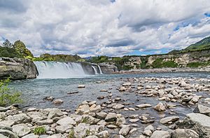
Maruia Falls
|
|

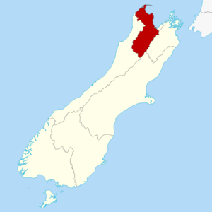
Tasman within the South Island, New Zealand
|
|
| Country | New Zealand |
| District | Tasman District |
| Wards |
|
| Community boards |
|
| Formed | 1992 |
| Seat | Richmond |
| Government | |
| • Body | Tasman District Council |
| Area | |
| • Total | 9,616.36 km2 (3,712.90 sq mi) |
| Population
(June 2023)
|
|
| • Total | 59,400 |
| • Density | 6.177/km2 (15.998/sq mi) |
| Time zone | UTC+12 (NZST) |
| • Summer (DST) | UTC+13 (NZDT) |
| Postcode(s) |
Map of postcodes
|
| ISO 3166 code | NZ-TAS |
| HDI (2021) | 0.927 very high · 7th |
The Tasman District (which in Māori is called Te Tai o Aorere) is a special area in the northwest of New Zealand's South Island. It's a place with its own local government, meaning it has its own council to make decisions.
Tasman District shares borders with the Canterbury, West Coast, and Marlborough Regions. It also borders Nelson City. The main office for the Tasman District Council is in Richmond.
Name
The Tasman District gets its name from Tasman Bay. This large bay on the north coast of the South Island was named after a Dutch explorer, Abel Tasman. He was the first European to discover New Zealand. This happened on December 13, 1642. The district was formed in 1989. It was created by joining two older areas called Waimea and Golden Bay counties.
History
Long ago, around the 12th century, Māori people arrived in Tasman Bay. They came on a large canoe called a waka named Uruao. These were the ancestors of the Waitaha people. Early Māori settlers explored the area well. They mostly lived along the coast because there was plenty of food there.
Over time, different Māori tribes moved into the area. This suggests there were many battles during the settlement process. Around 1828, the Ngāti Toa tribe, led by Te Rauparaha, and their friends, the Ngāti Rārua and Ngāti Tama tribes, began to take over parts of the South Island. They controlled the area from Farewell Spit to the Wairau River.
European settlers from England started arriving in Nelson in 1842. Captain Arthur Wakefield led this new settlement. From 1853 to 1876, the Tasman District was part of the Nelson Province.
In the 1850s, people started farming. Villages grew on the Waimea Plains and in Motueka. In 1856, gold was found near Collingwood. This started New Zealand's first gold rush. Later, a lot of iron ore was found at Onekaka. An ironworks factory operated there in the 1920s and 1930s.
Fruit growing became important at the end of the 1800s. By 1945, it was a big part of the local economy. Fruit growing is still very important today.
The Tasman District became an official local government area in 1989. It was part of the Nelson-Marlborough Regional Council. In 1992, the Tasman District Council became a special type of council called a unitary authority. This means it handles both regional and local tasks.
Geography
Tasman District is a large area in the western part of the South Island. It covers about 9,616 square kilometres. To the west, it has the Matiri Ranges, Tasman Mountains, and the Tasman Sea.
To the north, the Tasman and Golden Bays form its coast. The eastern border goes up to Nelson city. It also includes parts of the Spenser Mountains and the Saint Arnaud and Richmond Ranges. The Victoria Ranges are on Tasman's southern border. The highest point in the district is Mount Franklin, which is 2,340 metres tall.
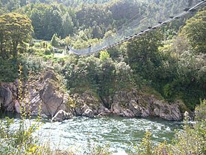
The landscape here is very different in different places. You can find huge mountains, deep valleys, and flat plains. Important rivers like the Buller, Motueka, Aorere, Tākaka, and Wairoa flow through it. The area around Mount Owen and Mount Arthur has a lot of limestone. This means there are many huge cave systems, including New Zealand's deepest caves at Ellis Basin and Nettlebed.
The district has lots of native forests and many birds. There are golden sand beaches and the unique 40-kilometre long sands of Farewell Spit. You can also find good fishing in the bays and rivers. All these things make Tasman a very popular place for tourists to visit.
Tasman District is home to three national parks:
- Abel Tasman National Park is New Zealand's smallest, at 225.41 square kilometres.
- Nelson Lakes National Park is 1,017.53 square kilometres.
- Kahurangi National Park is the largest, at 4,520 square kilometres.
The Maruia Falls are about 8 kilometres southwest of Murchison. They were formed by the 1929 Murchison earthquake. A landslide blocked the river's original path, creating the falls.
People and Population
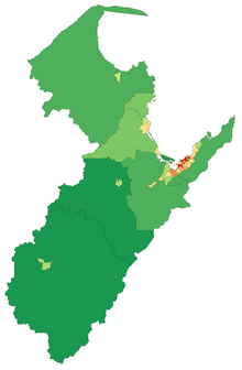
Tasman District covers about 9,616 square kilometres. In 2023, it had a population of 57,807 people. This was an increase of 5,418 people since 2018. The population density was about 6 people per square kilometre.
The average age of people in Tasman District in 2023 was 46.8 years. About 16.4% of the people were under 15 years old. About 23.3% were 65 years or older.
Most people in Tasman District are of European background (90.7%). There are also many Māori people (9.9%), Pasifika people (2.6%), and Asian people (4.0%). People can identify with more than one ethnicity.
In Tasman District, the most spoken language after English is German. In most other parts of New Zealand, the second most spoken language is Māori.
Some famous people who used to live in Tasman District include:
- Sir Ernest Rutherford, known as the "father of nuclear physics."
- Former Prime Ministers Bill Rowling and Sir Keith Holyoake.
- Sir Michael Myers, who was the Chief Justice of New Zealand from 1929 to 1946.
Towns and Settlements
Tasman District has six towns with more than 1,000 people. These towns are home to about 70% of the district's population.
| Urban area | Population (2018) |
% of region |
|---|---|---|
| Richmond | 19,200 | 32.3% |
| Motueka | 8,320 | 14.0% |
| Wakefield | 2,680 | 4.5% |
| Brightwater | 2,370 | 4.0% |
| Tākaka | 1,390 | 2.3% |
| Māpua | 1,630 | 2.7% |
Other towns and settlements include:
|
|
Economy
The Tasman District's economy was worth about $3.11 billion New Zealand dollars in 2033. This was about 0.8% of New Zealand's total economy. Over ten years, the economy in Tasman District grew by about 4.4% each year. This was faster than the average growth for all of New Zealand, which was 3.0% per year.
See also
 In Spanish: Región de Tasman para niños
 | Dorothy Vaughan |
 | Charles Henry Turner |
 | Hildrus Poindexter |
 | Henry Cecil McBay |


