
1929 Murchison earthquake facts for kids

|
|
| UTC time | 1929-06-16 22:47:30 |
|---|---|
| ISC event | 908150 |
| USGS-ANSS | ComCat |
| Local date | 17 June 1929 |
| Local time | 10:17 |
| Magnitude | Ms 7.8, Mw 7.3 |
| Depth | 12 km (7.5 mi) |
| Epicenter | 41°33′S 172°15′E / 41.55°S 172.25°E |
| Areas affected | South Island New Zealand |
| Casualties | 17 deaths, others injured |
The 1929 Murchison earthquake was a powerful earthquake that hit the Murchison area in New Zealand's South Island. It happened on June 17, 1929, at 10:17 AM. This earthquake was very strong, with a magnitude of 7.3. People felt it all over New Zealand. Sadly, 17 people died, mostly because the earthquake caused huge landslides. The rumbling sound of the earthquake was so loud that people heard it over 250 kilometers (155 miles) away in New Plymouth.
Contents
Why Earthquakes Happen in New Zealand

New Zealand is located right on the edge where two giant pieces of the Earth's crust meet. These pieces are called the Indo-Australian Plate and the Pacific Plate. They are always slowly moving.
In the South Island, a big crack in the Earth called the Alpine Fault takes up most of this movement. Other cracks, known as the Marlborough Fault System, also help. These plates don't just slide past each other; they also push into each other. This pushing can cause parts of the Earth's crust to bend or break. The 1929 Murchison earthquake happened on a specific crack called the White Creek Fault, located in the Buller Gorge.
Damage Caused by the Earthquake
Even though the earthquake's starting point, called the epicenter, was in a quiet area far from towns, it caused a lot of damage. The shaking was strong enough to harm a huge area, about 26,000 square kilometers (10,000 square miles).
Towns like Nelson, Greymouth, and Westport were all affected. Roads, buildings, and bridges were badly damaged. The worst damage came from the many landslides the earthquake triggered. These landslides destroyed several homes and caused 14 of the 17 deaths. Two other people died when coal mines collapsed.
Most buildings in the Murchison area were made of wood. They were twisted and moved off their foundations. However, many brick buildings and chimneys in Nelson, Greymouth, and Westport were also damaged.
How the Murchison Earthquake Felt
Before the main earthquake, there were several smaller shakes called foreshocks. People also heard loud booming sounds coming from the mountains around Murchison.
When the main earthquake hit, a large crack appeared on the ground near the Buller River. This crack showed that the ground moved about 4.5 meters (14.8 feet) up and down, and 2.5 meters (8.2 feet) sideways.
The earthquake caused many landslides, which then created 38 new lakes! Twenty-one of these lakes still exist today, including Lake Stanley. As mentioned, the earthquake also made unusually loud rumbling noises. These sounds were heard as far away as New Plymouth.
Scientists use a scale called the Mercalli intensity scale to describe how strong an earthquake feels in different places. For Murchison, the earthquake was rated as X, which means "Extreme." Most of the northern part of the South Island felt an intensity of VII, which means "Very strong."
Life After the Earthquake
The many landslides blocked roads, which meant that food supplies couldn't reach some areas near the earthquake's center. Because of this, and the danger from more aftershocks and possible floods, many people had to leave their homes. Most of them walked to safety.
The town of Karamea was completely cut off. No outside help could reach them for two weeks. Finally, a small plane, a de Havilland Tiger Moth, landed on the beach to bring supplies. It took many months to clear some of the blocked roads.
Studying Earth's Inside with Earthquakes
Earthquakes create waves that travel through the Earth. Scientists study these waves to learn about what's inside our planet. The 1929 Murchison earthquake was very important for this.
A scientist named Inge Lehmann studied the seismic waves from this earthquake. She noticed that some waves appeared in an area where they shouldn't have been, called the "shadow zone." This made her realize that there must be a solid inner core deep inside the Earth. This inner core reflected the waves, sending them to places they wouldn't normally reach. Her discovery helped us understand the structure of our planet much better!
Images for kids
-
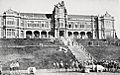
Wreckage of the tower of the main building at Nelson College following the earthquake
.jpg)
