
Kasaragod district facts for kids
Kasaragod District is a beautiful area in the state of Kerala, India. It's one of the 14 districts that make up Kerala. Kasaragod became its own district on May 24, 1984. Before that, it was part of the Kannur district when Kerala was formed on November 1, 1956.
People of Kasaragod

In 2011, a big count of people called a census was done in India. It showed that Kasaragod district had about 1,307,375 people living there. This is roughly the same number of people as in the country of Mauritius!
The district is quite busy, with about 654 people living in every square kilometer. Between 2001 and 2011, the number of people living here grew by about 8.18%.
Kasaragod is also known for having more females than males. For every 1000 males, there were about 1079 females. This is called the sex ratio. Also, many people in Kasaragod can read and write. About 89.85% of the people here are literate, which is a very good literacy rate.
Images for kids
-
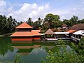
Ananthapadmanabhaswamy temple at Ananthapura, Kumbla
-
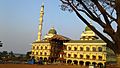
Malik Dinar Mosque, Kasaragod, is one of the oldest mosques in India.
-
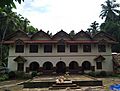
Maipady palace
-
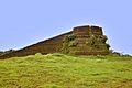
Arikady fort at Kumbla
-
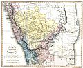
A map of Malabar District (Malayalam district) drawn by Francis Buchanan-Hamilton in 1807. Kasaragod region to the south of Payaswini/Chandragiri river of South Canara was also included in Malayalam region (just above the blue shaded region).
-
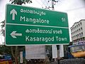
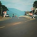
Road sign in Kasaragod town
-

Sunset at Valiyaparamba beach
-
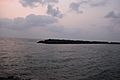
Manjeshwar harbour
-
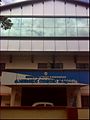
Kanhangad Municipal Office
-
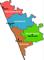
Taluks in Kasargod
-
Kasaragod railway station lies on Mangalore-Shoranur railway line in Palakkad railway division.
-
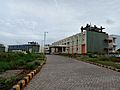
The Central University of Kerala is situated in the district.
-
The Central Plantation Crops Research Institute at Kasaragod was established in 1916.
-
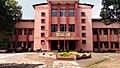
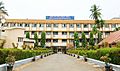
The Government College Kasaragod was established in 1957.
-
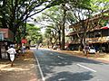
Thrikaripur town
-
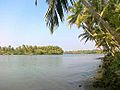
Edayilakkad island in Valiyaparamba
-
Panathur is an important hilly town in the district (Closer to Western Ghats)
-
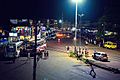
Badiyadka town during night


.jpg)


.jpg)


See also
 In Spanish: Distrito de Kasaragod para niños
