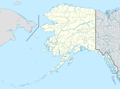
Kathakne, Alaska facts for kids
Quick facts for kids
Kathakne
|
|
|---|---|
| Country | United States |
| State | Alaska |
| Census area | Southeast Fairbanks |
| Elevation | 1,696 ft (517 m) |
| Time zone | UTC-9 (Alaska (AKST)) |
| • Summer (DST) | UTC-8 (AKDT) |
| GNIS feature ID | 1895065 |
Kathakne is a small place in Alaska, United States. It is known as an "unincorporated community." This means it doesn't have its own local city government. Instead, it's managed by the larger region around it.
Contents
About Kathakne
Kathakne is located in the Southeast Fairbanks Census Area. This area is a part of Alaska. The name "Kathakne" comes from an Alaska Native language.
Where is Kathakne Located?
Kathakne sits on the northeastern shore of Fish Lake. It is about 3 miles (5 kilometers) east of a town called Northway. You can also find it close to the Northway Airport.
How High is Kathakne?
The land in Kathakne is quite high up. Its elevation is 1,696 feet (517 meters) above sea level. This means it's nearly as tall as a 170-story building!
What is an Unincorporated Community?
An unincorporated community like Kathakne is a group of homes or buildings that are not part of an official city or town. They don't have their own mayor or city council. Instead, they are governed by the larger county or census area they are in.
For example, the Southeast Fairbanks Census Area handles things like roads and services for Kathakne.
Government and Representation
Even though Kathakne doesn't have its own city government, its residents are still represented. They have people who speak for them in the state government.
- A State Senator represents Kathakne in the Alaska Senate. This person helps make laws for the entire state.
- A State Representative speaks for Kathakne in the Alaska House of Representatives. This person also helps create state laws.
These elected officials make sure the needs of places like Kathakne are heard in the state capital.


