Katueté facts for kids
Quick facts for kids
Katueté
|
|
|---|---|
| Country | Paraguay |
| Department | Canindeyú |
| Population
(2017)
|
|
| • Total | 8,681 |
| Time zone | GMT-3 |
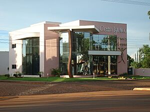
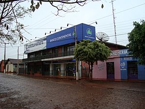
Katueté is a town and municipality in Paraguay. It is found in the central part of the Canindeyú Department. Katueté became an official district on May 24, 1994. It is about 362 kilometers (225 miles) from Asunción, the capital city. You can reach Katueté by traveling on Route 10.
The name Katueté comes from a Guaraní phrase. Dr. Alejandro Encina Marín was exploring the area with its owners. When they found a great spot for a town, he said in Guaraní, "katueté voi, ko ape oî porâta". This means something like "this place is truly good, it will be fine here."
Contents
Exploring Katueté's Geography
This area is known as the "high zone." It has grown a lot, especially in its physical features. You can clearly see valleys that are perfect for farming. The land is mostly flat or gently rolling. This makes it very suitable for agriculture.
Katueté shares its borders with several other places. To the north, it borders Corpus Christi and Álvarez. To the south, it borders Nueva Esperanza. To the east, it is next to Álvarez. To the west, it borders Corpus Christi and Ybyrarobaná.
Waterways and Rivers
The region has many important rivers and streams. These waterways flow into the large Paraná River. The Carapá River is one of them. There are also streams like Tayi Caré and Itabó. Many other small water sources keep the area well-watered.
Katueté's Climate
Katueté has a subtropical climate. The average temperature for the year is about 21°C (70°F). The lowest average temperature is around 15°C (59°F). In summer, temperatures can reach up to 41°C (106°F). During winter, they can drop to 0°C (32°F).
The area gets a lot of rain. The average rainfall is between 1,600 and 1,700 mm (63 to 67 inches). May is usually the wettest month. June is the driest month.
Katueté's Population
According to data from the DGEEC (Paraguay's national statistics office), Katueté has 10,912 residents. Of these, 5,729 are men and 5,184 are women. Most of the people in Katueté live in the countryside. About 70% of the population lives in rural areas.
Katueté's Economy
The land in Katueté is very fertile for growing crops. Many of the farmers here are descendants of Brazilian settlers. These lands used to belong to a company called La Industrial Paraguaya. They were bought by the Lunardelli group in the late 1960s.
The main crops grown in Katueté are soy, wheat, and cassava. This makes Katueté an important part of Paraguay's farming production. It is also a place where a new culture has developed. This is due to the "brasiguayos," who are Paraguayans with Brazilian family roots.
Several sawmills operate in the area, processing wood. There are also plants that process cassava. These plants have private investments from Brazil. They can store about 200 tons of raw materials each day. Other smaller industries also operate in the region.
Katueté's Infrastructure
The main road for travel is Route PY03. This road connects Katueté to Salto del Guairá and Asunción. It also links Katueté to other towns in the department and across the country. About 70% of the roads are dirt roads, and 30% are paved.
Katueté has a health center. However, there are no smaller clinics in the indigenous communities. Many people of Brazilian nationality use health services in Brazil.
Telephone services have been improved in the area. Digital telephone exchanges are available in Salto del Guairá, Francisco Caballero Álvarez, Corpus Christi, Nueva Esperanza, Katueté, and Curuguaty. Katueté benefits from Copaco telephone services and mobile phone services. The town also has other ways to communicate. Newspapers from the capital city reach all parts of the area.
See also
 In Spanish: Katueté para niños
 | Valerie Thomas |
 | Frederick McKinley Jones |
 | George Edward Alcorn Jr. |
 | Thomas Mensah |


