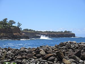
Keokea, Hawaii County, Hawaii facts for kids
Kēōkea is a small, populated area in Hawaiʻi County, Hawaii, United States. It's not a city with its own government, but rather a community where people live. Kēōkea is found on the big island of Hawaiʻi.
Where is Kēōkea?
Kēōkea is located at about 19°25′10″N 155°52′58″W. This spot is near where two main roads meet: Māmalahoa Highway (also known as Route 11) and Keala o Keawe Road (Route 160). The area is about 960 feet (293 meters) above sea level. If you look at satellite pictures, you can see that the climate is humid, meaning it gets a lot of moisture. Farming is a very important activity in this area. Just to the north of Kēōkea is another area called Hōnaunau.
What Does Kēōkea Mean?
The name Kēōkea is used for several places across the Hawaiian Islands. In the Hawaiian Language, kē ō kea has a special meaning. It can mean "the sound of whitecaps," which are the white foamy tops of ocean waves. It can also mean "the white sand," referring to the beautiful sandy beaches.
Kēōkea's History
Long ago, in ancient Hawaiʻi, Kēōkea was the name for a land division called an ahupuaʻa. This type of land stretched all the way from the shoreline up to the large volcano, Mauna Loa. This specific ahupuaʻa was owned by a very important person named Mataio Kekūanaōʻa.
Kēōkea Beach Park
There is also a county park named Kēōkea located on the northern coast of the Hawaiʻi Island. You can find this park at about 20°13′37″N 155°44′44″W. It's a great place to enjoy the ocean and the beautiful Hawaiian scenery.
See also
 In Spanish: Keokea (condado de Hawái) para niños
 | Anna J. Cooper |
 | Mary McLeod Bethune |
 | Lillie Mae Bradford |


