Keokee, Virginia facts for kids
Quick facts for kids
Keokee, Virginia
|
|
|---|---|

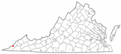
Location of Keokee, Virginia
|
|
| Country | United States |
| State | Virginia |
| County | Lee |
| Area | |
| • Total | 4.81 sq mi (12.46 km2) |
| • Land | 4.71 sq mi (12.20 km2) |
| • Water | 0.10 sq mi (0.26 km2) |
| Elevation | 2,080 ft (634 m) |
| Population
(2010)
|
|
| • Total | 416 |
| • Density | 88/sq mi (34.1/km2) |
| Time zone | UTC−5 (Eastern (EST)) |
| • Summer (DST) | UTC−4 (EDT) |
| ZIP code |
24265
|
| Area code(s) | 276 |
| FIPS code | 51-42104 |
| GNIS feature ID | 1495785 |
Keokee is a small community in Lee County, Virginia, in the United States. It's known as a census-designated place (CDP), which means it's an area that looks like a town but isn't officially a city or village. In 2010, about 416 people lived there.
Contents
History of Keokee
The community of Keokee has a history tied to its local services.
Early Beginnings
The Keokee post office, which helps people send and receive mail, was first opened in 1906. This was an important step in building the community.
Historic Buildings
A special building called Keokee Store No. 1 was added to the National Register of Historic Places in 2007. This list includes places across the country that are important to history and should be protected.
Geography of Keokee
Keokee is located in the northeastern part of Lee County. It sits at specific coordinates: 36.856575 degrees North and -82.907861 degrees West.
Nearby Communities
The area of Keokee includes two other small communities nearby: Darnell Town and Rawhide.
Natural Borders
To the north, Keokee shares a border with the state of Kentucky. This border follows the top of a mountain called Little Black Mountain, which is about 3,000 feet (914 meters) high.
Land and Water
According to official measurements, Keokee covers a total area of about 4.8 square miles (12.5 square kilometers). Most of this area, about 4.7 square miles (12.2 square kilometers), is land. A small part, about 0.1 square miles (0.3 square kilometers), is water. The water in this area flows south into the North Fork of the Powell River. This river is part of a larger system that eventually leads to the Tennessee River.
Travel and Roads
Keokee is about 15 miles (24 km) northeast of Pennington Gap, which is the biggest town in Lee County. It's also about 13 miles (21 km) west of Big Stone Gap. A local road, Virginia Secondary Route 624, goes north from Keokee to the Kentucky border. Once you cross into Kentucky, this road becomes Kentucky Route 38. This route then goes west through a valley to Harlan, Kentucky, which is about 31 miles (50 km) from Keokee.
See also
 In Spanish: Keokee (Virginia) para niños
 | Toni Morrison |
 | Barack Obama |
 | Martin Luther King Jr. |
 | Ralph Bunche |

