Kickapoo, Indiana facts for kids
Quick facts for kids
Kickapoo, Indiana
|
|
|---|---|
| Country | United States |
| State | Indiana |
| County | Warren |
| Township | Warren |
| Time zone | UTC-5 (Eastern (EST)) |
| • Summer (DST) | UTC-4 (EDT) |
| ZIP code |
47918
|
| Area code(s) | 765 |
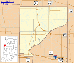
Kickapoo was once a small town in Indiana, United States. Today, it is known as a "ghost town" because no one lives there anymore. It was located in Warren County, within Warren Township.
History of Kickapoo

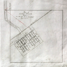
Kickapoo was officially planned on February 2, 1885. A man named Lewis Davisson created its first map, called a plat. This map showed where streets and buildings would go.
The town was built near a new train line. This was the Chicago and Great Southern Railway. The railroad helped connect Kickapoo to other places. However, Kickapoo never grew very large. A history book from 1913 said it had only "a small population." Over time, people moved away, and the town became empty.
Where Was Kickapoo Located?
Kickapoo was found in a specific area of Warren County. This area is known as section 29, township 22, range 7 west. Today, you can find the site along what is now called Kickapoo Road. This road is also known as County Road 425 E.
A stream named Kickapoo Creek flows past the old town site. This creek then joins the Wabash River. The meeting point is about one mile south of where Kickapoo used to be.
 | Jewel Prestage |
 | Ella Baker |
 | Fannie Lou Hamer |


