Kill Creek Township, Osborne County, Kansas facts for kids
Kill Creek Township is a small area located in Osborne County, Kansas, in the United States. In the year 2000, only 35 people lived here. It is a quiet place known for its history and connection to an important American book.
Quick facts for kids
Kill Creek Township
Osborne County, Kansas |
|
|---|---|

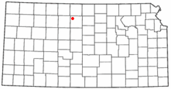
Location of Kill Creek, Kansas
|
|
| Country | United States |
| State | Kansas |
| County | Osborne |
| Area | |
| • Total | 36.1 sq mi (93.5 km2) |
| • Land | 36.0 sq mi (93.3 km2) |
| • Water | 0.1 sq mi (0.2 km2) |
| Elevation | 1,768 ft (539 m) |
| Population
(2000)
|
|
| • Total | 35 |
| • Density | 1.0/sq mi (0.4/km2) |
| Time zone | UTC−06:00 (CST) |
| • Summer (DST) | UTC−05:00 (CDT) |
| FIPS code | 20-36750 |
| GNIS feature ID | 472267 |
| Website | County Website |
Contents
History of Kill Creek
Kill Creek Township gets its name from a nearby creek. This creek was named after a historical event involving conflict that happened there in the 1860s. It is important not to confuse this Kill Creek with another one in Johnson County, Kansas.
Founding and Early Days
Kill Creek Township was officially started in 1872. It was created from a larger area called Liberty Township. Later, in 1880, the western part of Kill Creek Township became its own area, known as Mount Ayr Township.
The community of Kill Creek was once a busy stop. It was located in the northern part of the township. This area was an important point on the Bull City-Russell Freight Trail.
Population Changes
Over the years, the number of people living in Kill Creek Township slowly decreased. Today, most of the original community has disappeared. Only a few residents live in farmhouses scattered across the township.
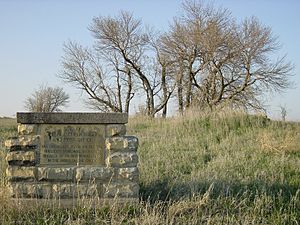
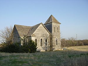
A memorial marker from 1949 shows where the general store and post office used to be. The Kill Creek Presbyterian Church, built in 1885, was a symbol of the community for a long time. It closed in 1985 and was taken down in 2006.
Famous Book Connection
Kill Creek is known around the world because of a classic American book. The book is called "Sod-House Days: Letters of a Kansas Homesteader 1877–1878". It was written by Howard Ruede (1852–1925).
Howard Ruede lived in Kill Creek from 1877 to 1901. The book was published in 1937 after he had passed away. It is based on letters Howard wrote to his family in Pennsylvania from his homestead in Kill Creek.
The book is sold in about 24 countries worldwide. More than 40 colleges and universities in the United States and Canada use it as a textbook. In 2012, the book celebrated its 75th year in print.
Heritage Tour
You can explore the places mentioned in the book on a special tour. It is called The Rediscovering "Sod-House Days" Heritage Backway. This tour is 31.5 miles long and has 27 stops.
You can take the tour by car or bicycle. It is open to the public and is featured in the book "Osborne County Kansas Scenic & Heritage Backways" (2013).
Geography
Kill Creek Township is located at coordinates 39°21′9″N 98°52′51″W / 39.35250°N 98.88083°W. This means it is in a specific spot on the map.
According to the United States Census Bureau, the township covers a total area of about 36.0 square miles (93.3 square kilometers).
Demographics
Demographics is the study of populations. It looks at things like how many people live in an area and how that number changes over time. The table below shows the population of Kill Creek Township.
| Year | Population | Households |
|---|---|---|
| 1878 | 431 * | |
| 1880 | 379 | 89 |
| 1900 | 307 | 56 |
| 1910 | 276 | 58 |
| 1920 | 233 | 53 |
| 1930 | 245 | 53 |
| 1990 | 54 | |
| 2000 | 35 | 20 |
The asterisk (*) next to the 1878 population means something special. It includes an area that later became Mount Ayr Township in 1880. This was before the 1880 census was taken.
See also
 In Spanish: Municipio de Kill Creek para niños


