King John's Hill facts for kids
King John's Hill is an ancient place in Hampshire, southeast England. It's where you can find the remains of an Iron Age hillfort. A hillfort was a type of fort built on a hill, used by people long ago for protection. This hill is in the village area of Worldham, within the East Hampshire District. It is a very important historical site, officially known as a Scheduled Ancient Monument. This means it's protected by law because of its historical value.
King John's Hill has a small hillfort with several rings of defence. These are called "multivallate" defences. Experts believe it was built around 100 BC, based on pieces of pottery found there. Later, during the Middle Ages (around the 13th to 14th centuries AD), people lived there again. They found signs of old buildings and more pottery from that time. People think these might be the remains of a hunting lodge. It's traditionally said that King John himself built this lodge.
Where is King John's Hill?
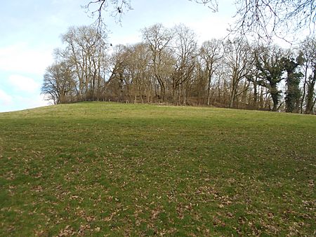
The hill stands about 129 meters (423 feet) above sea level. It's just over 0.5 kilometers (0.3 miles) southeast of the village of East Worldham. It's also about 4 kilometers (2.5 miles) east of the town of Alton. King John's Hill is located inside the beautiful South Downs National Park. The hill is made of a type of rock called greensand. It has a flat top and very steep sides. Today, it's covered in thick woods and dense plants.
What Does the Hillfort Look Like?
This hillfort is quite small compared to others. Its defences were not very strong. It's somewhere between a large hillfort and a smaller protected village. The fort is shaped like an oval and covers an area of about 0.8 hectares (2 acres).
Even though some parts have been damaged by quarrying (digging for stone), it is still very well preserved. Archaeologists have dug here and found lots of evidence. They found things from the Iron Age, the medieval period, and even later times.
The northern side of the fort's defences was destroyed by quarrying. But on other sides, you can still see two curved banks of earth. These are separated by a wide, flat area. On the northeast side, a natural ridge meets the fort. A shallow ditch was dug through this ridge. This ditch connects to a later boundary that goes around the bottom of the hill on the east side. This boundary also encloses several flat areas on the lower slopes of the hill.
How Was King John's Hill Investigated?
Archaeologists dug up parts of the hill in 1939 and 1947. They found pieces of pottery from the Iron Age. They also discovered two storage pits that had been filled in. These pits were likely used to store food or other important items.
Evidence of people living on the site during the medieval period was also found. This included old stonework and more pottery. Even later remains were discovered from the Tudor period. These included short sections of walls, packed earth floors, bricks, tiles, and ovens. A special type of pin, called a ring-headed pin, was found in one of the Iron Age storage pits. It was made from wire.
The old stories about King John having a hunting lodge here are supported by historical records. These records show that a deer park existed in East Worldham as far back as 1372. A deer park was a large area of land where deer were kept for hunting.
 | Delilah Pierce |
 | Gordon Parks |
 | Augusta Savage |
 | Charles Ethan Porter |


