
South Downs National Park facts for kids
Quick facts for kids South Downs National Park |
|
|---|---|
|
IUCN Category V (Protected Landscape/Seascape)
|
|

View of the South Downs from Devil's Dyke
|
|

Map of the South Downs National Park
|
|
| Location | United Kingdom (South East England) |
| Length | 140 km (87 mi) |
| Width | 11.2 km (7.0 mi) |
| Area | 1,627 km2 (628 sq mi) |
| Established | 1 April 2010 |
| Visitors | 16m |
| Governing body | South Downs National Park Authority |
| Website | www.southdowns.gov.uk |
The South Downs National Park is England's newest national park. It was officially named on March 31, 2010. This special park covers about 1,627 square kilometers (628 square miles) in southern England.
It stretches for 140 kilometers (87 miles) from Winchester in the west to Eastbourne in the east. The park goes through three counties: Hampshire, West Sussex, and East Sussex. It includes the famous chalk hills of the South Downs. These hills form the white cliffs of the Seven Sisters and Beachy Head along the coast. The park also covers a large part of the western Weald. This area has many wooded hills and valleys made of sandstone and clay. The South Downs Way is a long walking path that runs through the entire park. It's the only National Trail that is completely inside a national park.
Contents
History of the South Downs National Park
The idea for a South Downs National Park started in the 1920s. People were worried about the beautiful downland being damaged. They were especially concerned about new houses being built everywhere, like in Peacehaven.
In 1929, a group called the Campaign to Protect Rural England suggested creating national parks. They wanted a park in the South Downs. After World War II, a report in 1945 did not include the South Downs as a national park. However, another report in 1947 by Sir Arthur Hobhouse did suggest it. He said a national park should be a "beautiful and relatively wild country" that is "strictly preserved" for everyone's benefit.
Why the Park Was Delayed
The South Downs was the last of the suggested national parks to be created. One reason for the delay was that a lot of the chalk downland was used for farming after 1940. This changed the landscape. In 1956, officials thought the area was no longer suitable for a national park.
Instead, they decided to make it an Area of Outstanding Natural Beauty (AONB). This means it's a special area recognized for its natural beauty. Two AONBs were created: the East Hampshire AONB in 1962 and the Sussex Downs AONB in 1966. These two areas later became the basis for the South Downs National Park.
Making the Park Official
In 1999, the government decided to support the idea of a South Downs National Park again. In 2003, an official order was made to create the park. However, there were some disagreements and objections. This led to a long public inquiry that lasted from 2003 to 2005.
The inquiry's results were delayed because of a legal issue with another national park. In 2006, the report suggested making the park 23% smaller. This meant leaving out parts of the existing AONBs. Many people were upset by this, especially the Campaign to Protect Rural England. They wanted the western Weald area to be included to protect it from building.
Because of these concerns, the public inquiry was reopened in 2008. Finally, on March 31, 2009, the government announced that the South Downs would become a national park. The Secretary of State, Hilary Benn, signed the order on November 12, 2009. He made sure that important areas like the western Weald, Lewes, and Ditchling were included.
The new national park officially started on April 1, 2011. The South Downs National Park Authority took over its management. To celebrate, an opening ceremony was held in Petersfield. In 2016, the park was given International Dark Sky Reserve status. This helps protect the park from light pollution, making it easier to see the stars. It was only the second such area in England.
How the Park is Managed

The South Downs National Park Authority (SDNPA) manages the park. This authority started on April 1, 2010, and became fully responsible for the park on April 1, 2011. Its main jobs are:
- To protect and improve the park's natural beauty, wildlife, and history.
- To help people understand and enjoy the park's special qualities.
The SDNPA also has a duty to support the local communities. This means helping the people who live and work in the park. The SDNPA is a public organization. It gets money from the government. A board of twenty-seven members runs it. These members include national experts, local government representatives, and people from parish councils. The current chair of the SDNPA is Ian Phillips.
Geography of the South Downs National Park

The South Downs National Park stretches for about 140 kilometers (87 miles) across southern England. It goes from St Catherine's Hill near Winchester in the west to Beachy Head, near Eastbourne in East Sussex in the east.
In the western part, the park's southern edge is about 10 kilometers (6 miles) inland from the coast. This means it does not include big coastal cities like Southampton or Brighton and Hove. Further east, the park's edge is closer to the coast. It carefully avoids urban areas like Worthing and Eastbourne. However, the park does include some towns in the western Weald, such as Petersfield, Midhurst, and the historic towns of Arundel and Lewes.
People and Visits
About 108,000 people live inside the national park. Most of them live in Hampshire, West Sussex, and East Sussex. The park gets around 39 million visits each year. This number is expected to grow because it is now a national park.
The park covers about 1,625 square kilometers (627 square miles). The largest part of the park is in Chichester District. The park includes two areas that were previously Areas of Outstanding Natural Beauty (AONBs): the East Hampshire AONB and Sussex Downs AONB. It also includes the Queen Elizabeth Country Park.
Different Landscapes

The South Downs National Park is special because of its chalk downland. This is a type of rolling hill landscape made of chalk. However, almost a quarter (23%) of the park is very different. This area is called the western Weald. It has densely wooded hills and valleys made from older sandstones and clays.
The highest point in the national park is Blackdown. It is 280 meters (919 feet) above sea level and is located in the Weald. The highest point on the chalk hills of the South Downs is Butser Hill, which is 271 meters (889 feet) high.
Geology of the Park
Most of the national park is made of chalk downland. But a significant part also includes the sandstones and clays of the western Weald. This creates a very different landscape with many wooded hills and valleys.
How the Chalk Formed
The chalk formed during the Late Cretaceous period, between 100 million and 66 million years ago. At that time, the area was under the sea. The chalk is made of tiny calcite plates from microscopic sea creatures called coccolithophores.
Later, during the Cenozoic era, the chalk was pushed upwards. This movement also created the Alps. The strong chalk rock has been shaped by weathering over time. This created a classic cuesta shape. It has a steep, north-facing chalk escarpment that rises sharply above the lower valleys of the Low Weald.
The White Cliffs
The chalk escarpment reaches the English Channel west of Eastbourne. Here, it forms the dramatic white cliffs of Beachy Head, the Seven Sisters, and Seaford Head. These cliffs were formed after the last Ice Age. As sea levels rose, the English Channel was created. The sea then wore away the chalk, forming the cliffs.
The South Downs run from west to north-west, from the Eastbourne area through southern Sussex to the Hampshire downs. They separate the coastal plain from the clays and sandstones of the Weald. Behind the steep escarpment, you find the high, smooth, rolling downland hills. These are broken up by dry valleys and gaps where rivers like the Cuckmere, Ouse, Adur, and Arun flow through.
Chalk is a white sedimentary rock. It is very uniform, fine-grained, and allows water to pass through easily. It contains many layers of flint nodules. Flint has been used for making stone tools and as a building material for houses. Other areas in Britain with similar chalk landscapes include the North Downs and the Chilterns.
In its western part, the national park extends north beyond the chalk hills into the western Weald. This area includes the valley of the western River Rother, which is cut into Lower Greensand rock. It also has densely wooded hills and valleys of the Greensand Ridge and Weald Clay south of Haslemere.
Images for kids
-
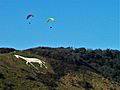
The Litlington White Horse in the village of Litlington

See also
 In Spanish: Parque nacional de South Downs para niños
