Brighton and Hove facts for kids
Quick facts for kids
Brighton and Hove
City of Brighton and Hove
|
||
|---|---|---|
|
City and unitary authority
|
||
|
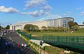
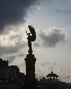
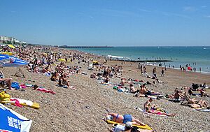
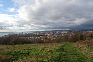
Clockwise, from top: the seafront; the bandstand; Falmer Stadium; the Peace Statue; Churchill Square
|
||
|
||
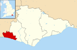
Brighton and Hove shown within East Sussex and England
|
||
| Sovereign state | United Kingdom | |
| Country | England | |
| Region | South East England | |
| Historic county | Sussex | |
| Ceremonial county | East Sussex | |
| Administrative seat | Hove | |
| Established | 1 April 1997 | |
| City status | 31 January 2001 | |
| Government | ||
| • Type | Unitary authority | |
| • Body | Brighton and Hove City Council | |
| Area | ||
| • City and unitary authority | 33.80 sq mi (82.67 km2) | |
| • Urban | 34.5 sq mi (89.4 km2) | |
| Area rank | 234th | |
| Population
(2005 est.)
|
||
| • City and unitary authority | 290,885 | |
| • Rank | 45th | |
| • Urban | 474,485 (15th) | |
| • Urban density | 13,740/sq mi (5,304/km2) | |
| • Metro | 769,000 (15th) | |
| Ethnicity (2021) | ||
| • Ethnic groups |
List
|
|
| Religion (2021) | ||
| • Religion |
List
55.2% no religion
30.9% Christianity 7.1% not stated 3.1% Islam 1% other 0.9% Buddhism 0.9% Judaism 0.8% Hinduism 0.1% Sikhism |
|
| Time zone | UTC±0 (Greenwich Mean Time) | |
| • Summer (DST) | UTC+1 (British Summer Time) | |
| Postcode areas |
BN (1, 2, 3, 41)
|
|
| ONS code | 00ML (ONS) E06000043 (GSS) |
|
| ISO 3166-2 | GB-BNH | |
Brighton and Hove is a vibrant city in East Sussex, England. It is made up of the popular seaside towns of Brighton and Hove, along with several smaller villages. The city is managed by the Brighton and Hove City Council.
Brighton and Hove is part of the second-largest urban area in South East England. It is a fun and busy place to visit or live. In 2014, the city joined with other nearby councils to form the Greater Brighton City Region.
Contents
- How Brighton and Hove Became One City
- Exploring the Areas of Brighton and Hove
- Brighton: A Lively Seaside Town
- Hove: A Quieter Neighbour
- Portslade, Portslade Village, and Mile Oak
- Aldrington, Hangleton, and West Blatchington
- Westdene, Withdean, and Patcham
- Hollingbury and Hollingdean
- Coldean, Moulsecoomb, and Bevendean
- Kemptown, Whitehawk, and Roedean
- Woodingdean, Ovingdean, and Rottingdean
- The Brighton and Hove Boundary
- How Brighton and Hove is Governed
- Economy and People
- Media in Brighton and Hove
- Freedom of the City
- See also
How Brighton and Hove Became One City
For a long time, Brighton and Hove were separate towns. In 1992, a government group looked at how local areas were run in England. They thought about making Brighton and Hove into separate local councils. However, many people in both towns wanted them to join together.
Even though some people in Hove worried that Brighton would become too dominant, the idea of joining was very popular. So, in 1997, the councils of Brighton and Hove officially merged. This created the new Brighton and Hove Borough Council.
Later, in 2001, Brighton and Hove was given special city status as part of the Millennium celebrations. This meant the borough council became a city council.
Even though they are now one city, many locals still see Brighton and Hove as two different places. Hove is mostly residential and has its own quiet seafront. Brighton is known as a lively seaside resort with many festivals and a growing digital industry. The famous saying ""Hove, actually"" shows how people still see them as distinct.
Some local groups, like the Brighton and Hove Albion football club and the Brighton & Hove bus company, were around long before the towns officially joined.
Exploring the Areas of Brighton and Hove
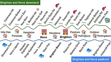
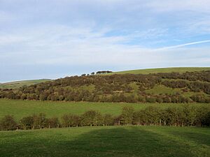
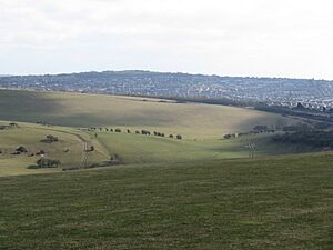
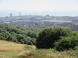
The City of Brighton and Hove includes many different areas. It has a long coastline and parts of the South Downs National Park. Offshore, the Rampion Wind Farm helps provide clean energy.
Brighton: A Lively Seaside Town
Brighton has been a major town in Sussex for centuries. It had its own town hall and local control since the 1500s. The original Brighton area covered much of what is now central Brighton.
Over the years, Brighton grew bigger. In 1854, it became an official borough. Then, in 1927, more areas like Ovingdean and Rottingdean were added. This made Brighton much larger to the north and west. Many new homes were built in areas like Woodingdean, Moulsecoomb, Bevendean, and Whitehawk.
In 1950, Brighton was split into two areas for Parliament: Brighton Pavilion (for the centre and north) and Brighton Kemptown (for the east). The town also expanded to include the Brighton Marina in 1968.
Hove: A Quieter Neighbour
Hove was a small village that started to grow in the early 1800s. It expanded alongside Brighton, moving west. In 1873, Hove, West Hove, and Brunswick joined together to protect their identity from Brighton.
Hove built its first public buildings in the late 1800s, including its original town hall in 1882. In 1889, Hove became its own borough, giving it control over its local matters. More areas like Aldrington and Hangleton were added in 1927.
In 1950, Hove got its own Member of Parliament. Later, in 1972, the nearby town of Portslade-by-Sea also became part of Hove. These boundaries stayed mostly the same until Hove joined with Brighton.
Portslade, Portslade Village, and Mile Oak
To the west of Brighton and Hove is Portslade. This area has three distinct parts: Portslade-by-Sea, Portslade Village, and Mile Oak. Each has its own unique feel.
Portslade-by-Sea is an industrial port with a busy canal. Its name comes from the Roman port, Novus Portus.
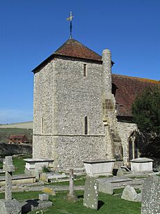
Portslade Village has kept its old-world charm. Many buildings have original flint walls. You can find old manor house ruins, tree-lined parks, and a historic church.
Mile Oak is a newer area. In the 1920s, it was just a few farm buildings. But then, many homes were built, especially in the 1960s. The new A27 road in the 1990s stopped further building into the nearby Downs.
Downland Areas Near Portslade
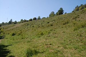
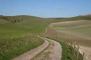
North of Mile Oak, across the A27, are beautiful downland areas. These include Cockroost Hill, Cockroost Bottom, and Mount Zion. These places are special because of their rare wildlife. You can find unique downland flowers, orchids, butterflies, and insects.
The slopes also have a lot of history. There's a 4000-year-old Bronze Age settlement. You can also see signs of Iron Age and Roman-British farms. The Monarch's Way, a long footpath, passes through Mile Oak and Portslade.
Aldrington, Hangleton, and West Blatchington
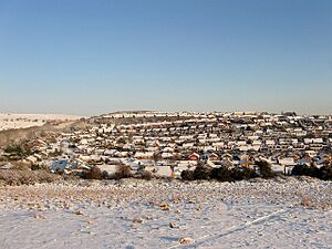
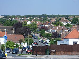
Aldrington is located between Portslade-by-Sea and Hove. For many centuries, it was mostly countryside with very few people. Today, it is a residential area.
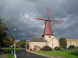
West Blatchington was also once a sheep grazing area. Now it is built up. It is known for its windmill and a secondary school.
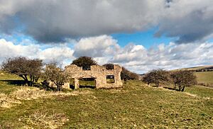
Hangleton is north of Aldrington. It was a medieval village in the 1200s with about 200 people. The village was then abandoned for about 600 years. It started growing again in the 1950s. Today, it is popular for its sea views and green spaces.
Hills and Trails in Hangleton
Between Hangleton and Westdene, south of the A27, is Toads Hole Valley. This area was once full of wildlife, including rare animals like dormice and hedgehogs. Now, new homes are planned for this site.
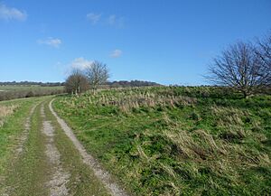
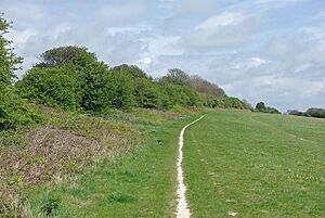
North of the A27 are two golf courses. They are separated by the Old Dyke Railway Trail. This trail follows an old railway line that took people from Hove to Devil's Dyke. The railway closed in 1938, and the trail was created in 1988.
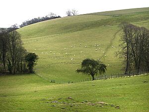
The area has many old Down pastures. To the west is Benfield Hill, a Local Nature Reserve. It is famous for its glowworm displays on summer evenings. You can also find rare flowers and butterflies here.
To the east is Round Hill, which has signs of human history from different periods. There are old burial mounds called barrows. The eastern slope of Round Hill is rich in chalk grassland flowers. You might see rare moths and spiders here too.
Westdene, Withdean, and Patcham
Patcham, Westdene, and Withdean are divided by the London Road. Patcham has the longest history. It was a large settlement in the Domesday book (1086). It still has old flint cottages, allotments, and winding paths. You can see the Norman church with medieval wall paintings.
Withdean and Westdene were once farmland. They were developed in the 1920s and 1930s with houses and flats. Withdean Park is home to a national collection of lilacs. Withdean Woods is a nature reserve with woodland birds like woodpeckers and owls.
Waterhall and Patcham Downland
West of the A23 and north of Westdene is Waterhall. Its old golf course is now being returned to nature, with chalk grassland and rare adders. You can find Bronze Age burial mounds here. Many beautiful flowers and butterflies, like the chalkhill blue, now thrive.
To the north is Varncombe Hill. It has old pasture glades with many rockrose flowers. To the east of Waterhall is Sweet Hill. It has a lovely flowery bank and an old dewpond. The Sussex Border Path goes north from here to Pangdean Bottom. This area has ancient chalk grassland with rare flowers and butterflies.
Patcham Downland and The Chattri
The hills north of Patcham lead up to Ditchling Beacon. Tegdown Hill has a special "ring barrow" from ancient times. From here, you can see other Iron Age camps like Hollingbury Castle.
The Sussex Border Path goes through this area. You can walk into Ewe Bottom and see beautiful chalk downland flowers. Deep Bottom is also a colourful old pasture site.
South of the A27, on the western edge of Patcham, is Ladies Mile Down. This is a Local nature reserve with rare plateau chalk grassland. It has ancient Iron Age field systems and a Bronze Age burial mound. In summer, you can see many flowers and glowworms.
The Chattri is a memorial site. It is where First World War Indian Sikh and Hindu soldiers, who died in Brighton, were cremated. It has a white marble dome and is a peaceful place for walks.
Hollingbury and Hollingdean
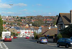
Hollingbury is a hillside area east of Patcham. Until the 1930s, it was open downland with farms. After World War Two, factories and homes were built here.
Hollingdean is a residential area with many council houses. It is located in a valley that rises towards the hillfort.
Hollingbury Castle and Wild Park
At the top of the Down, between Hollingbury, Hollingdean, and Coldean, is a green space. At its centre is Hollingbury Castle or Hillfort. This hillfort is a very old monument. It also has Bronze Age burial mounds. The area is home to birds like linnets and goldfinches.
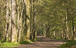
South of the hillfort is Hollingbury Golf Course and Hollingbury Park. The park has an old pavilion and the two-century-old Hollingbury Woods. These woods are popular for walks.
West of Moulsecoombe is Wild Park. This valley was opened as a park in 1925. It was once famous for butterflies and moths. Even today, it is rich in diversity. You can find orchids, harebells, and many types of butterflies. In autumn, different fungi grow in the woods.
Coldean, Moulsecoomb, and Bevendean
Coldean, Moulsecoomb, and Bevendean are suburbs built in the 1950s after World War II. They are all located in beautiful downland areas.
Coldean is in a deep valley near Hollingbury Hillfort. New homes are planned for green land next to the South Downs National Park.
Bevendean is in a valley between Bevendean Down and Heath Hill.
Moulsecoomb is home to the University of Brighton's Moulsecoomb campus and Falmer Stadium.
Stanmer Village and Park
North-east of Coldean are two valleys. One holds Stanmer village, a historic place. It has flint cottages and a church from 1838. The village pond might be why it's called "Stanmer," meaning "stony pool." There's also an old well with a wooden donkey wheel.
Stanmer Woods were changed in the 1700s by the Pelhams family. They planted many trees around the village. In 2007, the City Council opened up the woods and fields for public access. The largest part, the Great Wood, has many ancient plants.
The next valley is home to the University of Sussex, which opened in 1961. It is a large university with over 16,000 students.
Bevendean Down and Falmer Hill
Bevendean Down is a Local Nature Reserve. Its warm, south-facing slopes are home to lizards and many butterflies. Local people work with farmers to care for this area. You can find rare butterflies like the Chalkhill and adonis blue.
Hogtrough Bottom has different types of grassland and scrub. It is home to rare species like bastard toadflax and unique fungi. The mix of purple, blue, and yellow flowers creates a beautiful scene in summer.
On the south side of Bevendean is Heath Hill. This area has horse pastures with rich wildlife, including swallows, swifts, and bats. These farmsteads are important for the local nature.
Falmer Hill offers great views of Hollingbury Castle and Stanmer Park. The top of the hill was farmed until World War II. It once had about ten Saxon burial mounds, but they are no longer visible.
Kemptown, Whitehawk, and Roedean
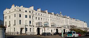
Kemp Town is a district east of Brighton. It was designed by Thomas Read Kemp and includes elegant buildings like Sussex Square. The Royal Sussex Hospital is also in this area. The beach south of Kemp Town is called Black Rock.
North of Kemp Town is Whitehawk, a district built since 1931. On the hill between Whitehawk Hill and Race Hill is Whitehawk Camp. This is a very old Neolithic camp, one of only eight known in the Sussex Downs. It is a protected ancient monument.
East of Kemp Town is Roedean. It has some housing and Roedean school, a girls' school facing the sea.
Whitehawk Hill and Sheepcote Valley
Whitehawk Hill has large allotment gardens on its lower slopes. A transmitting station sits on its top. The ancient Whitehawk Camp is north of the hilltop.
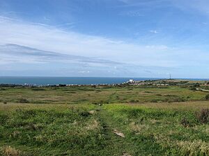
East of Whitehawk is Sheepcote Valley. This large area is open to the public. It was once a rifle range and later a rubbish dump. Now, it is a place where many birds breed and stop during migration. You can see rare birds like warblers and redstarts. The lower valley has a caravan park and playing fields.
To its east is East Brighton Golf Course. In winter, short-eared owls often live here. Below the course is Roedean Bottom, which has a small area of ancient downland turf. Here, you can find rare orchids and tiny moss snails.
East of the Golf Course is Wick Bottom. This peaceful valley was once a medieval farm. It now has many chalk-loving plants.
Woodingdean, Ovingdean, and Rottingdean
Ovingdean is east of Brighton and slightly inland from the sea. It is a historic settlement that has existed since the Iron Age (around 600 BC). The Domesday book (1086) recorded it as 'hovingedene'.
Today, Ovingdean has about 1,200 people. Many old flint walls, cottages, and barns have been kept. The Norman church of St Wulfran's is the oldest building. South of the village is a rehabilitation centre for Blind Veterans UK.
Rottingdean is east of Ovingdean and has an even longer history. The first people settled here around 2500 BC. It later became known for smuggling. Rottingdean is its own parish within the city. Beacon Hill is a Local Nature Reserve with pristine chalk grassland and a historic windmill.
Woodingdean is north of Ovingdean. It was largely developed in the 1950s and 1960s. Its name comes from Woodendean Farm, which was in Ovingdean.
East Brighton Downland and Undercliff Path
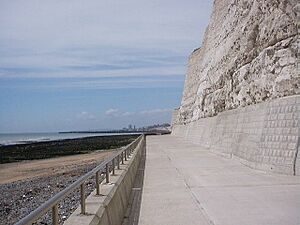
The undercliff path runs between Brighton Marina and Saltdean. It's a popular path for walking, running, or cycling. The beach below is great for rock pooling. Many birds, like fulmars and peregrine falcons, nest in the chalk cliffs. Rare plants like sea stock and sea lavender also grow here.
West of the Falmer Road from Woodingdean is Happy Valley. This area has old Down pasture herbs and bushes. Further south is Mount Pleasant, a small area of rich chalk grassland. It has many beautiful flowers like Pride of Sussex rampion.
East of Woodingdean is the Bostle barrow field. It has many small grassy mounds, likely Saxon, and three larger Bronze Age burial mounds. The Bostle combe slope is an ancient Down pasture with soft grass.
A little further east is one of Brighton's most special natural sites, Castle Hill. It is known for rare orchids, grasshoppers, and amazing butterfly displays. You can see thousands of chalkhill blue butterflies here.
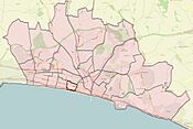
The Brighton and Hove Boundary
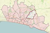
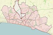
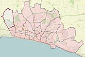
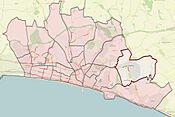
The official border of Brighton and Hove starts at Shoreham Port on the coast. It crosses the A259 road in Portslade. The border then runs north, separating Portslade from Southwick.
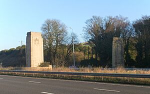
It goes west of Mile Oak and crosses the A27 towards Devil's Dyke. Then it turns east over the Downs. The border reaches its most northern point near Pyecombe. It crosses the A23 at the Patcham Pylons, which is a landmark for traffic entering the city.
Continuing east, the border runs north of the Chattri and Stanmer Park. It then turns south, passing the University of Sussex campus and Falmer Stadium. The border follows Falmer Road to Woodingdean. Finally, it heads southeast through Balsdean and enters Saltdean, returning to the coastline at Saltdean Beach.
How Brighton and Hove is Governed
Brighton and Hove City Council is in charge of local government services. This means they handle things like schools, parks, and rubbish collection. Elections for the council happen every four years.
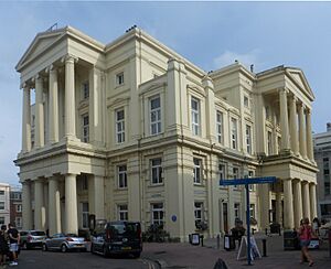
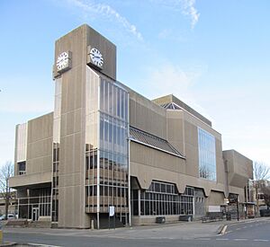
Councillors choose a Mayor of Brighton and Hove each year. This is a ceremonial role. The current mayor is Councillor Jackie O'Quinn. The council uses a cabinet system to make decisions. Both Brighton Town Hall and Hove Town Hall are used for council meetings.
The council has been controlled by different political parties over the years. Currently, the Labour Party has the most councillors. Bella Sankey is the current Leader of the council.
The city is represented by three Members of Parliament (MPs) in the UK Parliament. Hove is represented by Labour MP Peter Kyle. Brighton Pavilion is represented by Green MP Siân Berry. Brighton Kemptown is represented by Labour MP Chris Ward.
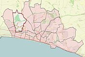
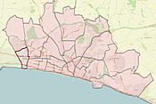
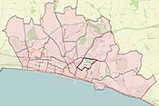
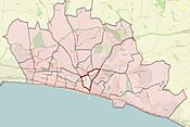
City Wards
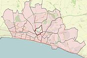
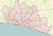
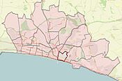
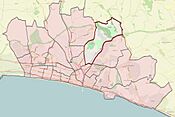
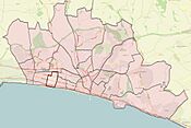
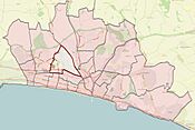
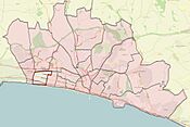
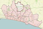
The city is divided into different areas called wards. Each ward has councillors who represent the people living there.
Economy and People
Brighton and Hove's economy is mostly based on services. It is strong in creative, digital, and electronic technologies. Tourism and entertainment are also very important. The city has many hotels, fun attractions, Brighton Pier, and the Shoreham/Portslade Harbour.
The 2011 census showed that fewer people needed government support compared to 2001.
Who Lives in Brighton and Hove?
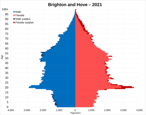
The first count of people in Brighton was in 1801. In 2011, the city had 273,369 residents, with an equal number of males and females.
The 2011 census found that most people (89.1%) were white. About 4.1% were Asian, 3.8% were of mixed race, 1.5% were Black, and 0.8% were Arab.
In terms of religion in 2011, 42.90% were Christian, and 42.42% said they had no religion. Smaller numbers followed Islam (2.23%), Buddhism (1.00%), and Judaism (0.98%).
Interestingly, in the 2001 census, Brighton and Hove had the highest percentage of people who said their religion was Jedi in all of England and Wales!
Media in Brighton and Hove
- BBC Radio Sussex broadcasts from its studios in Brighton.
- Local TV news comes from BBC South East Today and ITV News Meridian.
- TV signals are received from the Whitehawk Hill transmitter.
- Local newspapers include The Argus and Brighton and Hove Independent.
- Brighton and Hove News is a popular local news website.
Freedom of the City
The "Freedom of the City" is a special honour given to people or groups. Here are some who have received it in Brighton and Hove:
Individuals Honoured
- Adam Trimingham: 2004
- Henry Allingham: 2009
- Flt Lt Marc Heal: 2011
- Aung San Suu Kyi: 2011 (This honour was later taken back in 2023.)
- Steve Ovett: 2012
- Roger French: 2013
- Dick Knight: 2013
- Tony Bloom: 2017
- Chris Hughton: 2017
- Sir Peter Field: 2021
- Mary Jane Clarke: 2023
Military Units Honoured
- The Royal Sussex Regiment: 1944 (for Brighton) and 1958 (for Hove).
- The Queen's Regiment: 1966.
- The Princess of Wales's Royal Regiment: 1996.
Organisations and Groups Honoured
- "All those who helped during the COVID-19 pandemic": 2021.
- Brighton & Hove Albion Football Club: 2023.
See also
 In Spanish: Brighton & Hove para niños
 | DeHart Hubbard |
 | Wilma Rudolph |
 | Jesse Owens |
 | Jackie Joyner-Kersee |
 | Major Taylor |


