Shoreham-by-Sea facts for kids
Quick facts for kids Shoreham-by-Sea |
|
|---|---|
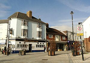 East Street, a pedestrianised street in Shoreham-by-Sea |
|
| Area | 3.80 sq mi (9.8 km2) |
| Population | 20,547 2011 Census |
| • Density | 5,407/sq mi (2,088/km2) |
| OS grid reference | TQ220051 |
| • London | 47 miles (76 km) north |
| District |
|
| Shire county | |
| Region | |
| Country | England |
| Sovereign state | United Kingdom |
| Post town | Shoreham-by-Sea |
| Postcode district | BN43 |
| Dialling code | 01273 |
| Police | Sussex |
| Fire | West Sussex |
| Ambulance | South East Coast |
| EU Parliament | South East England |
| UK Parliament |
|
Shoreham-by-Sea, often just called Shoreham, is a town and port located on the coast in West Sussex, England. In 2011, about 20,547 people lived there.
The town is surrounded by nature. To the north are the South Downs hills. To the west is the Adur Valley. To the south, you'll find the River Adur and Shoreham Beach, which faces the English Channel. Shoreham is right in the middle of the towns along the south coast. It's about the same distance from Brighton and Hove to the east and Worthing to the west. The town covers an area of about 2,430 acres.
Contents
A Look Back: Shoreham's History
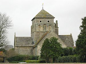
The older part of Shoreham, called Old Shoreham, has been around since before Roman times. St Nicolas' Church, located near the River Adur, has parts built in the Anglo-Saxon period. The name "Shoreham" comes from Old English words.
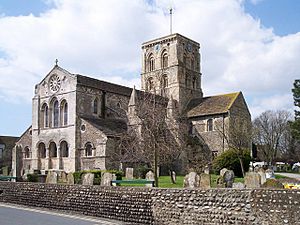
The new town and port of Shoreham were started by the Normans around the late 1000s. St Mary de Haura Church (meaning St Mary of the Haven) was built after 1103. Around this time, the town centre was planned with a grid pattern. This layout is still visible today. The church you see now is only about half the size of the original building.
A Muslim geographer named Muhammad al-Idrisi wrote about Shoreham around 1153. He called it "a fine and cultivated city." Shoreham was even known as a Royal Port. Captain Henry Roberts, who worked with Captain Cook, was from Shoreham in the 1700s.
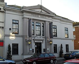
Shoreham grew quickly when nearby towns like Brighton and Worthing expanded. The arrival of the railway in 1840 also helped. Shoreham became a busy Victorian sea port. It had many shipyards and a lot of trade by sea. Shoreham Harbour is still used for business today. The town became an urban district in 1910, with Shoreham Town Hall as its main office.
Kingston Buci: An Old Village
Kingston Buci is an old village located east of Shoreham-by-Sea. It has a medieval church, a rectory, a manor house, and a large old barn. These buildings still make it a special place. The church was changed a lot in the 1200s. At that time, the river's mouth moved, making Kingston a port for a while.
The "King" in Kingston might refer to a Saxon king of Sussex. The "Buci" part comes from the Anglo-Norman owners' hometown in Normandy.
Shoreham Beach: A Unique Coastline
Shoreham Beach is south of the town. It's a shingle spit (a narrow piece of land extending into the sea). This spit was formed over thousands of years by sand and pebbles moving along the coast. It blocks the River Adur from flowing straight south into the sea. Instead, the river turns east before reaching the English Channel.
In the 1600s and 1700s, the river's mouth kept moving east. This made it hard for ships to use the port. By 1810, it was almost opposite Aldrington church. In 1816, the river's mouth was fixed in its current spot between two piers. Once the harbour was stable, Shoreham Fort was built in 1857 to protect it.
Around the early 1900s, old railway carriages were turned into summer homes on the beach. This area became known as 'Bungalow Town'. It was even home to the early British film industry! Francis L. Lyndhurst started the Sunny South Film Company. They made their first movie on Shoreham Beach in 1912 and built a film studio there. Shoreham Beach officially became part of Shoreham-by-Sea in 1910.
During the Second World War, many houses were removed for defence reasons. Most of the remaining old homes have been replaced by modern ones. The Church of the Good Shepherd, built in 1913, is still standing. Along the Adur mud flats near Shoreham Beach, you can see many houseboats. These are made from old barges, tugs, and even mine sweepers.
The Monarch's Way is a long walking path. It follows the beach west from Hove, past Portslade and Southwick. It ends near the harbour mouth's east breakwater. This path remembers the escape route of King Charles II to France after a battle.
Downland Areas: Nature and Wildlife
 |
Coombes | Upper Beeding |  |
|
| Lancing | Brighton and Hove | |||
| English Channel |
The River Adur, the downs (hills), and the sea are home to many different plants and animals. The mudflats are a great place for wading birds and gulls. This includes the ringed plover, which tries to nest on the shingle coast. The pied wagtail is often seen in town during winter.
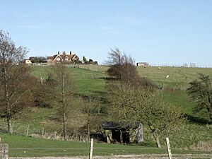
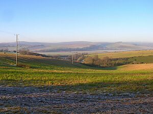
You can also find insects like dragonflies over the river's flood plains. The south and west-facing downs attract at least 33 types of butterflies. This includes a very important group of chalkhill blue butterflies on Mill Hill. The ground under the downs is chalk, with river mud in the old channels. The Adur district has many different natural areas in a small space. These include chalk downs, butterfly meadows, freshwater areas, salt marshes, lagoons, woodlands, shingle beaches, and large sandy areas.
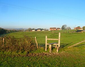
Southwick Hill and its connected areas are the second largest remaining ancient Down pasture on the Brighton Downs. The town is also the end point of the Monarch's Way. This 615-mile walking path follows the escape route of King Charles II in 1651. He used it after being defeated by Cromwell in the Battle of Worcester.
Mill Hill: A Butterfly Haven
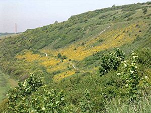
Mill Hill is also known as Shoreham Bank. It's a Local Nature Reserve and has been famous for its butterflies since the 1820s. In May, the hillside turns yellow with horseshoe vetch, which is a food plant for butterflies. In August, the hill is full of colours from flowers like knapweeds, pink centaury, eyebright, wild carrot, and wild thyme.
This hill is known for its dingy skipper and grizzled skipper butterflies in spring. In summer, the chalkhill blue and Adonis blue butterflies are a highlight. From Mill Hill, you can see Applesham Farm, which was a village in 1086. To the north is Old Erringham, an old Saxon farm. To the south is the Norman church of Old Shoreham. Next to it are the wooden piers of the 1781 toll bridge, which collected money until the 1960s.
Unfortunately, Mill Hill now has a lot of noise from traffic and planes. Some special mosses and snails have disappeared. Even with efforts from volunteers, too much dense scrub has grown on the hill. This has harmed the diverse plant life.
Southwick Hill: A Protected Landscape
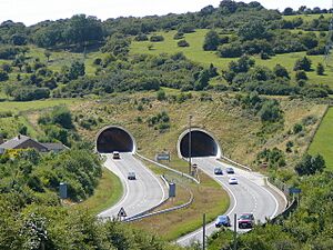
Southwick Hill is owned by the National Trust and has special wildlife areas. In 1985, a plan for the A27 road bypass was going to cut through the hill. But activists campaigned, and the road was rerouted through a tunnel under the hill instead.
In summer, you can find flowers like round-headed rampion, blue scabious, and autumn gentian on the hill paths. Rabbits play on the lawns among plants like purging flax, eggs and bacon, and wild thyme. There are also bushes of raspberry and rose-bay willowherb. Butterflies like common blue, clouded yellow, and red admiral fly here. You might even spot glowworms. In autumn, parts of the grass are colourful with many waxcap and other old meadow fungi.
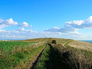
Southwick Hill has changed over the years. It used to be a great example of Down pasture from the late 1800s to 1940. However, in recent years, the hill has been divided by fences. This has led to some areas being under-grazed, losing their rich plant life. Still, the hill has a mix of old pasture and thickets, keeping much of the wildlife that has disappeared elsewhere.
The Crooked Moon Hedge
Hedges are quite rare on these Downs, except around farms. The Crooked Moon Hedge is on top of an old field bank from prehistoric times. The southern slopes of Southwick Hill used to have an Iron Age field system. The hedge contains a lot of maple and ash trees. It is thought to be three to four centuries old.
The 'Rest and Be Thankful' Stone
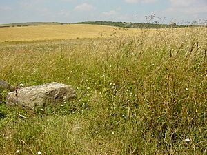
There is a large, flat stone covered in lichen by the path to Southwick Hill. This stone marks a corner on the old boundary between Kingston Buci and Southwick. It was important enough to be shown on old maps.
Thundersbarrow Hill
Thunders Barrow is a large ancient burial mound, or barrow. Part of it was dug away in the 1800s to make a dew pond. It sits just north of Southwick Hill. The meaning of its name is unknown.
This spot is far enough from the main road that you can hear the silence of the Downs and the sounds of birds. This is where the peacefulness of the Downland begins. The banks of Thundersbarrow's late Bronze Age and Iron Age camp are still tall enough to walk around. When the village was dug up in 1932, two corn-drying ovens were found. They still had soot and bits of burned grain inside.
Erringham Hole
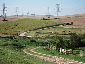
Erringham Hole is a bushy valley east of Thundersbarrow. The Celtic villagers who lived here built huge field banks, some up to 12 feet high. It was named 'Erringham Hole' because it was part of Old Erringham Farm. This area has flowery chalk grassland, scrub, and many rabbits. The rabbits encourage plants like tall mullein and eyebright.
For a long time, this valley was open, and the old field system was easy to see. However, because animals stopped grazing and scrub was not controlled, the diverse grassland has been lost. It has been replaced by scrub and even woodland.
Hazelholt Bottom
Hazelholt Bottom is a peaceful slope with large, flowery clearings. You can often see roe deer in the wide corn field below. The National Trust owns the south slope.
Hazelholt has rich old chalk grassland. You can find cowslips in spring and devil's-bit scabious in September. In mid-summer, there are many butterflies, including adonis blue and chalkhill blue. At the top of the valley, there is more old grassland and large blackberry bushes. Since 1945, scrub has taken over much of this area. The remaining grassland is only lightly grazed, which allows brambles and thorns to grow. This means it is losing its ancient character.
Freshcombe
Freshcombe is owned by the National Trust. Its slopes have very old gorse bushes. These bushes were already well-established on maps from 1873, so they might be hundreds of years older.
This is the only place in the South Downs that has the plant saw-wort. It looks like a thinner version of knapweed. It still blooms a lot in a small clearing among the gorse. It's a plant that survived from the time when the Downland had more heathland. The clearing where it blooms also has flowers like betony, red clover, and St John's wort.
Old Erringham Farmstead
Old Erringham Farmstead has an old flint farmhouse with large chimneys. It also has old flint barns. It has one of only two medieval chapels on the Brighton Downs. This chapel now serves as a shed for one of the modern farm workers' cottages. It has a tiny church window on its south side.
The farm is an ancient monument. It includes the remains of a medieval settlement and an 11th-century ringwork (a type of fort). This fort was probably built to defend against the Vikings. It's a mixed farm with corn crops, beef cattle, and hay meadows. The farm helps to protect the natural value of Old Erringham Combe and Anchor Bottom. Around the farm, you can see colourful flowers like red star-thistle, musk thistle, and viper's bugloss in summer.
Old Erringham Combe and Shaw
Old Erringham Combe is a mix of different natural areas. This makes it a great safe place for Downland wildlife. The south-facing bank is the hottest spot. Below it, there are willows and a small area of wet grassland. Here, you can find plants like lesser marsh grasshopper orchid, bastard toadflax, and wild thyme.
In summer, butterflies like wall brown and clouded yellow fly here. Day-flying moths also enjoy the drying grassland. A rare snail, the Carthusian snail, still lives in this valley. This might be because cattle have grazed here for centuries.
Old Erringham Shaw is a tangled wood of sycamore, ash, elm, and thorn trees. It's more open at the northern end. Here, the remains of four large old beech trees and many may blossom flowers make it a good spot for insects.
Slonk Hill
On Slonk Hill, there were at least two Bronze Age burial mounds and a small Iron Age settlement. They were surrounded by a rectangular ditch, perhaps forming a 'temple' area. Animals and coins were buried here as part of rituals. Evening shadows show dips and bumps at the hill's southern end. These are likely from trenches dug for a large army camp during the First World War.
Three areas on the hill were saved from damage by farming over the years. These include an old Down pasture on the eastern slope, an old track, and a patch of hillside to the north. More recently, the use of farm chemicals has stopped. Now, the hillside is colourful again with many plants. These areas have flowers like pyramidal orchid and round-headed rampion.
Mossy Bottom
Mossy Bottom gets its name from 'Muster' Bottom. This is where shepherds used to gather their sheep. The Mossy Bottom slope is public access land. It has old Iron Age field banks made by farmers from Thundersbarrow village. These banks used to be called "Thunder's Steps." You can find large old anthills here. Plants like large thyme, cowslip, harebell, and round-headed rampion also grow here.
Getting Around: Transport in Shoreham
Brighton City Airport is west of the main town. It has been privately owned since 2006. This is the UK's oldest licensed airport that is still open. Its 1936 Art Deco terminal building is a special historic site. The terminal has been used as a filming location for TV shows and movies.
The town has its own train station, Shoreham-by-Sea railway station. It's on the West Coastway Line. Local bus services are provided by the Brighton & Hove bus company and Stagecoach South. Compass Travel runs a local town route.
The Shoreham Tollbridge crosses the River Adur in the west of town. This bridge is a historic building. It was the last toll bridge in Sussex. The bridge was part of the A27 road until it closed to traffic in 1968. It is now too weak for vehicles. After a lot of repair work, it reopened for people walking on October 23, 2008. The Adur Ferry Bridge, in the south of town, crosses the River Adur to Shoreham Beach. It opened to the public on November 13, 2013.
Local News and Entertainment
Local news and TV shows come from BBC South East and ITV Meridian. Radio stations include BBC Radio Sussex, Heart South, More Radio Worthing, and Seaside Hospital Radio. Local newspapers are the Shoreham Herald, West Sussex Gazette, and The Argus.
INSIDE Shoreham & Southwick is a free magazine that started in 2005. It goes to homes in Shoreham and Southwick every month. It features articles about local people, history, and upcoming events.
Sports and Fun in Shoreham
Shoreham-by-Sea has a non-League football club called Shoreham FC. They play at Middle Road stadium. There is also a rugby union club, Shoreham RFC, which plays at Buckingham Park.
Southdown Golf Club was founded in 1902 but stopped operating in the 1940s. The town centre hosts monthly farmers' and artisans' markets in East Street. These take place on the second and fourth Saturday of each month. There is also an annual 'Light up Shoreham' Christmas market.
Climate
| Climate data for Shoreham (1991–2020) | |||||||||||||
|---|---|---|---|---|---|---|---|---|---|---|---|---|---|
| Month | Jan | Feb | Mar | Apr | May | Jun | Jul | Aug | Sep | Oct | Nov | Dec | Year |
| Mean daily maximum °C (°F) | 8.1 (46.6) |
8.3 (46.9) |
10.4 (50.7) |
13.1 (55.6) |
16.3 (61.3) |
19.0 (66.2) |
20.9 (69.6) |
21.0 (69.8) |
18.9 (66.0) |
15.4 (59.7) |
11.6 (52.9) |
8.8 (47.8) |
14.4 (57.9) |
| Mean daily minimum °C (°F) | 2.3 (36.1) |
2.2 (36.0) |
3.5 (38.3) |
5.1 (41.2) |
8.1 (46.6) |
10.9 (51.6) |
13.0 (55.4) |
13.0 (55.4) |
10.9 (51.6) |
8.3 (46.9) |
5.2 (41.4) |
2.8 (37.0) |
7.1 (44.8) |
| Average rainfall mm (inches) | 80.4 (3.17) |
56.7 (2.23) |
45.6 (1.80) |
45.1 (1.78) |
45.9 (1.81) |
46.6 (1.83) |
54.1 (2.13) |
58.7 (2.31) |
59.1 (2.33) |
82.2 (3.24) |
90.3 (3.56) |
87.4 (3.44) |
752.6 (29.63) |
| Average rainy days (≥ 1 mm) | 12.7 | 10.2 | 9.0 | 9.1 | 8.3 | 7.7 | 7.6 | 8.4 | 8.2 | 11.5 | 13.1 | 12.6 | 118.8 |
| Source: Met Office | |||||||||||||
Airshow Event
Most years, in late summer, Shoreham Airport hosts the Royal Air Forces Association (RAFA) Shoreham Airshow. On August 22, 2015, a jet plane taking part in the airshow crashed onto the busy A27 road near the airport. This sad event resulted in the deaths of eleven people and injured several others.
Famous People from Shoreham
Many interesting people have connections to Shoreham-by-Sea:
- Writer Brian Behan lived on a boat in the town in the 1960s.
- Playwright Charles Bennett was born in Shoreham-by-Sea in 1899.
- Mark Benson, a former England cricketer and umpire, was born here in 1958.
- Composer Havergal Brian moved to Shoreham-by-Sea in 1958 and wrote many symphonies.
- Paul Chaloner, a well-known esports commentator, was born in Shoreham in 1971.
- Raymond O. Faulkner, who created a standard dictionary for Egyptian hieroglyphs, was born in Shoreham in 1894.
- Actress Vanessa Howard was born in Shoreham-by-Sea in 1948.
- Mel Hopkins, a former footballer for Tottenham Hotspur and Wales, retired to Shoreham Beach.
- Artist Alison Lapper lives in Shoreham.
- Bert Longstaff, a professional footballer, played for Shoreham F.C.
- Broadcaster Mike Mendoza lives on Shoreham Beach.
- Comedian Max Miller lived in Kingston Lane.
- Fiona Mont was said to have been flown out of Shoreham Airport in 1999.
- Kjetil Mørland from the band Absent Elk lives in Shoreham-by-Sea.
- Actor Luke Newton was born in Shoreham-by-Sea in 1993.
- Cecil Pashley, an aviation pioneer, was important in early flight.
- Phyllis Pearsall, who created the Geographers' A–Z Street Atlas of London, lived on Shoreham Beach.
- Harry Ricardo founded Ricardo Consulting Engineers in Shoreham-by-Sea.
- Captain Henry Roberts sailed with Captain James Cook and was a cartographer.
- Actor David Ryall was born in the town in 1935.
- Singer Leo Sayer was born in Shoreham-by-Sea in 1948.
- Hubert Scott-Paine, an aircraft and boat designer, was born in Shoreham in 1890.
- Olympic swimmer Gemma Spofforth was born in Shoreham.
- Professional footballer Michael Standing was born in Shoreham-by-Sea in 1981.
- Footballer Marcus Tudgay was born in Shoreham-by-Sea.
- Football presenter Darren Tulett is from Shoreham.
- Playwright Judy Upton was born in Shoreham-by-Sea in 1966.
- Businessman Nicholas van Hoogstraten was born in Shoreham-by-Sea in 1946.
- Writer Ted Walker was married in Shoreham. Many of his writings describe the Shoreham coastline.
- Architect Amon Henry Wilds moved to Old Shoreham in 1857.
- Nathaniel Woodard, who founded Lancing College, was a curate in New Shoreham. His experiences there led him to create schools to improve education.
Sister Cities
Shoreham, along with other towns in the Adur area, is twinned with:
- Żywiec, Poland
- Riom, France
See also
 In Spanish: Shoreham-by-Sea para niños
 | Ernest Everett Just |
 | Mary Jackson |
 | Emmett Chappelle |
 | Marie Maynard Daly |


