Knights Hill (New South Wales) facts for kids
Quick facts for kids Knights Hill |
|
|---|---|
| Highest point | |
| Elevation | 778 m (2,552 ft) |
| Prominence | 188 m (617 ft) |
| Geography | |
| Location | New South Wales, Australia |
| Parent range | Illawarra |
Knights Hill is a cool hill that's part of the Illawarra Range in New South Wales, Australia. It stands tall at 778 meters (about 2,552 feet) above sea level. This means it's quite high up!
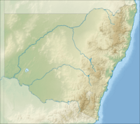
The hill is located about 8 kilometers (5 miles) southwest of a town called Albion Park. Knights Hill isn't just one single bump. It's actually made up of several smaller hills that sit on a flat area. This flat area is right next to the edge of the Illawarra escarpment.
Contents
What Makes Knights Hill Special?
Knights Hill is one of the highest points along the entire Illawarra escarpment. The escarpment is like a long, steep cliff or slope that runs along the coast. From the top of Knights Hill, you can see amazing views of the surrounding area.
Views and Lights
You can easily spot Knights Hill from the coastal plain to the north. People as far away as Stanwell Park can see it. One of the television antennas on top of the hill has a special light. This light flashes constantly and can be seen from even further away, like the city of Wollongong.
What's on Top?
When you reach the top of the plateau on Knights Hill, you'll find a few interesting things. There are large TV antennas that help broadcast television signals to homes nearby. There's also a small farm located up there.
A Bit of History
The name "Knights Hill" first appeared on a map created by a surveyor named Robert Hoddle. A surveyor is someone who measures and maps out land. Robert Hoddle explored and mapped this region a long time ago, in the early 1800s.
Hoddles Track
Robert Hoddle was so important to the area that a walking track is named after him. This track is called the Hoddles Track. It's a reminder of his early work in mapping the beautiful Illawarra region.
 | Chris Smalls |
 | Fred Hampton |
 | Ralph Abernathy |


