
Illawarra escarpment facts for kids
Quick facts for kids Illawarra |
|
|---|---|

Lookout from the Illawarra Escarpment above Wombarra over the northern Illawarra plain viewing Austinmer, Thirroul, Bulli, Wollongong up to Port Kembla in the far distance.
|
|
| Highest point | |
| Peak | Bells Hill, New South Wales |
| Elevation | 803 m (2,635 ft) |
| Dimensions | |
| Length | 92 km (57 mi) NNE |
| Geography | |
| Country | Australia |
| State | New South Wales |
| Region | Illawarra |
| Range coordinates | 34°20′S 150°50′E / 34.333°S 150.833°E |
| Geology | |
| Orogeny | Sydney Basin |
| Age of rock | Tertiary |
The Illawarra Escarpment, also known as the Illawarra Range, is a line of cliffs and high land west of the Illawarra coast in New South Wales, Australia. It's like a natural wall that separates the flat coastal area from the higher lands to the west. This impressive range stretches from Stanwell Park in the north down to the Shoalhaven River in the south.
The highest point in this range is Bells Hill, which stands at 803 metres (2,635 ft) tall. Other parts of the escarpment are usually between 300 metres (980 ft) and 768 metres (2,520 ft) high. The city of Wollongong is the main city in the Illawarra region.
Contents
History of the Illawarra Escarpment

The Illawarra Escarpment was formed a very long time ago, between 225 and 280 million years ago. Over millions of years, creeks and rivers slowly wore away the rock, shaping it into the cliffs we see today. Most of the escarpment is made of sandstone, and you can see many large boulders and ledges.
The highest parts are in the south, near Albion Park, at Knights Hill (709 metres (2,326 ft)) and Mount Murray (768 metres (2,520 ft)). This area was lifted up about 70 million years ago, along with the Blue Mountains.
Many towns along the coast were first started because of the natural resources found here. People came to harvest cedar trees from the slopes or to mine coal from beneath the escarpment. To move these resources, passes were built over the mountains. Famous passes include Rixons Pass, Bulli Pass, O'Briens Road, and Macquarie Pass.
Plants and Animals of the Escarpment
The Illawarra Escarpment is home to a huge variety of native plants and animals. It's a safe place for many different kinds of wildlife.
Unique Trees and Forests
The area is famous for the beautiful Illawarra Flame Tree, which has bright red flowers. You can also find rare red cedar trees that were not cut down during the logging days. Places like Saddleback Mountain and Minnamurra Rainforest still have parts of ancient rainforests. In the north, you'll find dry sclerophyll forests. At Mount Kembla, the plants from the northern and southern areas meet, creating a special mix.
Amazing Wildlife
Many native animals live here. You might spot wallabies, brushtail possums, and gliding possums. There are also frogs, goannas, brush turkeys, and flying foxes. The escarpment is also home to snakes, bower birds, glossy black cockatoos, and many other colorful parrots. You can also find owls and native birds of prey.
Unfortunately, some introduced animals like fallow deer, red deer, rabbits, feral cats, and red foxes also live here. The escarpment is a very important refuge for species that have been affected by human development and bushfires. Sadly, there are currently 12 animal species in this area that are considered threatened.
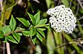
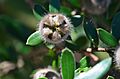
- Some native plants photographed in the region
-
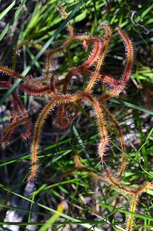
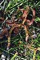
Drosera binata Barren Grounds
-
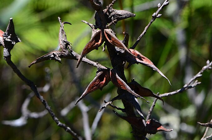
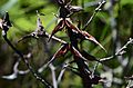
Hakea teretifolia Barren Grounds
-

Platysace lanceolata Barren Grounds
-

Persoonia sp. (Geebung) Barren Grounds
-

Leptospermum grandifolium Barren Grounds


Endangered Rainforest Community
A special type of forest found on the escarpment is called the Illawarra Escarpment Subtropical Rainforest. This unique forest community has been declared an endangered ecological community under New South Wales law. This means it needs special protection to survive.
Geography of the Escarpment

The Illawarra Escarpment stretches for a long distance. In the north, it starts near the white cliffs of the Royal National Park. It then goes south, with cliffs often running close to the coast. It's about 300 metres (980 ft) above sea level at Scarborough.
Further south, it reaches 415 metres (1,362 ft) at Sublime Point near Thirroul. It continues to Brokers Nose (440 metres (1,440 ft)) and then to Mount Keira, which sticks out from the main cliffs. South of that is Mount Kembla, another sandstone outcrop, at 534 metres (1,752 ft). The range then goes southwest along the Dapto cliffs and turns inland at Macquarie Pass. It then goes east to Knights Hill (709 metres (2,326 ft)), and finally to Noorinan Mountain and Saddleback Mountain in the south.
The Cambewarra Range is a similar mountain range that continues from Noorinan Mountain and goes around Kangaroo Valley.
The heights of the escarpment vary. Bald Hill and Stony Batter are around 300 metres (980 ft) high. Brokers Nose is 440 metres (1,440 ft). South of Mount Ousley Road, it's generally above 350 metres (1,150 ft). Mount Keira is 464 metres (1,522 ft), and Mount Kembla is 534 metres (1,752 ft). The highest points are Knights Hill at 709 metres (2,326 ft) and Mount Murray at 768 metres (2,520 ft).
The escarpment is mostly made of hard sandstone. There are many walking tracks to the top of these peaks, including Saddleback Mountain and Noorinan Mountain. The plants here are a mix of northern and southern eucalypt trees. The range also has a lot of history, including Hoddles Track, an old path that used to go from Kiama to Bowral.


Passes Over the Escarpment
There are several important passes that allow people to cross over the Illawarra Escarpment:
- At Bald Hill, Lawrence Hargrave Drive goes down into Stanwell Park.
- At Bulli, the road from Bulli Pass Lookout goes down into the town of Thirroul.
- Rixons Pass is now a trail used for mountain biking.
- Mount Ousley Road is a freeway, the main route for cars, trucks, and buses.
- Mount Keira Road was built by convicts and is still used today.
- O'Briens Road is partly used by Harry Graham Drive, and the Mount Nebo section is now a walking and riding track.
- Cordeaux Road, near Mount Kembla, climbs to the catchment area in the west.
- Macquarie Pass is west of Albion Park and is protected by a national park.
- Jamberoo Mountain Road climbs through winding turns to the summit and along the escarpment.
- Caloola Pass, west of Albion Park, was an old route but is now only walkable.
- Johnsons Spur, between Dapto and Albion Park, was once a main access route but is now only walkable.
Saddleback Mountain Road reaches the summit. It was once part of Hoddles Track, an old path that used to go further west to the Southern Highlands.
Protected Natural Areas
Many parts of the Illawarra Escarpment are protected. They are part of the Illawarra Escarpment State Conservation Area or are state forests, like Kembla State Forest. However, some areas are private land or owned by mining companies. Popular lookouts like Mount Keira and Bald Hill are special reserves or parks. Mount Keira Summit Park is even part of the Wollongong Botanic Garden.
Walking Trails and Lookouts
The escarpment has many walking tracks and lookouts. These offer amazing views of the countryside, coastal villages, and suburbs. Well-known lookouts include Bald Hill, Bulli Pass, Sublime Point, and Mount Keira. There are also lesser-known tracks with great views, like Hoddles Track. Some tracks, like the Wodi Wodi track, have fallen into disrepair. Others, like the Mount Keira Ring Track, have been improved. One challenge for these areas is the spread of invasive plants like lantana.
Images for kids
-
Drosera binata Barren Grounds
-
Hakea teretifolia Barren Grounds
-
Platysace lanceolata Barren Grounds
-

Persoonia sp. (Geebung) Barren Grounds
-
Leptospermum grandifolium Barren Grounds
See also
 In Spanish: Escarpa de Illawarra para niños
