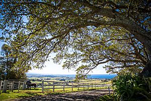
Saddleback Mountain (New South Wales) facts for kids
Quick facts for kids Saddleback Mountain |
|
|---|---|
| Highest point | |
| Elevation | 600 m (2,000 ft) |
| Geography | |
| Location | Illawarra region, New South Wales, Australia |
| Parent range | Nuninuna Range |
Saddleback Mountain is a cool mountain located near Kiama in the Illawarra region of New South Wales, Australia. This mountain rises about 600 meters (2,000 feet) above sea level. It is part of the Illawarra escarpment, which is like a long, steep cliff.
From Saddleback Mountain, you can see amazing views. You can look west towards Noorinan Mountain and Barren Grounds Plateau. To the south, you might spot Coolangatta Mountain and Pigeon House Mountain all the way to Ulladulla. On a clear day, you can even see north over Lake Illawarra and to the distant Cronulla Sandhills and Kurnell Oil Refinery.
Contents
Exploring Saddleback Mountain
When you look at Saddleback Mountain from towns like Kiama and Shellharbour, it has a special shape. It looks like a saddle, which is why it got its name! It connects to the very end of the Illawarra Escarpment.
Getting to the Top
You can reach the top of Saddleback Mountain by driving up Saddleback Mountain Road. This road starts in Kiama and goes all the way to the summit. It has a steep turn-off from the main road. Many people enjoy walking or driving up this road. However, large buses are not allowed because the road can be tricky.
Amazing Views from the Lookouts
Near the top, you'll find the Saddleback lookout. It's close to some electric towers. There are also western and southern lookouts. These spots offer fantastic views and are very popular with tourists. You can drive up the winding, pretty road to the summit. Along the way, you'll see lots of dairy farms, which are common in this area.
The main lookout has a wooden deck that sticks out. From here, you can see Noorinan Mountain, Knights Hill, and Lake Illawarra. You can also spot Stockyard Mountain and other features of the flat land below. On the horizon, you might even see the chimneys of Port Kembla. The west lookout lets you see Noorinan Mountain and the Barren Grounds Plateau. To the south, you can see Fox Mountain, Mount Coolangatta, and the Shoalhaven River.
Surrounding Areas
The lower parts of the mountain stretch down to Kiama and Gerringong and reach the sea. They also go down into the Jamberoo Valley and near the Minnamurra River. Long ago, this whole area was covered by a thick rainforest called the Illawarra Scrub. Now, only a small part of this rainforest remains around the summit lookout.
The lower hills are mostly used for dairy farming. You can still see many old stone walls built by early settlers. On the eastern side of the mountain, there's a place called Saddleback House. In the northern foothills, you'll find Jerrara Dam. This was the first water supply for the region, built a long time ago in the 1800s. Just north of the main summit, there's another peak called Mount Brandon. About 3 kilometers (1.9 miles) south is Fox Mountain, which is like an extension of Saddleback Mountain with its own peak.
A Volcanic Past
Saddleback Mountain is actually what's left of a collapsed volcano! It was once a volcanic vent that has since fallen in on itself.
 | Misty Copeland |
 | Raven Wilkinson |
 | Debra Austin |
 | Aesha Ash |


