Shoalhaven River facts for kids
The Shoalhaven River is a river in New South Wales, Australia. It starts in the Southern Tablelands and flows into the ocean near Nowra. It's a "perennial" river, meaning it flows all year round. The river ends in an estuary, which is where the river meets the sea, near the South Coast of New South Wales.
Quick facts for kids Shoalhaven River |
|
|---|---|
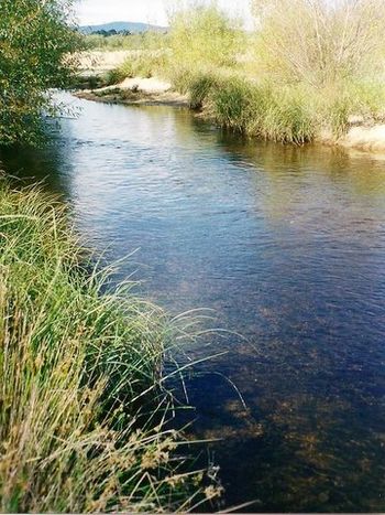
Shoalhaven River, near the Great Dividing Range, west of Batemans Bay.
|
|
|
Location of the Shoalhaven River mouth in New South Wales
|
|
| Country | Australia |
| State | New South Wales |
| Region | Sydney Basin (IBRA), Southern Tablelands, South Coast |
| LGAs | Queanbeyan–Palerang, Shoalhaven |
| Cities | Nowra, Bomaderry |
| Physical characteristics | |
| Main source | Euranbene Mountain, Great Dividing Range west of Bendethera 864 m (2,835 ft) 35°58′15″S 149°38′3″E / 35.97083°S 149.63417°E |
| River mouth | Tasman Sea, Pacific Ocean Shoalhaven Heads 0 m (0 ft) 34°51′S 150°44′E / 34.850°S 150.733°E |
| Length | 327 km (203 mi) |
| Basin features | |
| Basin size | 7,086 km2 (2,736 sq mi) |
| Tributaries |
|
| Islands | Pig (Burraga), Comerong |
Contents
River's Journey and Features
The Shoalhaven River starts on the eastern side of the Great Dividing Range. This is near Euranbene Mountain, about 350 kilometers southwest of Sydney. The river's upper parts flow north through a farming area near Braidwood.
The river then goes into a deep, remote canyon east of Goulburn. Finally, it reaches the flatter coastal lands at Nowra. Here, the Nowra Bridge crosses over it. The Shoalhaven River has 34 smaller rivers and streams, called tributaries, that flow into it. These include the Mongarlowe, Corang, Endrick, and Kangaroo rivers. The river drops 864 meters over its 327-kilometer journey.
Berrys Canal: A Historic Shortcut
The Shoalhaven River's mouth has two entrances to the Tasman Sea. These entrances are about 5 kilometers apart. The southern entrance, at Crookhaven Heads, is always open. The Shoalhaven River flows south through a channel called Berrys Canal. It then joins the Crookhaven River and flows east into the sea.
Berrys Canal was built in June 1822 by convicts. It was overseen by Hamilton Hume and directed by Alexander Berry. This canal made it easier for ships to travel to the first European settlement in the area. Building the canal also created Comerong Island. It was dug by hand and was the first navigable canal built on land in Australia. Berrys Canal is still one of only two navigable canals in New South Wales.
The northern entrance, near Shoalhaven Heads, opens only sometimes. It opens when there is a lot of water flowing or during floods.
Water Supply for Sydney
Tallowa Dam is the main dam on the Shoalhaven River. It is part of the Shoalhaven Scheme, which helps supply water to Sydney. The dam creates Lake Yarrunga. Some water from this lake is pumped over the Southern Highlands into Lake Burragorang. There were plans for a much bigger water storage area at Welcome Reef, but these plans have been put on hold.
River Environment and Fish
The Shoalhaven River and its tributary, the Kangaroo River, were once famous for Australian bass fishing. However, Tallowa Dam blocked these fish from moving upstream. This stopped Australian bass from reaching over 80% of their old homes in the river system. To help fix this, young bass grown in hatcheries have been put into Lake Yarrunga.
In 2009, a special "fishway" was finished at Tallowa Dam. This fishway helps bass and other native fish move past the dam. Unfortunately, harmful European carp have also been illegally introduced into Lake Yarrunga. They are now found in large numbers there.
History of the Shoalhaven River
First Peoples' History
The Aboriginal peoples of the lower Shoalhaven River area are the Jerrinja tribal peoples. They are the traditional owners of this land. Important Aboriginal places in the Shoalhaven area include Coolangatta Mountain, Bundarwa (Beecroft Headland), Cambewarra Mountain, Didthul or Pigeon House Mountain, Kangaroo Valley, Burrill Lake, and Murramarang Aboriginal Area.
The upper part of the Shoalhaven River, around Braidwood, is the traditional land of the Walbanga people.
European Exploration and Settlement
The explorer George Bass discovered the entrance to the Shoalhaven River in 1797. He was on a journey down the south coast of New South Wales in a small boat. He named the river "Shoals Haven" because he found many mud and sand banks, called shoals, at its mouth.
About 20 kilometers west of Nowra, there are properties along the Shoalhaven River. These were given to the people of Australia by artist Arthur Boyd, his wife Yvonne, and the Boyd family. These properties are now managed by the Bundanon Trust. They provide a place for visual arts, writing, music, and other performing arts. They also support education and research in the arts.
River Crossings
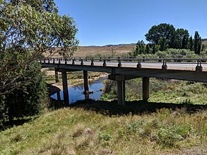
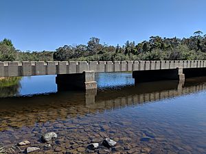
Many bridges and crossings allow people to get over the Shoalhaven River. Here are some of them, listed from the river's start to its mouth:
- Ballalaba bridge
- Farringdon crossing, between Farringdon and Bendoura
- Bombay bridge
- Warri Bridge, which carries the Kings Highway near Braidwood. The first bridge here opened in 1874.
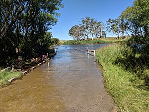
- Stewart's Crossing, which is a ford (a shallow place to cross) on Stewart's Crossing Road.
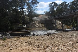
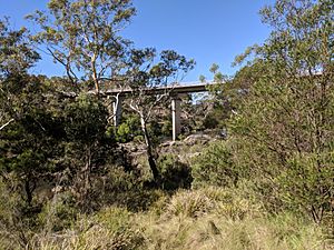
- Oallen Crossing, which used to be a timber bridge. It was replaced around 2015 with a new, higher concrete bridge. This new bridge helps cars travel faster and is less likely to be flooded.
- Nowra Bridge, which carries the Princes Highway between Bomaderry and Nowra.
- Comerong Island Ferry, which carries vehicles and people to Comerong Island near the river's mouth.
Images for kids
See also
- List of rivers of Australia § New South Wales
- List of rivers in New South Wales (L-Z)
- Morton National Park
- Rivers of New South Wales
- Shoalhaven Scheme
 | Lonnie Johnson |
 | Granville Woods |
 | Lewis Howard Latimer |
 | James West |


