Hamilton Hume facts for kids
Quick facts for kids
Hamilton Hume
|
|
|---|---|
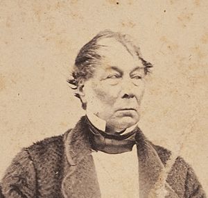
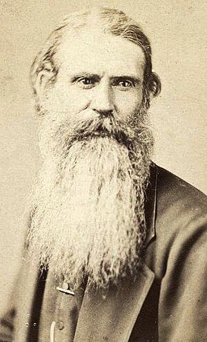
Studio portrait of Hamilton Andrew Hume, around 1869
|
|
| Born | 19 June 1797 |
| Died | 19 April 1873 (aged 75) |
| Resting place | Yass, New South Wales, Australia |
| Occupation | Explorer; Magistrate |
| Years active | 1814−1873 |
| Known for | Hume and Hovell expedition |
| Spouse(s) |
Elizabeth Dight
(m. 1825) |
Hamilton Hume (born June 19, 1797 – died April 19, 1873) was an important early explorer in Australia. He explored parts of what are now the states of New South Wales and Victoria.
In 1824, Hume and William Hovell led an expedition. They were the first Europeans to travel overland from Sydney to Port Phillip. This area is now near the city of Melbourne. Later, in 1828, Hume joined Charles Sturt on another trip. They were the first Europeans to find the Darling River.
Contents
Early Life and Family
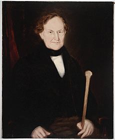
Hamilton Hume was born on June 19, 1797. His birthplace was Seven Hills, near Parramatta. This area is now a suburb of Sydney. He was the oldest son of Andrew Hamilton Hume and Elizabeth Hume.
His father, Andrew Hume, was a high-ranking official. He was the Commissary-General for New South Wales. This meant he was in charge of supplies for the colony. Hamilton Hume learned most of what he knew from his mother.
Adventures as an Explorer
Hamilton Hume started exploring when he was only 17 years old. He went with his younger brother John and an Aboriginal boy. They traveled southwest from Sydney towards Berrima. Hume quickly became very skilled at navigating the Australian bush.
First Journeys
In 1817, Hume went on a trip with James Meehan. Meehan was a deputy surveyor-general. They also traveled with Charles Throsby. During this journey, they saw Lake Bathurst and the Goulburn Plains.
The next year, in 1818, Hume explored with John Oxley and Meehan. They traveled to Jervis Bay on the coast. In 1822, he went south along the coast with Alexander Berry. They reached the Clyde River and went inland near Braidwood.
Berry later settled in the Shoalhaven area. In June 1822, Hume and a group of convicts dug a canal. This canal connected the Shoalhaven River and the Crookhaven River. It was Australia's first canal for boats. They finished the work in just 12 days. Today, this canal is the main flow of the Shoalhaven River.
The Hume and Hovell Expedition
In 1824, Governor Brisbane met with Hume about a new expedition. The goal was to reach Spencer Gulf. Governor Brisbane also spoke with William Hovell about the same idea.
The government could not pay for the trip. So, Hume and Hovell decided to pay for it themselves. The government did provide some supplies. These included packsaddles, weapons, clothes, and blankets.
Hume later wrote that he was the leader of the trip. But Governor Brisbane saw it as a joint effort. He said the discovery was made by "two young men Messrs Hovell and Hume."
Each explorer brought three helpers. They also had five bullocks, three horses, and two carts. The journey was very tough. They had to cross many major rivers. These included the Murrumbidgee River, Murray River, Mitta Mitta River, Ovens River, and Goulburn River. Hovell had named the Murray River after Hume. But Charles Sturt changed its name in 1830.
After crossing the Goulburn River, they faced very difficult land. They tried for three days to cross the Great Dividing Range. They were stopped at Mount Disappointment. Hume then changed direction to the west. On December 12, they reached lower land near Broadford.
Hume found a pass through the ranges the next day. He led the group across the Dividing Range at Hume’s Pass. On December 16, 1824, they reached Port Phillip Bay. This was at Bird Rock, near Geelong.
The group started their return journey on December 18. Hume chose a route further west. This helped them avoid the mountains and save time. On January 16, 1825, they ran out of flour. They soon found the carts they had left behind. Two days later, they reached Hume's station at Gunning.
Hume and Hovell each received land grants of about 1,200 acres. This was a small reward for such important discoveries. Their expedition was the first to find an overland route. This route connected southern New South Wales to Port Phillip. The city of Melbourne now stands on its shores.
Exploring the Blue Mountains
In 1827, Hume explored the western Blue Mountains. He was with Lieutenant George M. C. Bowen. Hume named a landform the Darling Causeway. He named it after Governor Ralph Darling. He also found three passes through the mountains. These passes would have avoided the very steep Mount York route. During this time, he named the Lithgow Valley. He named it after William Lithgow, who was a government official.
Finding the Darling River
In November 1828, Hume went on a journey with Charles Sturt. They traveled into western New South Wales. There, they discovered the Darling River. This river is the longest branch of the Murray River.
Hume could talk with some Aboriginal people they met. These people agreed to guide them. Later, when the guides left, Sturt praised Hume's skill. Hume was very good at tracking their animals when they wandered off. It was a dry year, so finding water was hard. Their good bush skills saved the group.
Sturt wanted Hume to join his second expedition. This trip started in late 1829. But Hume had to harvest his crops and could not go. After this, Hume stopped being an explorer. He spent his later years as a successful farmer.
Later Life and Legacy
Hamilton Hume married Elizabeth Dight on November 8, 1825. They were married at St Philip's Church in Sydney. Elizabeth survived him, but they did not have any children.
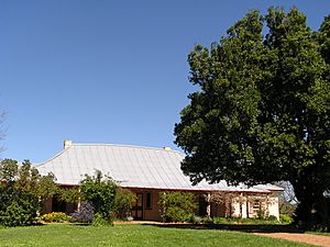
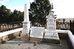
Hume worked as a magistrate in Yass. He lived at Cooma Cottage in Yass until he died on April 19, 1873. A special two-seater buggy that Hume used is now in the National Museum of Australia in Canberra.
Honours
Many things are named after Hamilton Hume. The Hume Highway is a major road between Sydney and Melbourne. It is named in his honour.
Hume and Hovell were also featured on Australian money. Their pictures were on the one-pound banknote from 1953 to 1966. The Hume Dam and Lake Hume were named after him in 1996. The Canberra suburb of Hume is also named for him. So is the federal voting area called the Division of Hume. The City of Hume council in Melbourne, formed in 1994, also carries his name.
In 1976, Australia Post issued a postage stamp. It showed the portraits of both Hume and Hovell. The Hume and Hovell Track is a 440-kilometer walking trail. It runs between Yass and Albury and is named after them.
See also
 In Spanish: Hamilton Hume para niños
- Hume and Hovell expedition
 | Stephanie Wilson |
 | Charles Bolden |
 | Ronald McNair |
 | Frederick D. Gregory |


