Mount Keira facts for kids
Quick facts for kids Mount KeiraWollongong, New South Wales |
|||||||||||||||
|---|---|---|---|---|---|---|---|---|---|---|---|---|---|---|---|
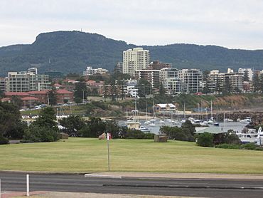
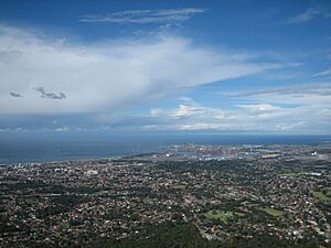
Overlooking Wollongong Harbour and North Wollongong to Mount Keira
|
|||||||||||||||
| Population | 1,665 (2016 census) | ||||||||||||||
| Postcode(s) | 2500 | ||||||||||||||
| Elevation | 463.9 m (1,522 ft) | ||||||||||||||
| Location |
|
||||||||||||||
| LGA(s) | City of Keiraville | ||||||||||||||
| State electorate(s) | Keira | ||||||||||||||
| Federal Division(s) | Cunningham | ||||||||||||||
|
|||||||||||||||
| Mount Keira | |
|---|---|
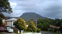
Mount Keira seen from Keiraville
|
|
| Highest point | |
| Elevation | 464 m (1,522 ft) |
| Geography | |
| Location | Illawarra region, New South Wales, Australia |
Mount Keira (pronounced KEER-uh) is a special place in the Illawarra region of New South Wales, Australia. It is both a mountain and a suburb.
The name Mount Keira comes from the Wodi Wodi people, who are the traditional owners of this land. They called the mountain Geera or Djera. Early maps used the name Keera, and later the 'i' was added. The entire Illawarra escarpment, which Mount Keira is part of, is sacred to the Wodi Wodi people.
The suburb of Mount Keira is a small community that sits on top of the mountain and its southern side. It is a semi-rural part of Wollongong.
Mount Keira stands about 464 meters (1,522 feet) above sea level. It is located about 4 kilometers (2.5 miles) northwest of the city of Wollongong. Its unique shape and closeness to Wollongong make it a well-known landmark. People love to visit the summit lookout for amazing views of the city. The mountain also has a long history of coal mining. It was formed millions of years ago when the Illawarra escarpment folded, and then shaped by creeks.
Contents
Indigenous History and Significance
Mount Keira is on the traditional lands of the Wodi Wodi people. They are part of the larger Dharawal language group. Evidence shows that Dharawal people have lived in the Illawarra area for at least 30,000 years. Their stories, land features, and old records tell us about how they used this land.
The Story of Mount Keira and the Five Islands
According to the Alcheringa, or Dreaming stories, of the local Aboriginal people, Mount Keira is Geera. She was the daughter of Oola-boola-woo, the West Wind. The story of Mount Keira is connected to how the Five Islands were created. These islands are just off the coast of Wollongong.
Oola-boola-woo had six daughters: Mimosa, Wilga, Lilli Pilli, Wattle, Clematis, and Geera. They lived on top of the Illawarra escarpment. One by one, the first five daughters misbehaved. This made Oola-boola-woo angry, and he threw them and the ground beneath them into the sea. This formed the Five Islands.
Geera was now the only child left on the escarpment. She had no one to play with or talk to, as her father was often away. Geera spent her days sitting, hunched over. She watched the Aboriginal camps below and looked out to sea at her five sisters. Over time, she turned to stone, with dust and leaves building up around her. She became part of the escarpment, and today she is known as Mount Keira.
Why Mount Keira is Important for Learning
Mount Keira is seen as one of the most important places for learning and teaching for the Dharawal people. Today, many major schools and universities in the Illawarra are located near Mount Keira. These include the University of Wollongong, Wollongong TAFE, Wollongong High School, and Keira High School. Mount Keira Demonstration School is a small public school at the base of the mountain.
Future Plans for Mount Keira
Mount Keira is sometimes called the "Uluru of the Illawarra" because of its deep cultural importance. There are plans to develop Mount Keira further for adventure tourism. These plans have led to some discussions within the Indigenous community. They want to make sure the site is always respected as a spiritual and historical place.
Geographic Features of Mount Keira
Mount Keira is part of the Illawarra escarpment. It connects to the escarpment by a high saddle on its western side. The top of the mountain is a flat area of hard sandstone. This plateau is surrounded by cliffs on three sides. From the bottom of these cliffs, the mountain slopes down to the surrounding foothills and the flat coastal plain.
From Wollongong, the mountain looks quite flat on top. But from the north, it seems like a natural part of the escarpment.
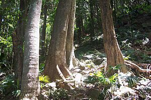
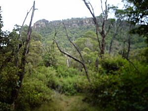
Most of the mountain is covered in forests. These include eucalypt (sclerophyll) forests and sub-tropical rainforests. People live on the lower slopes of the mountain. The suburbs around Mount Keira are Balgownie, Mount Pleasant, Mount Ousley, Keiraville, West Wollongong, Figtree, and Mount Kembla.
Several creeks flow down Mount Keira. There are also many gullies on its slopes. Byarong Creek drains the southern and western slopes. It flows west of Byarong Park and then down to Figtree and the sea. Creeks on the eastern slopes flow into Para or Fairy Creek. This creek goes through the Wollongong Botanic Gardens before reaching Fairy Lagoon. Cabbage Tree Creek drains the northern slopes.
Mount Ousley Road goes up the northern side of the mountain and over the escarpment. It is a main road connecting Wollongong and Sydney. On this road is the small suburb of Mount Pleasant. Here you can find the Illawarra Rhododendron Park. It has thousands of azaleas and hundreds of rhododendrons, as well as camellias. There is also a section of rainforest with short walking trails. The park covers 13 hectares (32 acres).
On the southern side, Mount Keira Road winds through the bush up the back of the mountain. This road leads to Byarong Park, a Girl Guides camp, and a Scout camp. It also leads to the summit lookout via Queen Elizabeth Drive. The Scout camp was started in 1939. Lady Baden Powell, whose husband founded Scouting, once called it "surely one of the most beautiful campsites in the world." Mount Keira Road was built by convicts between 1835 and 1836.
Mount Keira Summit Lookout
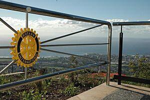
In 1955, the Rotary Club of Wollongong, with help from the local government and businesses, built the summit lookout. In 2005, the Summit Park was updated. It now offers amazing views of the coast from Kiama to Sydney. The park is managed as part of the Wollongong Botanic Garden. It covers 9.4 hectares (23 acres) and is a popular spot for tourists. Many visitors climb the Ken Ausburn Track to reach it.
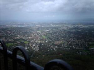
From the summit, you can see far and wide. You can see the Kurnell Refinery 53 kilometers (33 miles) north. To the south, you can see the northern headland of Jervis Bay, 64 kilometers (40 miles away). On a clear day, you might even see the Blue Mountains to the west. You can also see 77 kilometers (48 miles) out to sea. From the Victoria Rock Lookout, you can clearly see Knights Hill, Mount Kembla, and Saddleback Mountain.
At the summit, there is a restaurant called The Mountaintop. It serves food and drinks. A large transmission tower stands nearby, which is easy to see from the plain below. In 2006, coin-operated binocular telescopes were added. They let you see distant places like Stanwell Park up close.
The summit lookout and Queen Elizabeth Drive officially opened in 1959.
Plants and Animals
Eucalypt forests and rainforests cover the mountain's top and untouched slopes. Rainforests grow best in sheltered areas, especially on the southern side.
The mountain was heavily logged in the past. Trees like blackbutt, blue gum, and turpentine were cut down. Red cedar was very valuable, and there are stories of huge trees with trunks over 3 meters (10 feet) wide being felled. Some original bushland remains on the west and north slopes. However, much of the eastern slopes are now covered by new bushland that grew after clearing in the 1930s.
Some of the plants you can find on Mount Keira include:
- Cabbage tree palm (Livistona australis)
- Coast white box (Eucalyptus quadrangulata)
- Giant stinging tree (Dendrocnide excelsa)
- Native Tamarind (Diploglottis australis)
- Red cedar (Toona australis)
- Sassafras (Doryphora sassafras)
- Turpentine (Syncarpia glomulifera)
- Citronella (Citronella moorei)
- Jackwood (Cryptocarya glaucescens)
- Bollygum (Litsea reticulata)
Some plants that are not native, like lantana (Lantana camara), have also grown on the mountain. This happened especially after the 1968 bushfires.
The forests are home to many types of birds and other animals.
Some notable animals you might see include:
- Echidna (Tachyglossus aculeatus)
- Eastern Blue-tongued lizard (Tiliqua scincoides scincoides)
- Superb lyrebird (Menura novaehollandiae)
- Wallaby
There are also some Rusa deer living on and around the mountain. Local residents often see them around sunrise or sunset.
Walking Tracks
Mount Keira has several walking tracks for people to explore.
Mount Keira Ring Track
The Mount Keira Ring Track is a moderate walk that goes around the mountain. It is about 5.5 kilometers (3.4 miles) long and takes 3 to 5 hours to complete. The track circles the mountain at an average height of 250 meters (820 feet). You can start the walk from several places, including Mount Keira summit, Byarong Park, the Scout Camp, or Queen Elizabeth Drive.
From Byarong Park, a picnic area with parking, you can reach the Ring Track by a short path. This path goes from the picnic area to the Girl Guide Camp road. It then crosses the road and goes up through rainforest before joining the Ring Track.
The Ring Track has two main branches. The left branch gently climbs the southern side of Mount Keira. The right branch goes along the eastern side of the mountain. From the Ring Track, you can also connect to the Robertsons Lookout track. This is a short 1.2-kilometer (0.75-mile) walk to a viewpoint. From there, you can see the Scout Camp, Mount Keira, and the Illawarra coast.
Highlights of the Ring Track include beautiful rainforests and many unique Australian animals. You might see wallabies, lyrebirds, brush turkeys, and echidnas. Lyrebirds are common on the southern slopes. The rainforests have an open area underneath, with ferns and low shrubs. Where the environment has been disturbed, you might see weeds like Lantana. Eucalyptus forests grow where rainforests have been cleared.
Walkers can climb from the Ring Track to the Mount Keira summit using the Dave Walsh Track. This track starts opposite the Scout Camp Road. At the summit, the Dave Walsh track leads to Five Islands Lookout. A short 200-meter (656-foot) path leads to the summit park. This park has parking, toilets, and a café.
The track surface varies. The southern and eastern parts are well-formed and have steady slopes. The northern part is steeper and rougher. The northern side has some especially beautiful rainforests. Part of the southern section of the track follows an old road built by convicts. The Ring Track is well-known and popular with joggers, walkers, and school groups.
Dave Walsh Track
The Dave Walsh Track is named after a Scout leader. It climbs from Mount Keira Road, opposite the Scout Camp road. It goes through an open area with ground ferns, up the western slope of Mount Keira. It leads to Five Islands Lookout and the Summit Track. At the Mount Keira summit, you can also reach it from a maintenance trail. This trail leads from the carpark in Summit Park.
The trees along the track are mainly Eucalyptus. Ground plants include Lomandra Longifolia and Maidenhair fern. Many animals live in this area, such as wallabies, lizards, snakes, birds, and insects.
Ken Ausburn Track
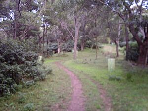
The Ken Ausburn Track starts at the end of Northfields Avenue. This is near the University of Wollongong and Wollongong Botanic Garden. It begins with a steep grass path, then turns into wooden steps and a boardwalk. At the top of the steps, a plaque tells you about bird species found on the track.
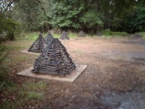
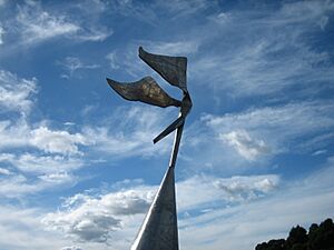
The track then follows a level path to an open grass area. Here you will find the Lawrence Hargrave Memorial Sculpture. This sculpture was made from 1988 to 1989 by Herbert "Bert" Flugelman. It is made of stainless steel and is part of the University of Wollongong Art Collection.
After this, the track gradually climbs a ridge to the Northern Illawarra Lookout. This lookout offers views to the north. A plaque here tells the story of a shipwreck at Towradgi Point. The track continues through a cutting. A plaque explains that this cutting is from the Mount Keira Tramway, which opened in 1859.
The track goes up more wooden steps and reaches a brick airshaft. This shaft was completed in 1907 and was used to ventilate the Kemira Colliery coal mine. A plaque tells the mine's history. From here, the track goes a short distance to the Mount Pleasant Management Trail. It then reaches the northeastern entrance to the Ring Track at Geordies Flat on Mount Keira Road. This track is popular with joggers and tourists. It has many plaques that point out interesting sights, like an old grey ironbark tree that survived logging.
Mount Pleasant Track
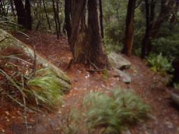
The Mount Pleasant Track is 750 meters (2,460 feet) long. It connects Parrish Avenue at Mount Pleasant and Mount Keira Road. The track climbs the middle slopes of Mount Keira through dense rainforest. It starts as a steep 3-meter (10-foot) wide trail for about 300 meters (984 feet). Then it narrows to less than 1 meter (3 feet). The last 500 meters (1,640 feet) wind through the rainforest, which has many ferns, vines, and palms. Large rocks show where rockfalls have happened from the sandstone plateau above.
About 100 meters (328 feet) north of the track start at Parrish Avenue are the Illawarra Rhododendron Gardens. These gardens are lush, quiet, and cool.
Mount Pleasant Management Trail
The Mount Pleasant Management Trail is used for walking and mountain bike riding. Bicycles are only allowed on management trails, not on walking tracks, in this area. The trail goes between the suburb of Mount Pleasant and Mount Keira Road. It comes out at a sharp bend called Geordies Flat. The trail is 2 to 3 meters (6.5 to 10 feet) wide.
From Mount Pleasant, the trail climbs steadily to where it meets the Ken Ausburn Track. From here, it goes up a steep hill before leveling out to Mount Keira Road. Near the Ken Ausburn track entrance, you can see views of Wollongong. From Mount Pleasant, you can see good views of the northern cliff face. This track is also a good place for birdwatching, as many species can be seen, including lyrebirds.
Keira Summit Track
The Keira Summit Track goes along the edge of the Mount Keira cliff line. It connects the Queen Victoria Lookout and Five Islands Lookout. The track forms a short 600-meter (1,968-foot) loop when combined with a management trail. This trail leads between the Five Islands lookout and the summit car park. The track goes through thick bush at the eastern clifftop. It includes plants like Sleber's Mint Bush, Lomandra grasses, and many native flowering plants.
Mining History
Coal was first found at Mount Keira in 1839 by Rev W. B. Clarke, a geologist.
In 1848, James Shoobert, a retired sea captain, dug a tunnel into a coal seam. He then found another seam with better quality coal and dug more tunnels in 1849 and 1850. This was called the Albert Coal Mine, the first in the Illawarra. Shoobert did not have enough money to develop the mine. So, in 1856, he sold it to Henry Osborne.
In April 1857, a new tunnel was opened into a higher coal seam by William Robson for Osborne. This was called the Osborne Wallsend Colliery. On April 16, 1857, the first 3.5 tonnes (3.4 long tons) of coal from this new mine were taken to the wharf at Wollongong's Belmore Basin. This coal was for a trial on the S.S. Illawarra ship. Keira coal became known for being very good. By the 1870s, large amounts of coal were being sent to Sydney, India, and parts of Asia.
At first, coal was moved in wooden skips that held about 1 tonne (1 long ton). Horses pulled these skips to the surface. Then, bullock teams carted the coal down the mountain. Later, a system was built to bring coal to the surface. A special incline was also built to send coal down to the foot of the mountain.
In May 1861, a narrow-gauge tramway was built from the incline to Belmore Basin (Wollongong Harbour). In 1878, the tramway was made wider. Horses that pulled the coal were replaced by steam locomotives. These locomotives, Keira No. 1 and Keira No. 2, were the first to work on this coal route. The locomotives at Keira stopped running in 1954 when the line closed.
Today, you can still trace the route of the old tramway on a map. It followed Gooyong Street, Rose Street, Throsby Drive, and then went between Campbell Street and Smith Street to Osborne Park and Belmore Basin. In 1937, Australian Iron & Steel bought the coal mine for its steelworks in Port Kembla. In 1942, a diesel locomotive was used at the mine. This was the first underground diesel locomotive in Australia.
In 1954, the old skipway and tramway were replaced by a new tunnel. This tunnel was dug from the escarpment. In 1955, the mine was renamed Kemira (from Kembla and Keira). New mining methods were introduced in the 1960s. The mine reached its highest production in 1979, producing 770,684 tonnes (758,515 long tons) of coal. In 1982, a slowdown in the steel industry led to many workers losing their jobs. Mining finally stopped on September 27, 1991.
 | Jackie Robinson |
 | Jack Johnson |
 | Althea Gibson |
 | Arthur Ashe |
 | Muhammad Ali |


