Jervis Bay Territory facts for kids
Quick facts for kids
Jervis Bay Territory
|
|
|---|---|
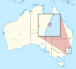
Location of the Jervis Bay Territory in Australia
Coordinates: 35°8′55″S 150°42′49″E / 35.14861°S 150.71361°E |
|
| Country | Australia |
| Separation from New South Wales | 1915 |
| Named for | John Jervis, 1st Earl of St Vincent |
| Largest city | Jervis Bay Village |
| Government | |
|
• Administered by
|
Department of Infrastructure, Transport, Regional Development, Communications and the Arts |
| Parliament of Australia | |
|
• Senate
|
represented by Australian Capital Territory senators |
| included in the Division of Fenner | |
| Area | |
|
• Total
|
67.8 km2 (26.2 sq mi) |
| Population | |
|
• 2023 estimate
|
307 |
|
• Density
|
5.8/km2 (15.0/sq mi) |
| Time zone | UTC+10:00 (AEST) |
|
• Summer (DST)
|
UTC+11:00 (AEDT) |
| Postcode |
NSW 2540
|
The Jervis Bay Territory (JBT) is a special area in Australia. It was created in 1915 from a piece of New South Wales (NSW). This was done so the Australian Capital Territory (ACT), which is inland, could have its own access to the sea.
Even though it's a separate territory, the JBT has often been managed as if it were part of the ACT. This is because the laws of the ACT apply there. Since 1989, different Australian government departments have been in charge of the JBT.
Contents
History of Jervis Bay Territory
Jervis Bay has a long and important history for Aboriginal Australians. The local Aboriginal people, the Yuin people, have a strong connection to this area.
The name Booderee, which is now a national park in the territory, means 'bay of plenty' or 'plenty of fish' in the local Aboriginal language. In 2016, the Yuin people asked for their native title to be recognized, showing their ongoing connection to the land.
European Exploration
The bay was first seen by Lieutenant James Cook in 1770. He was on his ship, the HMS Endeavour. He named the southern tip of the bay Cape St. George.
In 1791, Lieutenant Richard Bowen sailed into the bay. He named it Jervis Bay after Admiral John Jervis. Later that year, another ship, the Matilda, entered the bay for repairs.
Explorer George Bass visited the bay in 1797 and named Bowen Island. In 1819, John Oxley, another explorer, came by sea to explore the bay.
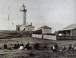
How the Territory Was Formed
When Australia became a federation, leaders decided on a few things about new federal territories. First, a new capital city would be built in New South Wales. Second, this capital city area would be separate from NSW to prevent NSW from having too much power.
Third, it was thought important for the federal government to control its own port and coastline. Since the new capital (Canberra) was far from the sea, a separate port area was needed. Jervis Bay was chosen as the best place for this federal port.
In 1909, the land around Jervis Bay was given by the NSW government to the Australian federal government. Then, in 1915, the Jervis Bay Territory officially became part of the Commonwealth. There was a plan to build a railway line between Canberra and Jervis Bay, but it was never built.
In 2021, about 310 people lived in the Jervis Bay Territory. About 12% of them worked in the military. Most of the land in the JBT (about 90%) is owned by the Wreck Bay Aboriginal Community Council. This council also helps manage the community.
Administration of Jervis Bay Territory
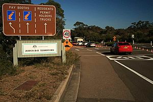
The Jervis Bay Territory is managed by the Australian federal government. Specifically, the Department of Infrastructure, Transport, Regional Development, Communications and the Arts is in charge.
Even though it's separate, the JBT is counted as part of the ACT for some things. For example, its residents are represented by senators from the ACT in the Australian Senate. For the House of Representatives, the JBT is part of the Fenner voting area.
The Jervis Bay Administration handles local government matters. It also provides primary school teachers and Australian Federal Police officers. People living in the JBT use the courts in the ACT. However, they cannot vote in ACT or NSW local elections. They can still share their opinions through community groups. Aboriginal people who are members of the Wreck Bay Aboriginal Community Council can vote in their council meetings.
The Australian government pays the ACT government to provide services like courts, education, and welfare. They also pay the NSW government for rural fire services and health care. The Shoalhaven City Council helps with rubbish collection and library services.
Geography of Jervis Bay Territory
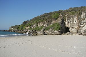
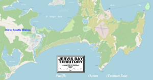
The Jervis Bay Territory is the smallest mainland territory in Australia. It has about 65.7 square kilometers of land and 8.9 square kilometers of marine reserve. Jervis Bay itself is a large natural harbor. It is about 16 kilometers long and 10 kilometers wide.
The bay opens to the Pacific Ocean on its eastern side. It is located about 198 kilometers south of Sydney. The closest city is Nowra, which is about 40 kilometers north. Most of the water in Jervis Bay is part of the Jervis Bay Marine Park. However, the waters within the JBT are part of Booderee National Park.
Booderee National Park
Booderee National Park covers about 90% of the Jervis Bay Territory. It is home to many different plants and animals. You can find about 206 types of birds, 27 types of mammals, 15 types of amphibians, and 23 types of reptiles there. There are also 180 types of fish in the area.
The park is unique because it sits where Australia's northern and southern climate zones meet. This allows for a wide variety of species to live there. The land was formed from ancient sand dunes and old rock formations.
Lakes and Islands
There are three small lakes in the territory. Lake Windermere is the largest, covering about 31 hectares. Lake Mckenzie is 7 hectares, and Blacks Waterhole is 1.4 hectares.
Bowen Island is located at the entrance to the bay. It is about 51 hectares in size. This island is an important place for little penguins, where they have their rookeries (breeding colonies).
Villages in Jervis Bay Territory
There are two main villages in the Jervis Bay Territory. Both use the postcode 2540.
- Jervis Bay Village (population 189)
- Wreck Bay Village (population 152)
There are also four private properties within the Booderee National Park that are not part of the park itself. One of these is Christian's Minde, a historic settlement. It was started in 1880 by the Ellmoos family from Denmark. It was one of the first guesthouses on the NSW south coast. The Ellmoos family's descendants still live in and care for these properties today.
HMAS Creswell
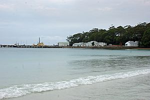
HMAS Creswell is a Royal Australian Navy College located inside Booderee National Park. It is named after Sir William Rooke Creswell, an important figure in the Royal Australian Navy.
Next to HMAS Creswell is the Jervis Bay Airfield. The Navy uses this airfield for its pilotless target aircraft called Kalkaras. These aircraft are launched from the airfield for training exercises. After the exercises, they land by parachute in the water and are picked up by boats from HMAS Creswell.
Proposed Nuclear Reactor Site
The Jervis Bay Territory was once considered as a location for a nuclear power plant. This project was planned for the southeastern part of the bay, near Murray's Beach.
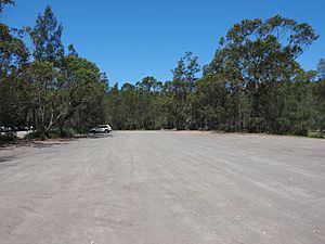
Work began on the site, including clearing land and building an access road. However, the project was cancelled in 1971. The cleared area where the plant was to be built is now used as a car park for Murray's Beach and its boat ramp.
See also
 In Spanish: Territorio de la Bahía de Jervis para niños
 | Jewel Prestage |
 | Ella Baker |
 | Fannie Lou Hamer |


