
La Fare-en-Champsaur facts for kids
Quick facts for kids
La Fare-en-Champsaur
|
||
|---|---|---|

Town hall and post office
|
||
|
||

La Fare-en-Champsaur
Location in France

La Fare-en-Champsaur
Location in Provence-Alpes-Côte d'Azur
|
||
| Country | France | |
| Region | Provence-Alpes-Côte d'Azur | |
| Department | Hautes-Alpes | |
| Arrondissement | Gap | |
| Canton | Saint-Bonnet-en-Champsaur | |
| Area
1
|
10.27 km2 (3.97 sq mi) | |
| Population
(Jan. 2019)
|
433 | |
| • Density | 42.16/km2 (109.20/sq mi) | |
| Time zone | UTC+01:00 (CET) | |
| • Summer (DST) | UTC+02:00 (CEST) | |
| INSEE/Postal code |
05054 /05500
|
|
| Elevation | 949–2,082 m (3,114–6,831 ft) (avg. 900 m or 3,000 ft) |
|
| 1 French Land Register data, which excludes lakes, ponds, glaciers > 1 km2 (0.386 sq mi or 247 acres) and river estuaries. | ||

La Fare-en-Champsaur is a small town, also called a 'commune,' located in the beautiful Hautes-Alpes department in France. It's a place where people live and work together, like a small community.
Contents
People Living in La Fare-en-Champsaur
The 'population' of a place tells us how many people live there. La Fare-en-Champsaur has seen its population change over the years. For example, in 1962, about 347 people lived there. By 2019, the number grew to around 433 people. This shows how communities can grow and change over time.
Population Numbers Over Time
Here is a quick look at how the number of people living in La Fare-en-Champsaur has changed:
- 1962: 347 people
- 1968: 354 people
- 1975: 397 people
- 1982: 409 people
- 1990: 422 people
- 1999: 413 people
- 2008: 418 people
- 2019: 433 people
Getting Around: Transport
Several roads help people travel to and from La Fare-en-Champsaur. The D17, D217, D945, and N85 roads all pass through this commune. These roads connect the town to other places, making it easier for people to get around.
Images for kids
-
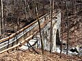
The Pont-du-Fossé canal in the woods above La Fare

See also
 In Spanish: La Fare-en-Champsaur para niños
