
La Honda Creek facts for kids
Quick facts for kids La Honda Creek |
|
|---|---|

La Honda Creek flows through Play Bowl in La Honda, California.
|
|
| Country | United States |
| Physical characteristics | |
| Main source | near Allen Lookout, San Mateo County, California 1,940 feet (590 m) 37°23′32″N 122°17′30″W / 37.3923°N 122.2918°W |
| River mouth | San Gregorio Creek 320 feet (98 m) |
| Length | about 7 miles (11 km) |


La Honda Creek is a small river located in San Mateo County, California. It's like a smaller stream that flows into a bigger one called San Gregorio Creek.
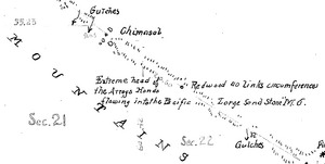
This creek starts high up, about 1,940 feet (590 meters) above sea level. Its journey begins near Bear Gulch Road and Skyline Boulevard (which is also California State Route 35). La Honda Creek flows for about 7 miles (11 kilometers). It eventually meets with another stream, Alpine Creek. Together, they form the larger San Gregorio Creek in the town of La Honda.
What's in a Name?
The name of the creek has changed over time. On old Spanish maps, it was sometimes called Arroyo Ondo. Later, on a map from 1856 for a place called Rancho Cañada de Raymundo, it was named Arroyo Hondo.
The word Hondo is Spanish. It means 'deep'. So, the creek was likely known for having deep parts.
Where Does it Flow?
California State Route 84 (CA 84) is a road that follows the valley where La Honda Creek flows. This road goes from a place called Sky Londa all the way to San Gregorio.
A big part of the land where the creek starts is protected. It's part of the La Honda Creek Open Space Preserve. This preserve helps keep the natural environment around the creek safe and healthy.
