La Perouse (New Zealand) facts for kids
Quick facts for kids La Perouse |
|
|---|---|
| Highest point | |
| Elevation | 3,078 m (10,098 ft) |
| Prominence | 496 m (1,627 ft) |
| Geography | |
| Location | South Island, New Zealand |
| Parent range | Southern Alps |
| Climbing | |
| Easiest route | glacier/snow/ice climb |
La Perouse is a tall and impressive mountain in New Zealand. It's part of the Southern Alps, a big mountain range that runs down the South Island. This mountain stands at about 3,078 metres (10,098 ft) (over 10,000 feet) high! It was once known by a different name, Mount Stokes.
Where is La Perouse?
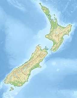
La Perouse is found in the Southern Alps on New Zealand's South Island. It is only about four kilometres southwest of Aoraki / Mount Cook, which is New Zealand's highest mountain.
This mountain sits right on the Main Divide. This is like a natural line that separates the rivers flowing to the east from those flowing to the west. La Perouse is also on the border between two amazing places: Aoraki/Mount Cook National Park and Westland Tai Poutini National Park.
On the northern side of La Perouse, a large ice river called the La Perouse Glacier begins. This glacier feeds water into the Cook River. The Cook River then flows all the way to the Tasman Sea.
Why is it Called La Perouse?
This mountain was first named Mount Stokes. It was named after John Lort Stokes. He was a helper on the famous second voyage of HMS Beagle (1831–1836). He also captained a survey ship called HMS Acheron.
However, there was already another Mount Stokes in Nelson. To avoid confusion, the mountain was renamed La Perouse. This new name honors a brave French explorer named Jean-François de Galaup, comte de Lapérouse. His expedition was lost near Vanikoro in the Solomon Islands in 1788.
The 1948 Mountain Rescue
La Perouse was the site of a very difficult rescue in New Zealand's climbing history. This happened in 1948. A climber named Ruth Adams was hurt. She had to be carried on a stretcher all the way over the mountain's top. They also had to go through deep valleys to reach the West Coast road.
Ruth Adams was part of a climbing team. This team included famous climbers like Harry Ayres and Edmund Hillary. This rescue was also the first time Edmund Hillary met another climber, Norman Hardie. They became lifelong friends. Norman Hardie later served on the board of Edmund Hillary's Himalayan Trust for 22 years.
 | Madam C. J. Walker |
 | Janet Emerson Bashen |
 | Annie Turnbo Malone |
 | Maggie L. Walker |


