Lac Sainte-Anne (Lac-Croche) facts for kids
Quick facts for kids Lac Sainte-Anne |
|
|---|---|
| Location | Lac-Croche (TNO), La Jacques-Cartier Regional County Municipality, Capitale-Nationale, Quebec, Canada |
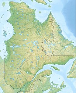
| Coordinates | 47°17′06″N 71°39′36″W / 47.285°N 71.66°W |
| Lake type | Natural |
| Primary inflows | (clockwise from the mouth) Discharge of lakes Louise, Trépanier, Cuvette, La Saulx and Bastonis, discharge of lakes Émilie, Sioui, de la Spartine, Beauclair and Petit lac Beauclair, discharge of an unidentified lake. |
| Primary outflows | Sainte-Anne River (Mauricie) |
| Basin countries | Canada |
| Max. length | 4.8 km (3.0 mi) |
| Max. width | 0.5 km (0.31 mi) |
| Surface area | 1.43 km2 (0.55 sq mi) |
| Surface elevation | 656 m (2,152 ft) |
Lac Sainte-Anne, also known as Sainte-Anne Lake, is a freshwater lake in Quebec, Canada. It is the very beginning of the Sainte-Anne River. This lake is located in a special area called the Laurentides Wildlife Reserve.
The lake is found in the unorganized territory of Lac-Croche. This area is part of the La Jacques-Cartier Regional County Municipality in the Capitale-Nationale region of Quebec.
Forest roads help people get to the lake. Road R0300 runs along the east side of the lake. Another road from the south connects to it. These roads are used for logging and for fun outdoor activities.
Logging is the main job in this area. Tourism, like visiting the lake for recreation, is also important.
The surface of Lac Sainte-Anne usually freezes over in early December. It stays frozen until the end of March. It is generally safe to walk or play on the ice from mid-December to mid-March.
Contents
About Lac Sainte-Anne's Geography
Lac Sainte-Anne is a long lake nestled in the mountains. It is about 4.8 kilometres (3.0 mi) long. The lake is also about 0.5 kilometres (0.31 mi) wide. Its surface sits high up, at an altitude of 656 metres (2,152 ft). The lake has three small islands.
How Lac Sainte-Anne Gets Its Water
Lac Sainte-Anne receives water from several smaller lakes. These lakes flow into Lac Sainte-Anne from different directions:
- From the north: Water comes from lakes Émilie, Sioui, de la Spartine, Beauclair, and Petit lac Beauclair.
- From the east: Water flows in from an unnamed lake.
- From the southwest: Water enters from lakes Louise, Trépanier, Cuvette, La Saulx, and Bastonis.
The Sainte-Anne River's Journey
Water flows out of Lac Sainte-Anne to form the Sainte-Anne River. The river then travels for many kilometers. It eventually reaches the northeast shore of the St. Lawrence River.
The Name of Lac Sainte-Anne
The name "Lac Sainte-Anne" was officially recognized on December 5, 1968. This was done by the Commission de toponymie du Québec. This commission is in charge of naming places in Quebec.
 | Misty Copeland |
 | Raven Wilkinson |
 | Debra Austin |
 | Aesha Ash |


