Ladysmith, Virginia facts for kids
Quick facts for kids
Ladysmith, Virginia
|
|
|---|---|

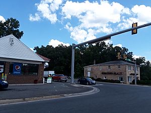
Central intersection in Ladysmith
|
|
| Country | United States |
| State | Virginia |
| County | Caroline |
| Elevation | 230 ft (70 m) |
| Time zone | UTC-5 (Eastern (EST)) |
| • Summer (DST) | UTC-4 (EDT) |
| ZIP code |
22501
|
| Area code(s) | 804 |
| GNIS feature ID | 1469093 |
Ladysmith is a small, unincorporated community in Caroline County, Virginia. An unincorporated community means it's a place that doesn't have its own local government. It's located along US 1 and SR 639. You can find it northwest of Ruther Glen. It's also about one mile west of I-95 exit 110. The area includes places like the Pendleton Golf Club.
Contents
A Look Back: Ladysmith's History
How Ladysmith Got Its Name
A post office started operating in Ladysmith in 1928. There are a couple of ideas about how the community got its name. Some people think it was named after a town called Ladysmith in South Africa. However, it's more likely that the community was named after the mother of Clara Smith. She was the original owner of the land where Ladysmith is located.
Famous Faces from Ladysmith
William Clark: Explorer and Leader
One famous person connected to Ladysmith is William Clark. He was born in Ladysmith in 1770. William Clark became a well-known explorer and a politician. He is most famous for his part in the Lewis and Clark Expedition. This expedition explored the western parts of the United States.
 | James B. Knighten |
 | Azellia White |
 | Willa Brown |


