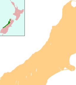
Lake Christabel facts for kids
Quick facts for kids Lake Christabel |
|
|---|---|
| Location | Grey District, West Coast Region, South Island |
| Coordinates | 42°25′S 172°14′E / 42.417°S 172.233°E |
| Primary outflows | Grey River |
| Basin countries | New Zealand |
| Surface area | 2.6 square kilometres (1.0 sq mi) |
| Shore length1 | 8.9 kilometres (5.5 mi) |
| Surface elevation | 655 metres (2,149 ft) |
| 1 Shore length is not a well-defined measure. | |
Lake Christabel is a small, beautiful lake located in the northern part of New Zealand's South Island. It's a special place, known for being the secret starting point of a major river.
Contents
What is Lake Christabel?
Lake Christabel is a freshwater lake. It covers an area of about 2.6 square kilometres (1 square mile). The lake is surrounded by stunning natural scenery. Its shoreline stretches for about 8.9 kilometres (5.5 miles). The lake sits quite high up, at an elevation of 655 metres (2,149 feet) above sea level.
Where is Lake Christabel Located?
You can find Lake Christabel about 12 kilometres (7.5 miles) southwest of the Lewis Pass. This pass is a mountain pass in the Southern Alps. The lake is part of the Grey District in the West Coast Region of the South Island. It's a somewhat remote area, known for its rugged landscapes.
How Was Lake Christabel Formed?
Lake Christabel has an interesting origin story. It was formed behind what is called a "landslide dam." Imagine a huge amount of earth and rocks sliding down a hillside. This slide can block a valley or a river. In this case, it created a natural barrier. Water then collected behind this barrier, forming the lake. Scientists believe this massive landslide happened a very long time ago. It was likely caused by a powerful "prehistoric earthquake." This means an earthquake that happened before people started recording history.
The Grey River's Beginning
One of the most unique things about Lake Christabel is its role in a major river system. The lake is the source of the Grey River. This river is one of the longest rivers on the South Island's West Coast. What makes its start so unusual is that the lake's water flows out underground. It doesn't have a visible river flowing directly from its surface. Instead, the water finds its way through the ground. It then emerges later to form the Grey River.
 | Janet Taylor Pickett |
 | Synthia Saint James |
 | Howardena Pindell |
 | Faith Ringgold |


