Lake Harriet (Oregon) facts for kids
Quick facts for kids Lake Harriet |
|
|---|---|
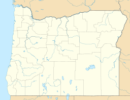
| Location | Mount Hood National Forest, Clackamas County, Oregon |
| Coordinates | 45°04′28″N 121°58′11″W / 45.074566°N 121.969802°W |
| Type | reservoir |
| Primary inflows | Oak Grove Fork Clackamas River |
| Primary outflows | Oak Grove Fork Clackamas River |
| Basin countries | United States |
| Max. length | 3,000 ft (910 m) |
| Max. width | 300 ft (91 m) |
| Surface elevation | 2,037 ft (621 m) |
Lake Harriet is a special lake in Clackamas County, located in the beautiful state of Oregon. It's not a natural lake, but a reservoir, which means it was created by people.
This reservoir is formed by holding back the waters of the Oak Grove Fork of the Clackamas River. It is found about 75 kilometres (47 mi) southeast of Portland. It is also about 31 kilometres (19 mi) southwest of Government Camp.
Contents
What is a Reservoir?
A reservoir is like a big, human-made lake. It is built to store water for different uses. People create reservoirs by building a dam across a river or stream.
These stored waters are very important. They can be used for drinking water, to help farms grow crops, or to create electricity. Reservoirs also help control floods.
How Reservoirs are Made
Building a reservoir involves careful planning. Engineers choose a good spot, often a valley, where a dam can be built. The dam then blocks the river's flow.
Over time, the water collects behind the dam, forming the reservoir. The size and shape of the reservoir depend on the valley and the dam's design.
Location and Natural Beauty
Lake Harriet is nestled within the Mount Hood National Forest. This forest is known for its stunning natural beauty. It has tall trees, clear streams, and amazing wildlife.
The area around Lake Harriet offers a chance to connect with nature. Visitors can enjoy the peaceful surroundings. The forest provides a home for many animals and plants.
The Clackamas River System
Lake Harriet is part of the larger Clackamas River system. This river is important for the region. It flows through forests and valleys.
The Oak Grove Fork is one of the branches of the Clackamas River. It feeds into Lake Harriet. This connection shows how all parts of a river system are linked.
Purpose of Lake Harriet
As a reservoir, Lake Harriet plays a role in managing water resources. While the exact primary purpose isn't detailed, reservoirs often serve multiple needs. They can provide water for nearby communities.
They might also help generate hydroelectric power. This is a clean way to make electricity using the force of moving water. Reservoirs are key to modern water management.
 | Isaac Myers |
 | D. Hamilton Jackson |
 | A. Philip Randolph |


