
Lake Hibara facts for kids
Quick facts for kids Lake Hibara |
|
|---|---|

Lake Hibara viewed from north of Mount Bandai
|
|
| Location | Kitashiobara |
| Coordinates | 37°41′0″N 140°3′20″E / 37.68333°N 140.05556°E |
| Basin countries | Japan |
| Surface area | 10.7 km2 (4.1 sq mi) |
| Max. depth | 30.5 m (100 ft) |
| Water volume | 0.13 km3 (110,000 acre⋅ft) |
| Shore length1 | 31.5 km (19.6 mi) |
| Surface elevation | 822.0 m (2,696.9 ft) |
| 1 Shore length is not a well-defined measure. | |
Lake Hibara (桧原湖, Hibara-ko) is a beautiful lake located in Yama District, Fukushima, Japan. It is the largest lake in the Bandai-kōgen highlands and is part of the amazing Bandai-Asahi National Park.
How Lake Hibara Was Formed
Lake Hibara is a special kind of lake called a mesotrophic lake. This means it has a medium amount of nutrients, which helps different plants and animals live there.
This lake was not always here! It was created in a very dramatic way on July 15, 1888. On that day, Mount Bandai erupted. A huge debris avalanche (a fast-moving slide of rock and soil) rushed down the mountain. This avalanche blocked a river, forming a natural dam. Over time, water collected behind this dam, creating Lake Hibara.
When the lake formed, it sadly covered a village called Hibara Village (桧原村, Hibara-mura). The ruins of this old village are still at the bottom of the lake today! It's like a hidden underwater town.
Exploring Lake Hibara
Lake Hibara is a popular spot for visitors. People come to enjoy its natural beauty, especially with the stunning Mount Bandai nearby.
You can often see people enjoying activities like:
- Boating
- Fishing
- Kayaking
- Hiking around the shore
In winter, when the lake freezes over, it becomes a popular place for ice fishing, especially for wakasagi (smelt fish).
Images for kids
- Views of Lake Hibara
-
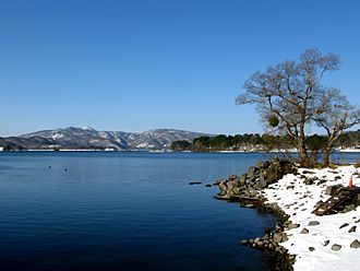
Lake Hibara with snow
-
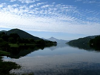
Looking south
-
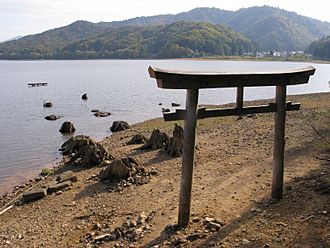
Submerged torii from the former location of Hibara Village.


- Takeda, Toru; Hishinuma, Tomio; Kamieda, Kinuyo; Dale, Leigh; Oguma, Chiyoichi (August 10, 1988). Hello! Fukushima - International Exchange Guide Book (1988 ed.). Fukushima City: Fukushima Mimpo Press
