Lake Hobart facts for kids
Quick facts for kids Lake Hobart |
|
|---|---|
| Rocky Lake | |
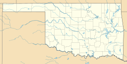
| Location | Washita County, Oklahoma |
| Coordinates | 35°10′41″N 99°4′34″W / 35.17806°N 99.07611°W |
| Type | Reservoir |
| Primary inflows | Little Elk Creek |
| Primary outflows | Little Elk Creek |
| Catchment area | 154 square kilometres (59 sq mi) |
| Surface area | 340 acres (1.4 km2) |
| Average depth | 4 feet (1.2 m) |
| Water volume | 4,210 acre-feet (5,190,000 m3) |
| Shore length1 | 5 miles (8.0 km) |
| Surface elevation | 1,647 feet (502 m) |
| Settlements | Hobart, Oklahoma; Rocky, Oklahoma |
| 1 Shore length is not a well-defined measure. | |
Lake Hobart, also known as Rocky Lake, is a man-made lake in Washita County, Oklahoma. It is located northwest of Rocky, near U.S. Route 183. The lake is about 9.5 miles (15.3 km) from the city of Hobart, Oklahoma, which is how it got its name.
About Lake Hobart
Lake Hobart was created in the 1950s. It was part of a bigger plan called the Washita Basin Project. The main goal was to improve the water supply for nearby towns. To do this, a dam was built across Little Elk Creek.
Water Supply and Fun
The lake provides water to three communities: Clinton, Cordell, and Hobart. An aqueduct (a special channel for carrying water) moves water from the lake to these towns.
Lake Hobart is a popular spot for outdoor activities. Many people enjoy fishing and boating here. There is also a place called Grissom Cemetery near the northern side of the lake.
Lake Facts
The dam that created Lake Hobart is made of earth. It stands about 29 feet (8.8 meters) high. The dam stretches for 1,950 feet (594 meters) across the creek.
The surface of the lake covers about 340 acres (1.4 square kilometers). When the lake is at its normal level, it holds about 4,210 acre-feet of water. At its fullest, it can hold up to 6,340 acre-feet.
 | Misty Copeland |
 | Raven Wilkinson |
 | Debra Austin |
 | Aesha Ash |


