Lake Ka-ho, Illinois facts for kids
Quick facts for kids
Lake Ka-ho, Illinois
|
|
|---|---|
|
Village
|
|

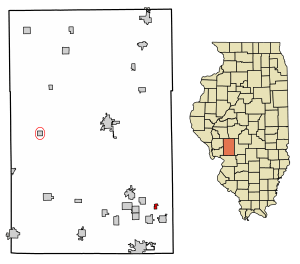
Location in Macoupin County, Illinois
|
|
| Country | United States |
| State | Illinois |
| County | Macoupin |
| Township | Cahokia |
| Area | |
| • Total | 0.32 sq mi (0.84 km2) |
| • Land | 0.28 sq mi (0.73 km2) |
| • Water | 0.04 sq mi (0.10 km2) |
| Elevation | 650 ft (200 m) |
| Population
(2020)
|
|
| • Total | 194 |
| • Density | 683.10/sq mi (264.20/km2) |
| Time zone | UTC-6 (Central (CST)) |
| • Summer (DST) | UTC-5 (CDT) |
| ZIP Code |
62069 (Mount Olive)
|
| Area code(s) | 217 |
| FIPS code | 17-41214 |
Lake Ka-ho is a small village in Illinois, United States. It is located in Macoupin County, within Cahokia Township. The village was officially formed in the year 2000.
In 2020, about 194 people lived in Lake Ka-ho. This number was a bit lower than in 2010, when 237 people lived there. The village is also part of a larger area called the St. Louis Metropolitan Statistical Area. This means it is connected to the bigger city of St. Louis, Missouri.
Geography of Lake Ka-ho
Lake Ka-ho village is in the southeastern part of Macoupin County. It is built around a lake also called Lake Ka-Ho. This lake is a reservoir, which is like a big, artificial lake that stores water. It was made on a small stream that flows into Panther Creek.
Just south of the village is another reservoir, Mount Olive Lake. This lake is also on Panther Creek. Both lakes are part of the watershed of Cahokia Creek. A watershed is an area of land where all the water drains into a common river or lake. Cahokia Creek flows southwest to the Mississippi River, near St. Louis.
Lake Ka-ho is about 2 miles (3.2 km) northwest of Mount Olive. It is also about 6 miles (9.7 km) southeast of Gillespie. A major highway, Interstate 55, passes close to the village. You can get to Lake Ka-ho from Exit 44, which is west of Mount Olive.
The village covers a total area of about 0.32 square miles (0.83 square kilometers). Most of this area, about 0.28 square miles (0.73 square kilometers), is land. The rest, about 0.04 square miles (0.10 square kilometers), is water from the lake.
Population Information
The study of how many people live in a place is called demographics. The United States government counts everyone living in the country every ten years. This is called the U.S. Decennial Census.
Here's how the population of Lake Ka-ho has changed:
| Historical population | |||
|---|---|---|---|
| Census | Pop. | %± | |
| 2010 | 237 | — | |
| 2020 | 194 | −18.1% | |
| U.S. Decennial Census | |||
See also
 In Spanish: Lake Ka-Ho (Illinois) para niños
 | Jessica Watkins |
 | Robert Henry Lawrence Jr. |
 | Mae Jemison |
 | Sian Proctor |
 | Guion Bluford |


