Lake River facts for kids
Quick facts for kids Lake River |
|
|---|---|
|
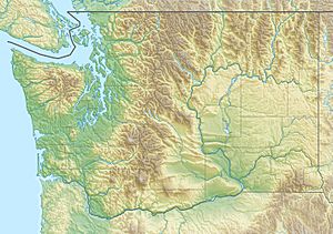
Location of the mouth of Lake River in Washington
|
|
| Country | United States |
| State | Washington |
| County | Clark |
| Physical characteristics | |
| Main source | Vancouver Lake Vancouver 8 ft (2.4 m) 45°41′53″N 122°43′05″W / 45.69806°N 122.71806°W |
| River mouth | Columbia River near Ridgefield 7 ft (2.1 m) 45°50′37″N 122°46′50″W / 45.84361°N 122.78056°W |
| Length | 11 mi (18 km) |
| Basin features | |
| Basin size | 100 sq mi (260 km2) |
Lake River is a smaller river, about 11 miles (18 km) long. It flows into the mighty Columbia River in the state of Washington, USA. It starts at Vancouver Lake in Vancouver. From there, it flows north until it joins the Columbia River near Ridgefield. This is also close to the northern tip of Bachelor Island.
Long ago, in 1841, an exploration team called the Wilkes Expedition called this river Calipaya Inlet.
Lake River is part of a cool water trail that is 32 miles (51 km) long. This trail connects Vancouver Lake to Woodland. It's perfect for kayaks and other small boats. You can also find parts of the Ridgefield National Wildlife Refuge right next to the river.
The River's Journey
Lake River is a very calm and flat waterway. It's almost like a slow-moving part of the Columbia River. Over its entire 11-mile (18 km) journey, it only drops about 1 foot (30 cm) in height.
The river generally flows north, staying close to the Columbia River. Then, it gently curves to the northwest to meet the larger river. Sometimes, the tides and high water from the Columbia River can make Lake River flow backward into Vancouver Lake. This can happen for a long time!
As the river leaves Vancouver Lake and Vancouver Lake Park, it gets water from Buckmire Slough on its left. After this, you'll see the Shillapoo Wildlife Area on the left. The small community of Felida is on the right. About 1.5 miles (2.4 km) further downstream, Salmon Creek joins the river from the right.
For the next half mile (0.8 km), the river flows between Curtis Lake on the right and Round Lake on the left. About 8 miles (13 km) before it reaches the Columbia River, Lake River enters the Ridgefield National Wildlife Refuge. Here, it passes between Green Lake on the right and Post Office Lake on the left. Whipple Creek also flows into Lake River from the right.
Over the next 2 miles (3.2 km), Campbell Lake is on the left side of the river. Flume Creek joins the river from the right about 4.5 miles (7.2 km) from where Lake River meets the Columbia.
The river then leaves the wildlife refuge. About 3 miles (4.8 km) from its end, the stream turns northwest and enters the town of Ridgefield, which is on the right. A little over a mile later, Bachelor Island Slough flows in from the left. Carty Lake is on the right as the river goes back into the wildlife refuge. Finally, Lake River flows into the Columbia River at the northern tip of Bachelor Island. This spot is about 0.5 miles (0.8 km) upstream from where the Lewis River joins the Columbia. It's also about 87.5 miles (140.8 km) from where the Columbia River meets the Pacific Ocean.
The River's Home and Its Health
A "watershed" is like a giant bowl of land where all the rain and snowmelt drain into a specific river or lake. Lake River's watershed is quite large, covering more than 100 square miles (260 km²).
This watershed includes the mostly city area of Burnt Bridge Creek, which is about 28 square miles (73 km²). The water from Burnt Bridge Creek flows into Vancouver Lake. The watershed also includes Vancouver Lake itself and the land around it. Plus, it covers the areas along Lake River and its smaller helper streams like Salmon, Whipple, and Flume creeks. Unfortunately, the water quality in all these areas is not very good.
 | Anna J. Cooper |
 | Mary McLeod Bethune |
 | Lillie Mae Bradford |


