Lake Taylorville facts for kids
Quick facts for kids Lake Taylorville |
|
|---|---|
| Location | Christian County, Illinois |
| Coordinates | 39°30′N 89°15′W / 39.50°N 89.25°W |
| Type | reservoir |
| Primary inflows | Sangamon River |
| Primary outflows | Sangamon River |
| Basin countries | United States |
| Max. length | 6.5 mi (10.5 km) |
| Max. width | 0.4 mi (0.6 km) |
| Surface area | 1,200-acre (4.8 km²) |
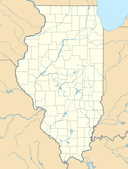
Lake Taylorville is a large, man-made lake in Christian County, Illinois. It covers about 1,200 acres (4.8 square kilometers). This lake was created in 1962 by building a dam across the South Fork of the Sangamon River.
The main reasons for building Lake Taylorville were to provide water for the nearby city of Taylorville, Illinois and to offer fun activities like boating and fishing. The lake is about 6.5 miles (10.5 kilometers) long and 0.4 miles (0.6 kilometers) wide. Taylorville, Illinois, is the closest town, located southeast of Springfield, Illinois. The city of Taylorville is in charge of managing the lake.
Contents
How Lake Taylorville Was Made
Lake Taylorville was built to serve two important purposes. First, it acts as a giant storage tank for drinking water. This water is then cleaned and sent to homes and businesses in Taylorville. Second, the lake provides a great place for people to enjoy the outdoors.
Building the Dam
In 1962, a dam was built across the South Fork of the Sangamon River. This dam held back the river's water, creating the large lake we know today as Lake Taylorville. Building a dam creates a "reservoir," which is just another name for a man-made lake used to store water.
Keeping Lake Taylorville Clean
Like many lakes in Central Illinois, Lake Taylorville faces a challenge called "siltation." This happens when tiny bits of soil, called silt, wash into the lake.
What is Siltation?
Siltation occurs when soil from nearby farms and land washes into the lake. Experts believe that about 90,000 tons of silt enter Lake Taylorville every year. This silt comes from the "drainage basin" of the Sangamon River's South Fork. A drainage basin is like a giant funnel where all the rain and water flow into one main river or lake.
When too much silt builds up, it can make the lake shallower. It can also affect the water quality and the plants and animals that live there.
Efforts to Reduce Silt
To help slow down siltation, the city of Taylorville built a special "silt dam" in 1998. This smaller dam was placed on Locust Creek, which is one of the smaller streams that flows into Lake Taylorville. The silt dam helps to catch some of the soil before it reaches the main lake.
Future Plans for the Lake
In 2006, leaders in Taylorville started talking about a big project called "dredging." Dredging means using special equipment to remove the silt and mud that has built up at the bottom of the lake. This would make the lake deeper again.
However, dredging is a very expensive project. Because of the high cost, the city council has not yet approved the plan. If the project does happen, it would likely take place in the fall. This is after the busy summer season when people use the lake for recreation, and before winter arrives.


