Lake Tennyson facts for kids
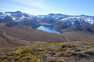
Lake Tennyson is a beautiful lake high up in the mountains of Canterbury, New Zealand. It sits about 1,102 meters (3,615 feet) above sea level. The first European person to see this lake was Frederick Weld in 1853, and he also gave it its name. The Clarence River starts just north of the lake and actually flows right through it!
Discovering Lake Tennyson
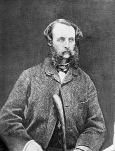
Lake Tennyson was first discovered by Frederick Weld in 1853. Frederick Weld was an important person in New Zealand's early government. He was the very first Member of Parliament for the Wairau area. A nearby mountain, Mount Weld, is named after him because he climbed it in 1855.
Weld was exploring this area because he was looking for a good way to move sheep between Nelson and Canterbury. It's thought that he named the lake after a famous poet, Alfred, Lord Tennyson. Weld was very impressed by the lake's beauty. He once said:
Lake Tennyson in beauty far surpasses anything that I have ever seen in New Zealand.
—Frederick Weld
About Lake Tennyson
This small lake was formed by glaciers long ago. It is 1,102 meters (3,615 feet) above sea level. On one side of the lake, there is a wide ridge of rocks and dirt left behind by a glacier. This area also has several small mountain pools, called tarns.
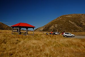
The Department of Conservation provides a simple camping area next to the lake. It's free to use, but you can't book a spot; it's available to whoever arrives first. The lake's edge is about 7.5 kilometers (4.7 miles) around. You can walk all the way around it, but in some places, you'll need to wade through the water.
Getting to Lake Tennyson
Lake Tennyson is located where the Clarence River begins, and the river flows right through it. The lake is surrounded by mountains: the St James Range is to the west, and the Crimea Range is to the east.
The lake is part of Molesworth Station, which is New Zealand's largest farm. There are two main ways to get there:
- From Hanmer Springs: This route is about 43 kilometers (27 miles) long. You take Clarence Valley Road, then Tophouse Road, following the Clarence River. You'll cross a bridge at the Maling Pass car park. After a short drive on the Rainbow Road, you'll see a sign for the lake's access road on your left. This road is usually fine for regular cars (two-wheel drive).
- From Saint Arnaud: This route is about 75 kilometers (47 miles) long. Just east of Saint Arnaud, you turn right off State Highway 63 onto Rainbow Road. This road follows the Wairau River up to Island Saddle, which is New Zealand's highest legal road at 1,347 meters (4,419 feet). From there, it's about 5.5 kilometers (3.4 miles) to the turn-off for Lake Tennyson. This road is only suitable for four-wheel drive vehicles. It also has times of the year when it's closed, and you might need to pay a small fee at Rainbow Station.
The Maling Pass car park, which is close to Lake Tennyson, is a popular starting point for people who want to explore the St James Cycle Trail.
 | Audre Lorde |
 | John Berry Meachum |
 | Ferdinand Lee Barnett |


