Lamont, Iowa facts for kids
Quick facts for kids
Lamont, Iowa
|
|
|---|---|

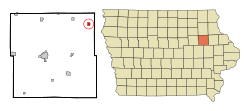
Location of Lamont, Iowa
|
|
| Country | |
| State | |
| County | Buchanan |
| Incorporated | December 10, 1892 |
| Area | |
| • Total | 0.58 sq mi (1.51 km2) |
| • Land | 0.58 sq mi (1.51 km2) |
| • Water | 0.00 sq mi (0.00 km2) |
| Elevation | 1,040 ft (317 m) |
| Population
(2020)
|
|
| • Total | 429 |
| • Density | 733.33/sq mi (283.18/km2) |
| Time zone | UTC-6 (Central (CST)) |
| • Summer (DST) | UTC-5 (CDT) |
| ZIP code |
50650
|
| Area code(s) | 563 |
| FIPS code | 19-43005 |
| GNIS feature ID | 0458215 |
Lamont is a small city located in Buchanan County, Iowa, in the United States. It's a friendly community where people live and work. According to the 2020 census, 429 people call Lamont home.
Contents
History of Lamont
Lamont has a history stretching back many years. The first people settled in this area in 1841. Later, in 1875, a post office was opened, making it easier for people to send and receive mail. The city became an official incorporated city on December 10, 1892.
Railroad's Arrival
A big change came to Lamont in 1886. The Chicago Great Western Railway decided to make Lamont a stop on its railroad line. This was important because railroads helped towns grow by bringing in goods and people.
Geography of Lamont
Lamont is situated in a specific spot in Iowa. Its coordinates are 42.600022 degrees North and -91.641186 degrees West. These numbers help pinpoint its exact location on a map.
Land Area
The United States Census Bureau reports that Lamont covers a total area of about 0.58 square miles (which is about 1.51 square kilometers). All of this area is land, meaning there are no large lakes or rivers within the city limits.
Population and People
The number of people living in Lamont has changed over the years. Understanding these changes helps us learn about the city's growth.
| Historical populations | ||
|---|---|---|
| Year | Pop. | ±% |
| 1900 | 636 | — |
| 1910 | 571 | −10.2% |
| 1920 | 495 | −13.3% |
| 1930 | 521 | +5.3% |
| 1940 | 589 | +13.1% |
| 1950 | 574 | −2.5% |
| 1960 | 554 | −3.5% |
| 1970 | 498 | −10.1% |
| 1980 | 554 | +11.2% |
| 1990 | 471 | −15.0% |
| 2000 | 503 | +6.8% |
| 2010 | 461 | −8.3% |
| 2020 | 429 | −6.9% |
| Source: and Iowa Data Center Source: |
||
Lamont in 2020
In 2020, the city had 429 residents. There were 188 households, which means 188 different homes where people lived. The population density was about 733 people per square mile. Most residents identified as White. A small percentage identified with other racial backgrounds or as Hispanic or Latino.
Many households included families. About 26.6% of homes had children under 18 living there. The median age in Lamont was 39.5 years. This means half the population was younger than 39.5, and half was older. About 26.8% of residents were under 20 years old.
Lamont in 2010
Back in 2010, Lamont had a slightly larger population of 461 people. There were 193 households. The racial makeup was similar to 2020, with most residents being White. About 30.6% of households had children under 18. The median age was 37.7 years.
Major Storm in 2008
In May 2008, Lamont experienced a very heavy thunderstorm. This storm brought a huge amount of rain in a short time. About seven inches of rain fell in just one hour. This caused significant flooding in many parts of the city. Most basements and some first floors of homes were affected by the water.
School System
Students in Lamont attend schools that are part of the Starmont system. This school district is a combination of three towns: STrawberry Point, ARlington, and LaMONT. Together, their names form the word "Starmont." This system helps provide education for students from all three communities.
See also
 In Spanish: Lamont (Iowa) para niños
 | Madam C. J. Walker |
 | Janet Emerson Bashen |
 | Annie Turnbo Malone |
 | Maggie L. Walker |

