
List of landmarks of St. Louis facts for kids

A St. Louis Landmark is a special title given to important historic buildings and places in St. Louis, Missouri. The city's leaders, called the Board of Aldermen, decide which places get this title. These landmarks are chosen because they are important to the city's history, culture, or look.
Once a place is a landmark, it's protected. This means that if anyone wants to change it, even for small repairs or to tear it down, they need special permission from the St. Louis Preservation Board. This helps keep these important places safe for future generations. Many St. Louis Landmarks are also recognized by the U.S. government, which can help with money for their upkeep.
Contents
How Places Become Landmarks
The Mayor chooses eight people to be on the Preservation Board. This board suggests places that should become landmarks. Then, the Board of Aldermen votes on these suggestions.
People can ask the Preservation Board to consider a property. This can be the owner, a city leader, or the city's Cultural Resources Office. The board looks at several things to decide if a place is important enough to be a landmark:
- Does it have a special history or cultural meaning for the city, state, or country?
- Did an important historical event happen there?
- Was it designed by a famous architect or artist who greatly influenced the area?
- Does it have unique design, details, materials, or craftsmanship?
- Is it a well-known and familiar part of a neighborhood or the city because of its location or look?
- Are there important old artifacts found there, or are they likely to be found there?
- Is it a piece of art in a public space?
However, some places are not under the Preservation Board's control. These include properties owned by the St. Louis Public Library, the St. Louis City Board of Education, the state of Missouri, or the United States government.
National Recognition for Landmarks
Some St. Louis Landmarks are so important that they also get a special title from the U.S. government: National Historic Landmark. This means they are very significant to the history of the entire country.
Many other St. Louis Landmarks are listed on the National Register of Historic Places. This is another way the U.S. government recognizes and helps protect historic places.
It's interesting to know that not all St. Louis Landmarks are on the National Register, and not all national landmarks in St. Louis are city landmarks. For example, Gateway Arch National Park and Ulysses S. Grant National Historic Site are very important national sites in St. Louis, but they are not listed as city landmarks.
Historic Districts in St. Louis
Besides individual buildings, St. Louis also has special areas called Historic Districts. These are neighborhoods or groups of buildings that are important together. The city has 18 of these districts. Eight of them are also "Certified Local Historic Districts," which means they meet certain national standards.
Local Historic Districts
- Benton Park
- Cherokee-Lemp Brewery
- Kingsbury-Washington Terrace
- Lafayette Square
- McKinley Heights
- North I-44
- Tower Grove East
- Union Station
- The Ville
Certified Local Historic Districts
- Central West End
- Compton Hill
- Fox Park
- Hyde Park
- Shaw Neighborhood
- Skinker-DeBaliviere-Catlin Tract-Parkview
- Soulard Neighborhood
- Visitation Park
Images for kids
-
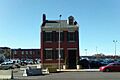
Stagger Lee's "Lid" Club
-
Ambassador Theatre in 1926
-
The American Theatre, once known as the Orpheum Theatre
-
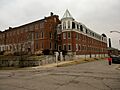
Anheuser-Busch Brewery in 1942
-
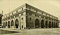
The Arcade Building
-
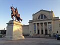
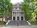
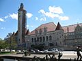
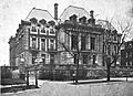
The Saint Louis Art Museum
-
The Ashley Street Power Plant
-
The Bee Hat Company Building
-
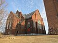
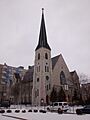
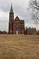
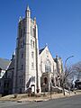
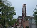
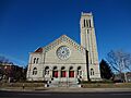
Bethlehem Lutheran Church
-
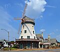
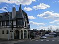
The Bevo Mill
-
The Bissell Mansion
-
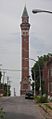
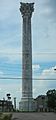
The Bissell Street Water Tower
-
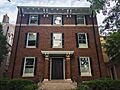
The Campbell House
-
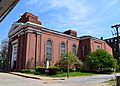
The Carondelet Branch Public Library
-
Centenary Methodist Church
-
Central Baptist Church
-
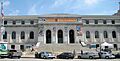
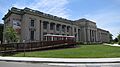
The Central Public Library
-
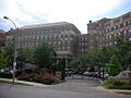
The Chase Park Plaza Hotel
-
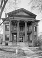
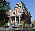
The Chatillon-DeMenil Mansion in 1936
-
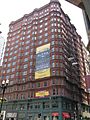
The Chemical Building
-
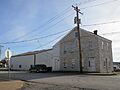
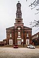
Christ Baptist Church
-
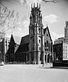
Christ Church Cathedral in 1942
-
The Christian Peper Building
-
The Church of the Messiah in 1940
-
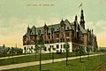
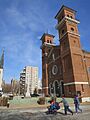
St. Louis City Hall
-
The Clemens House
-
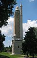
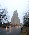
The Compton Hill Water Tower
-
The Convent of Sisters of St. Joseph
-
The Cupples House
-
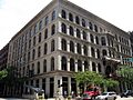
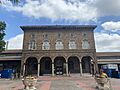
Cupples Station
-
The Emmanuel DeHodiamont House
-
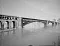
The Eads Bridge in 1942
-
Eastern Star Missionary Baptist Church
-
The Eugene Field House in 1942
-
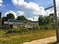
The Feasting Fox Restaurant and Pub
-
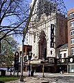
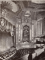
The Fox Theatre
-
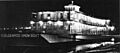
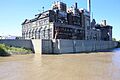
The Goldenrod Showboat
-
The Grand Avenue Water Tower
-
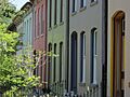
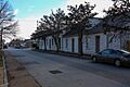
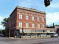
Harris Row
-
The Hartley B. Comfort Building in 1889
-
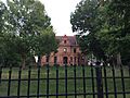
Henry Shaw's Country House
-
Henry Shaw's Town House
-
Holy Corners Historic District
-
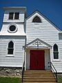
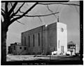
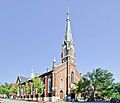
Holy Cross Lutheran Church
-
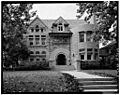
The Homer G. Phillips Hospital
-
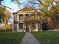
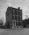
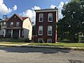
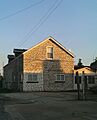
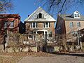
Homes: 200-204 Steins and 7012 Minnesota
-
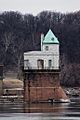
Intake Water Tower No. 1
-
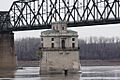
Intake Water Tower No. 2
-
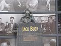
The Jack Buck Statue
-
The Jefferson Memorial
-
Kingsbury Place
-
The Otto Kulage House
-
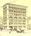
The Lammert Furniture Building
-
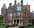
The Isaac H. Lionberger House
-
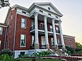
The Lyle Mansion
-
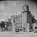
The Masonic Temple
-
The Maya Angelou Birthplace
-
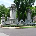
The Meeting of the Waters Fountain
-
The Memorial Home
-
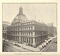
The Mercantile Library Collection
-
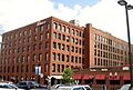
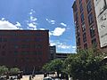
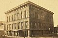
The Merchandise Mart Building
-
The Merchants Laclede Building
-
The Mississippi Valley Trust Building
-
The Missouri Athletic Club
-

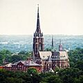
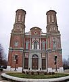
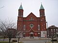
Most Holy Trinity Church
-
The Neighborhood Gardens Apartments Complex
-

The New Age Federal Savings & Loan
-
The New Jerusalem Church of God in Christ at the Cathedral
-
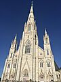
The Old Cathedral
-
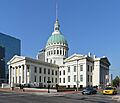
The Old Courthouse
-
The Old May Company Department Store Building
-

The Old Mutual Bank Building
-
The Old Post Office
-
The Old Strassberger Music Conservatory
-
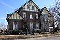
The Park Keeper's House (Cabanne House)
-
Pelican's Restaurant
-
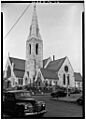
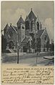
Pilgrim Congregational Church
-
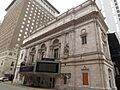
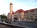
Powell Symphony Hall
-
Resurrection Church
-
The Schlichtig House
-
Second Presbyterian Church
-
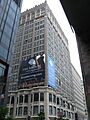
The Security Building
-
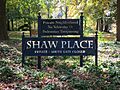
Shaw Place
-
The Sheldon Concert Hall
-
Shining Light Tabernacle
-
Soulard Market
-
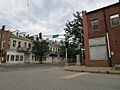
The South Broadway Bluff Area
-
SS. Peter and Paul Church
-
St. Mark's Episcopal Church
-
St. Alphonsus Catholic Church
-
St. Francis DeSales Church
-
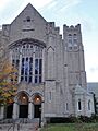
St. Francis Xavier College Church
-
St. John Nepomuk Church
-
St. John the Apostle and Evangelist Church
-
St. Joseph Church and Parish House
-
St. Liborius Parish Complex
-
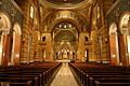
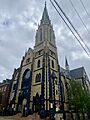
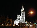
St. Louis Cathedral
-
St. Mary of Victories Catholic Church
-
St. Stanislaus Kostka Church
-
St. Vincent de Paul Church
-

The Statue of St. Louis
-
The Jacob Steins House
-
The Stockstrom House
-
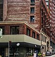
Store buildings
-
The T.S. Eliot House
-
Tillie's Corner
-
Union Avenue Christian Church
-
Union Market
-
Union Station
-

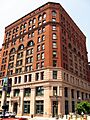
The Union Trust Building
-
The United Missouri Bank Building
-

The Vess Advertising Device
-
The von Harten Residence
-
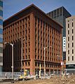
The Wainwright Building
-
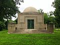
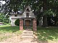
The Wainwright Tomb
-
Washington Tabernacle Baptist Church
-
Washington Terrace
-
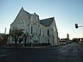
Westminster Presbyterian Church
-
The Woolworth Building


.jpg)


.jpg)


.jpg)

.jpg)
.jpg)
.jpg)
,_Garrison_%26_Locust_Streets,_Saint_Louis,_Independent_City,_MO.jpg)


.jpg)


.jpg)


.jpg)


.jpg)


.jpg)


.jpg)


.jpg)


_-_exterior.jpg)


_(18742949543).jpg)


See also
- Landmarks of St. Louis, Missouri
- List of public art in St. Louis
