Lane Cove North facts for kids
Quick facts for kids Lane Cove NorthSydney, New South Wales |
|||||||||||||||
|---|---|---|---|---|---|---|---|---|---|---|---|---|---|---|---|

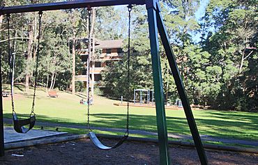
Helen Street Reserve,
Lane Cove North |
|||||||||||||||
| Population | 11,436 (2016 census) | ||||||||||||||
| Established | 20 January 2006 | ||||||||||||||
| Postcode(s) | 2066 | ||||||||||||||
| Location | 11 km (7 mi) NW of Sydney CBD | ||||||||||||||
| LGA(s) |
|
||||||||||||||
| State electorate(s) | Lane Cove | ||||||||||||||
| Federal Division(s) | North Sydney (Lane Cove) Bradfield (Willoughby) | ||||||||||||||
|
|||||||||||||||
Lane Cove North is a suburb located on the Lower North Shore of Sydney, New South Wales, Australia. It is about 11 kilometers north-west of the main city area of Sydney. This suburb is managed by two local councils: the Municipality of Lane Cove and the City of Willoughby. It's important to know that Lane Cove North is its own separate suburb, different from Lane Cove and Lane Cove West.
The suburb has clear boundaries. The Pacific Highway is to its east, Epping Road to its south, and the Lane Cove River to its west. To the north, you'll find the Chatswood Golf Course. The local government boundary is along Mowbray Road.
Contents
History of Lane Cove North
The area that became Lane Cove was first set up after World War II. It was a place where veterans from the war could get land grants to build their homes.
Lane Cove North officially became a separate suburb on January 20, 2006. Before this, it was part of other areas.
In 2005, something unusual happened here. An apartment building partly collapsed because of digging for the Lane Cove Tunnel. During this event, a pet bird was rescued from the building by a robot, which made news around the world! The area is currently being updated with many new buildings.
Historic Places in Lane Cove North
Lane Cove North has some places that are protected because of their history. These are called heritage-listed sites.
- 518 Pacific Highway: Chatswood South Uniting Church
Schools in Lane Cove North
- Mowbray Public School
Churches and Temples in Lane Cove North
- Presbyterian Church (Indonesian)
- Chatswood South Uniting Church
- Happy Science Shoshinkan
Sports and Fun in Lane Cove North
Lane Cove North offers many places for sports and recreation.
- Lane Cove Rugby Club and Lane Cove Junior Rugby Club play at Tantallon Oval.
- The Lane Cove Tigers Junior Rugby League club also plays at Tantallon Oval.
- North Sydney Athletics and Northern Suburbs Little Athletics use the Chatswood War Memorial Athletic Field.
- There is a Tennis Club at the corner of Hatfield Street and Mowbray Road.
- Scouts meet at Avian Crescent.
Parks and Green Spaces
Lane Cove North has many parks and reserves where you can enjoy nature and play.
- Tantallon Oval, at the corner of Epping Road and Tantallon Street
- Chatswood War Memorial Athletic Field, on Mowbray Road
- Batten Creek Reserve, on Kullah Parade
- Stringybark Reserve, on Karilla Avenue
- Helen Street Reserve, on Helen Street
- Mindarie Park, at the corner of Mindarie and Kullah Streets
- Coolaroo Park, on Moola Parade
- Girraween Park, on Girraween Street
- Stokes Park, on Stokes Street
- Mowbray Park, on Ulm Street
- Mowbray Primary Oval, on Hatfield Street
People of Lane Cove North
The 2016 census counted 11,436 people living in Lane Cove North. Here are some interesting facts about the people who live there:
- Age
- The average age of people in Lane Cove North was 34 years. This is younger than the national average of 38 years.
- About 17.2% of the population were children under 15 years old.
- About 11.2% of the population were people aged 65 years and older.
- Backgrounds
- About 51.7% of people were born in Australia.
- Other common countries of birth included China (5.9%), England (3.9%), and India (3.1%).
- Most people (58.2%) spoke only English at home.
- Other languages spoken included Mandarin (6.8%), Cantonese (4.3%), and Spanish (2.0%).
- Getting Around
- On the day of the census, about 34.8% of working people used public transport to get to work.
- About 47.8% of working people used a car to get to work, either as a driver or a passenger.
- Homes
- Most homes (69.4%) were flats, units, or apartments.
- About 24.1% were separate houses.
- The average household had 2.4 people living in it.
- Beliefs
- The most common response for religion was "No Religion" (34.9%).
- Other common responses were Catholic (21.6%) and Anglican (10.5%).

