Laurel Hill, New South Wales facts for kids
Quick facts for kids Laurel HillNew South Wales |
|||||||||
|---|---|---|---|---|---|---|---|---|---|

Laurel Hill
|
|||||||||
| Postcode(s) | 2649 | ||||||||
| Elevation | 1,045 m (3,428 ft) | ||||||||
| Location |
|
||||||||
| LGA(s) | Snowy Valleys Council | ||||||||
| County | Wynyard | ||||||||
| State electorate(s) | Albury | ||||||||
|
|||||||||
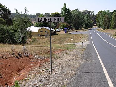
Laurel Hill is a small village in the southeastern part of the Riverina region in New South Wales, Australia. It's located about 14 kilometres (9 miles) southwest of Batlow and 22 kilometres (14 miles) northeast of Tumbarumba. It's a quiet place with a rich history.
Contents
Exploring Laurel Hill's Past
Gold Rush Days
In the late 1800s, people were busy mining for gold near Laurel Hill. This gold mining happened about 12 kilometres south of Batlow, along the Paddy's River. A place called Quartzville grew there, and at one time, about 2,000 people lived in this busy gold mining town.
To help with the gold mining, a special dam was built. This dam was used to wash alluvial gold (gold found in riverbeds) and for sluicing operations. The population spread into the nearby Bago forest area. Laurel Hill started to grow along the main road that coaches used to travel from Adelong to Tumbarumba.
Post Office History
The local post office first opened on 10 June 1878, and it was called Bago Post Office. In 1880, its name was changed to Laurel Hill. The post office served the community for many years before it finally closed in 1989.
The Miners Arms Hotel
The Miners Arms hotel was a well-known spot in Laurel Hill. The Waters family owned this hotel for a long time. They held the licence until 1887, when Mr. Dickson Currie took over.
In 1891, Mary Ann Waters became the hotel's owner again. The original hotel building was old and not safe, so Mr. Currie built a brand new hotel for her in the early 1900s. This new hotel was built across the road from where the old one stood.
Mr. Jim Waters bought the new hotel in 1910 and ran it until 1928. After that, it was sold to Mr. Hayden. Later, Mr. George King bought the hotel. He made some big changes, like updating the roof and closing in the front porch. Mr. King later moved away, and Mrs. Latham took over the hotel for a while before she also moved to Batlow. Sadly, the hotel building burned down in 1958 and was never rebuilt.
Forest Camp
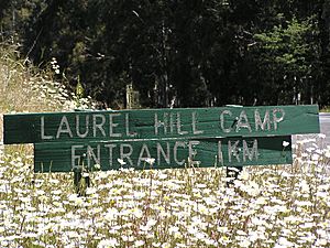
In 1957, a place called Laurel Hill Prison Farm was set up. It was later renamed the Leslie Nott Afforestation Camp in 1958. After that, it became known as the Laurel Hill Forest Camp. This camp was managed by the Forestry Commission of New South Wales. Today, this site is privately owned and used as a conference centre.
Climate and Weather
Bago Plateau Weather
The Bago Plateau, which is south of Batlow, has a much cooler and wetter climate. This is because it's very high up and exposed to the weather. Snow often falls from June to September. Sometimes, there are very heavy snowfalls that can stay on the ground for more than a week in shaded areas. It can even snow in late spring or early summer, though this is rare. During the winter months, the region often has a lot of cloud cover.
The weather information for this area comes from Pilot Hill, which is 1,128 metres (3,701 feet) above sea level.
| Climate data for Bago (Pilot Hill, 1921–1951, rainfall 1910–1951); 1,128 m AMSL; 35.62° S, 148.15° E | |||||||||||||
|---|---|---|---|---|---|---|---|---|---|---|---|---|---|
| Month | Jan | Feb | Mar | Apr | May | Jun | Jul | Aug | Sep | Oct | Nov | Dec | Year |
| Mean daily maximum °C (°F) | 23.5 (74.3) |
23.3 (73.9) |
20.7 (69.3) |
15.3 (59.5) |
11.1 (52.0) |
7.8 (46.0) |
6.6 (43.9) |
7.9 (46.2) |
11.5 (52.7) |
14.8 (58.6) |
18.4 (65.1) |
22.0 (71.6) |
15.2 (59.4) |
| Mean daily minimum °C (°F) | 9.7 (49.5) |
10.3 (50.5) |
8.3 (46.9) |
4.5 (40.1) |
1.5 (34.7) |
−0.4 (31.3) |
−1.4 (29.5) |
−0.7 (30.7) |
1.3 (34.3) |
3.3 (37.9) |
6.1 (43.0) |
8.3 (46.9) |
4.2 (39.6) |
| Average precipitation mm (inches) | 74.1 (2.92) |
75.5 (2.97) |
100.8 (3.97) |
102.0 (4.02) |
124.1 (4.89) |
166.7 (6.56) |
171.3 (6.74) |
158.1 (6.22) |
131.0 (5.16) |
132.5 (5.22) |
97.4 (3.83) |
80.0 (3.15) |
1,413.5 (55.65) |
| Average precipitation days (≥ 0.2 mm) | 6.1 | 5.7 | 6.7 | 6.6 | 8.0 | 12.4 | 11.7 | 13.9 | 11.9 | 10.5 | 7.7 | 7.3 | 108.5 |
| Source: Australian Bureau of Meteorology; Bago (Pilot Hill) | |||||||||||||


